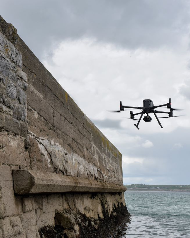
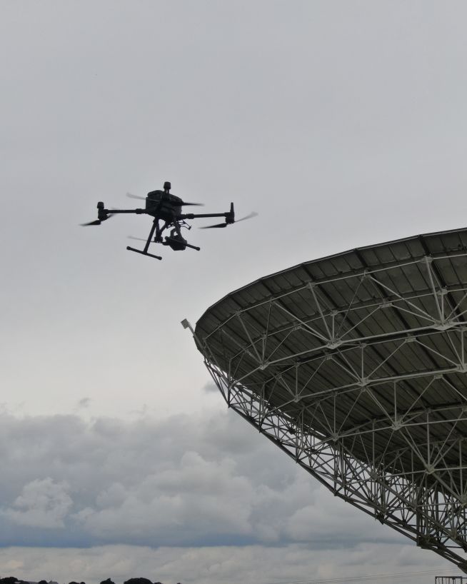
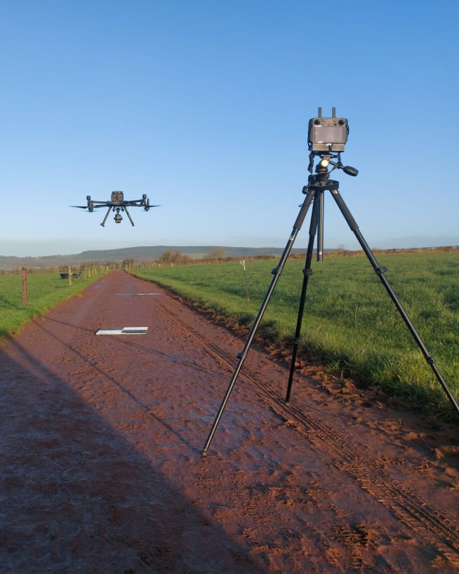
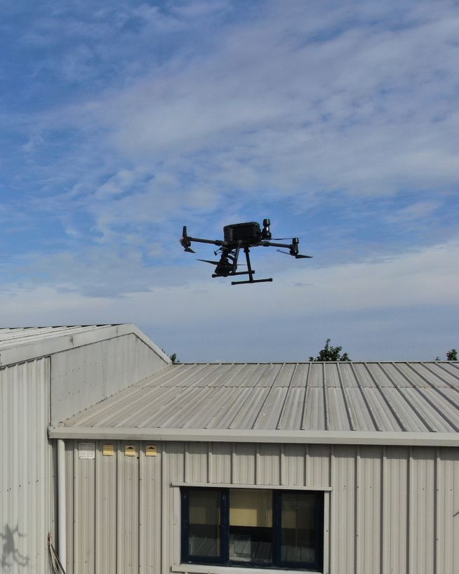
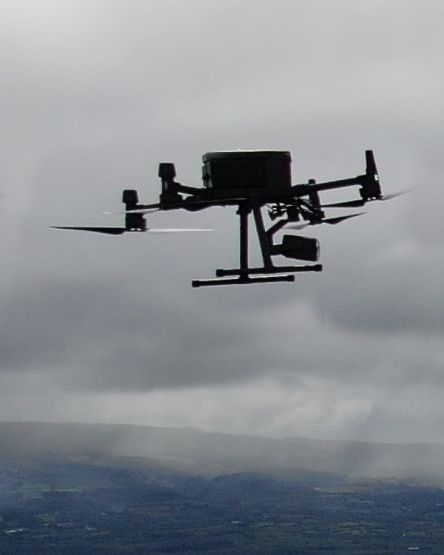
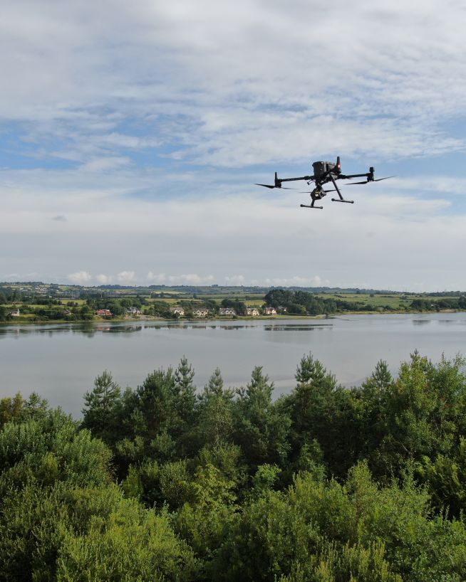
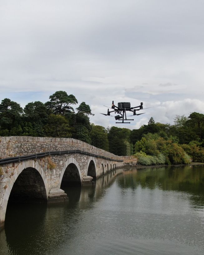
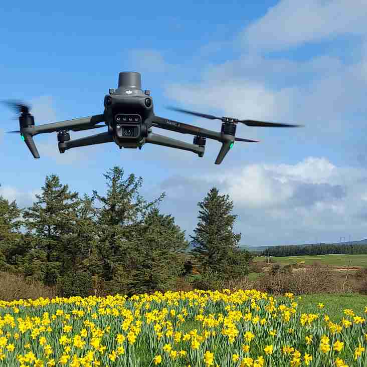
Drones can capture a subject from endless angles and heights, opening up a world of photographic possibilities. No more manned aircrafts, erecting structures or risking lives. Engineers with Drones makes getting ultra high-quality, insanely detailed aerial footage as easy as picking up the phone.
Find and fix air leaks to preserve your building's performance, energy efficiency and air quality.
Find and eliminate moisture intrusion to prevent rot and health problems associated with mould and mildew.
Reduce your energy costs and do your bit for the environment by finding and eliminating gaps in insulation.
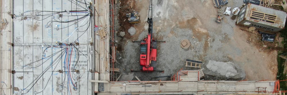
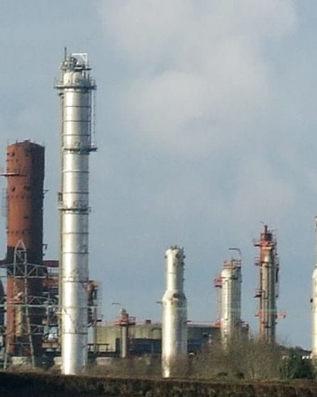
Find delamination in concrete structures with little to no downtime. Quick, reliable and cost-effective.
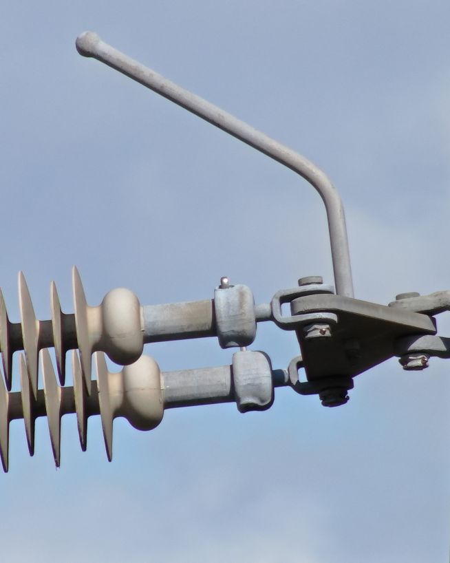
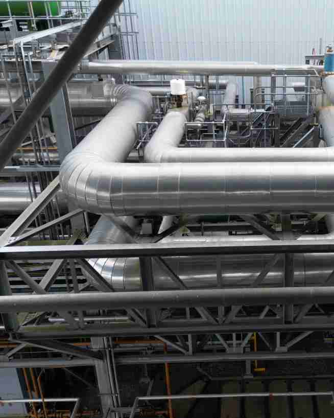
Identify and resolve potential problems with electrical distribution equipment before they lead to failure.
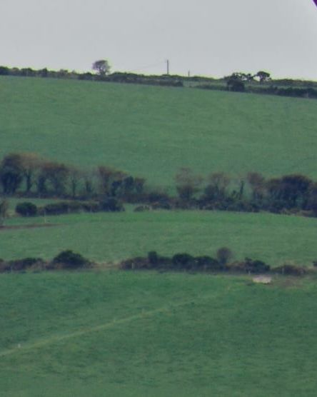
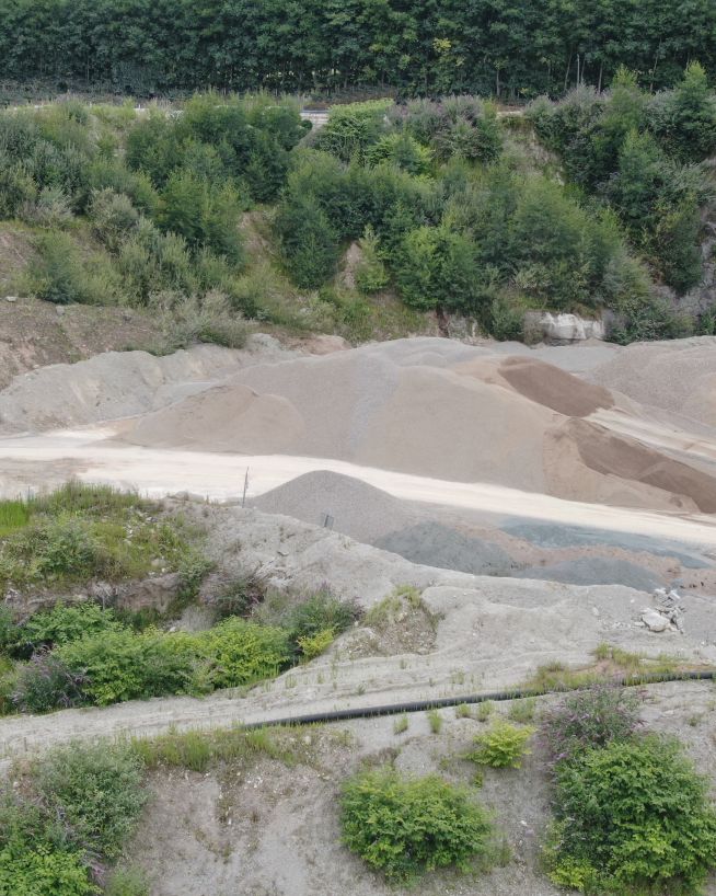
Monitor earthwork changes over time for a fast and cost-effective way to avoid any discrepancies.
Get instant and actionable data on the current status of your asset's fixtures, fittings and structure.
Cold bridges can be responsible for up to 30% of a building's heat loss. With drone technology, they're easy to find.
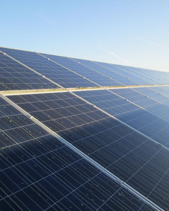
Keep your photovoltaic array running safely and efficiently by finding and fixing issues in your solar cells.
Easily locate and isolate any areas of your asset that have been affected by erosion or corrosion.
Using thermography, it's easy to detect gas leaks which are harmful to human health and the environment.
The applications of drone photography in domestic and industrial environments are almost limitless. Ask us what it can do for you.
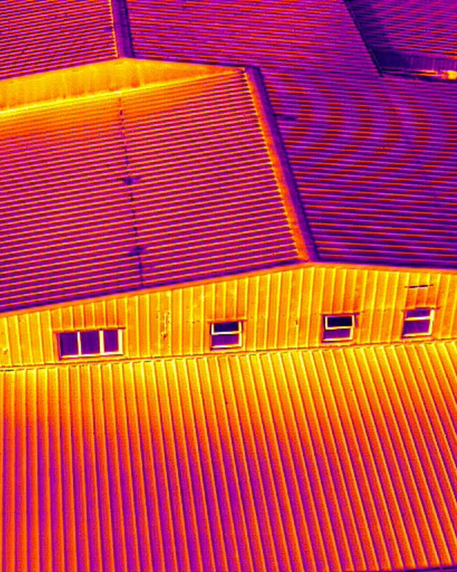
We use cutting-edge technologies to detect problems that would otherwise be invisible. These include 4K ultra-HD photography/video, LIDAR and thermal imaging.
Drones aren't just for flying up in the sky. Our specialist drones can fly into confined spaces like chimneys and boilers to look for issues that would otherwise be inaccessible.
Downtime is expensive and inconvenient. Using a drone, our engineers can conduct a thorough survey with little to no downtime.
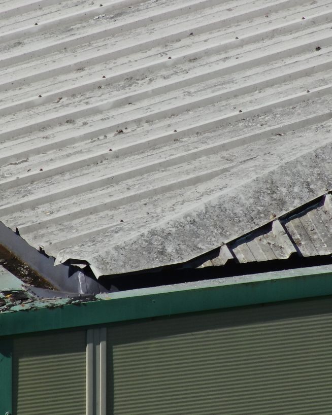
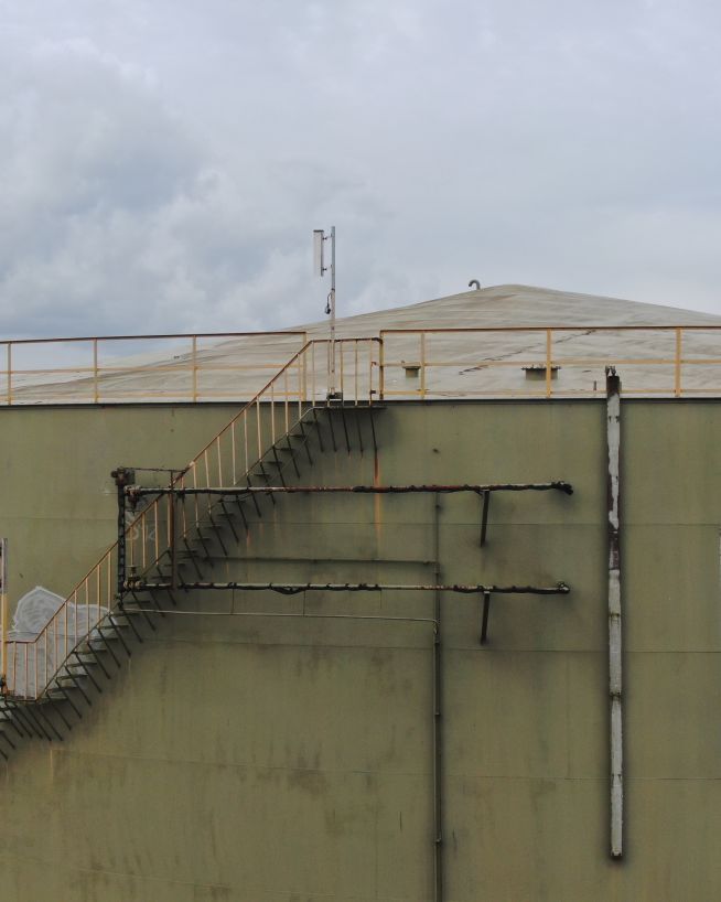
Our equipment won't touch or even go close to your assets. Our high-resolution cameras use optical zoom to give extreme close-up views while staying a safe distance away.
We understand that you need answers fast. We can deliver a plain-English report with clear-cut conclusions in days. Then, you can take the steps you need to and get back to doing what you do best.
Need us there in a hurry? No problem. Let us know what you need, and we can be there on the same day. After all, sometimes the problem just won't wait.
Sometimes the brief can change even in real-time. If need be, you can be stood there right next to the drone operator, directing them as the situation develops.
The safety of your personnel and our own is paramount, and we place it at the forefront of our company culture. Ask us about our HSSE systems and practices.
Drone photography is incredibly versatile, and we use it in various types of inspections serving multiple industries.
Fast, actionable data without the risks of traditional inspections
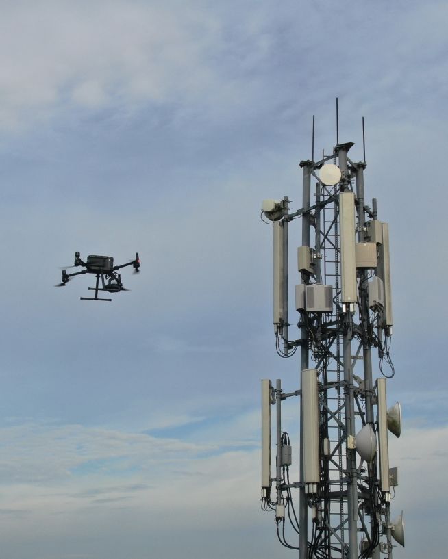
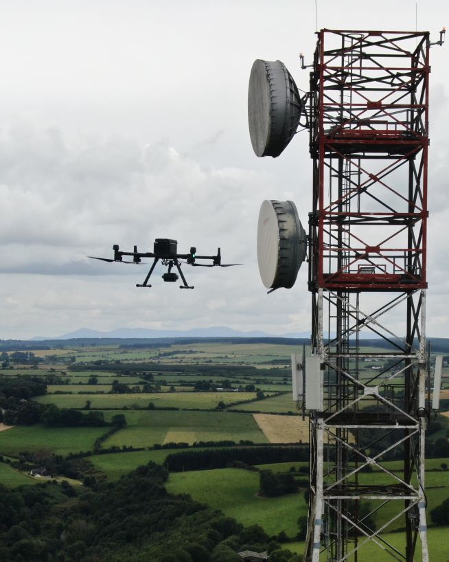
Verify radio path clearance and link feasibility for telecoms infrastructure
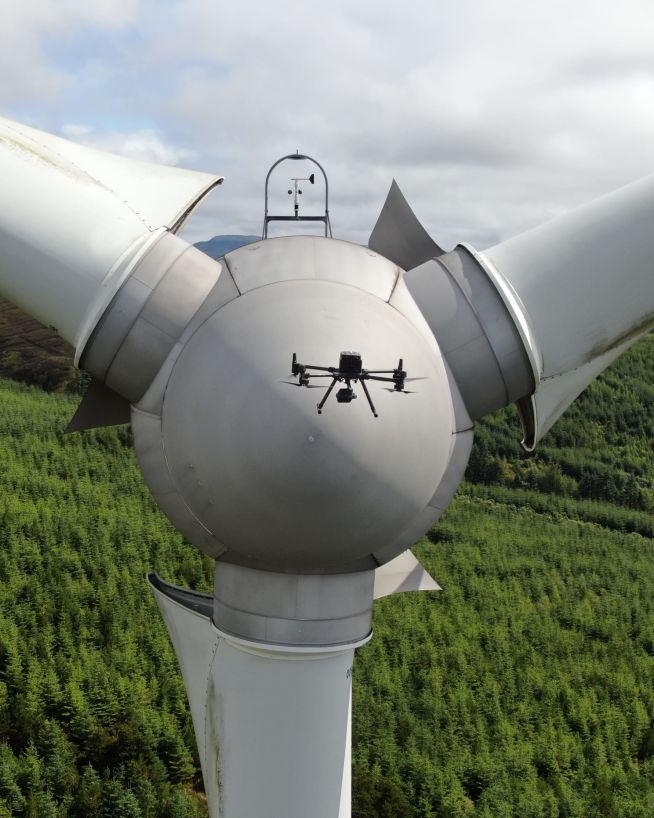
Inspect and maintain energy assets without risk or downtime
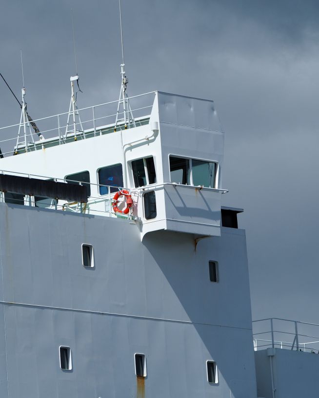
Safe, precise and instant reports on vessels and infrastructure
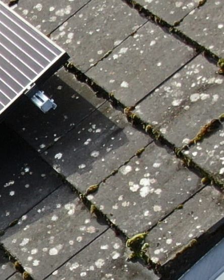
Ensure solar panel efficiency from precise data collection
Instantly usable data via a safer and more cost-effective process
Monitor coastal assets safely and with more precision
Instantly view complex structures, keeping risks to a minimum
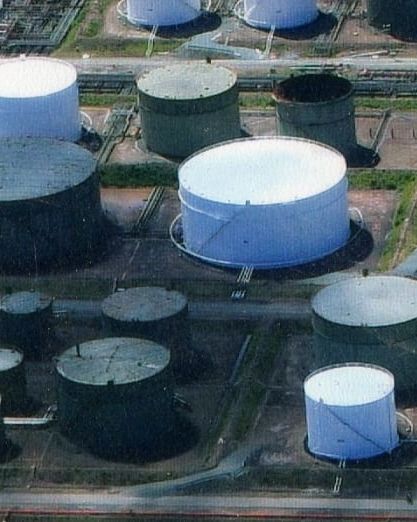
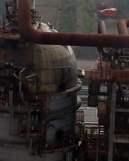
Safer and more cost-efficient flare (oil and gas) inspections
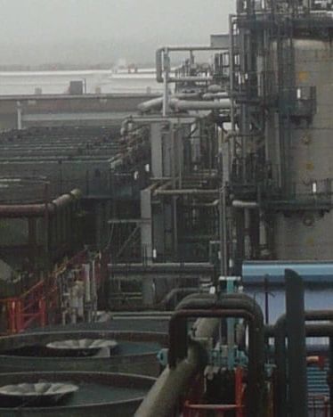
Keep production running while collecting instant critical data
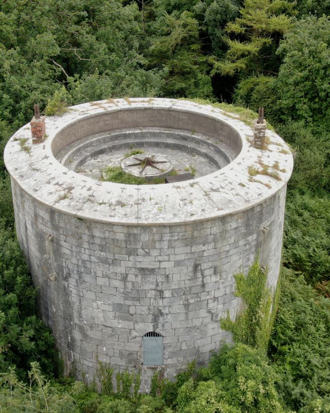
Analyse historical buildings without risk to people or property
Clearer, faster results without the risks
Record and document reliable visuals without safety concerns
Get critical data on cell and telecommunication infrastructure
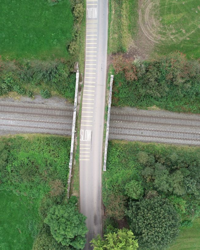
Faster, cheaper and more accurate analysis of land
Accurate and efficient analysis of crops and land
Get fast, usable data from a safe distance
Accurate, safe and instantly actionable data collection
Add "Wow Factor" to residential and commercial property listings
Critical, pinpoint details with none of the risk
Monitor status and progress without downtime
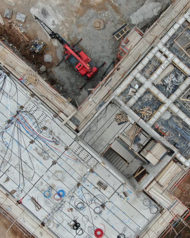
Instant, actionable data with no downtime
Get actionable data on quality and operational health
A more cost- and time-effective way to receive critical data
Actionable data from a safe distance, with less downtime
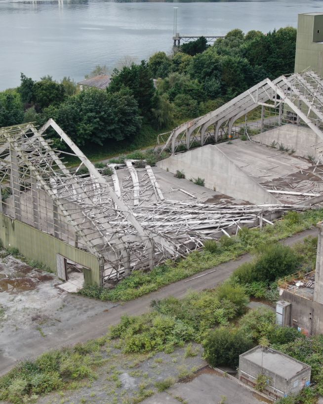
Assess damage quickly and with pinpoint accuracy
Efficient, fast and safe.
Safer, more precise data collection at a fraction of the cost
Safer, more cost-efficient, with less downtime
Eliminates downtime and safety concerns, at a fraction of the cost
Aerial mapping and site documentation for planning, development, and land management
We take emails, phone calls, messages, everything! If you are unsure of what's possible we are happy to advise, the most important thing is to get in touch. We'll be happy to answer any questions you may have.
With drones, it's best to begin where you want to end up. What sort of deliverable would you like when it's all finished? If you are not sure then we can advise. We can look at what you would like and work backwards from there.
Once we have agreed on what is to be done, the scope of work is set and a price is agreed upon. We feel it is vital that everyone knows what they are getting and what they are paying for it. There should be no confusion.
Once we have confirmation you are happy to proceed, we start the ball rolling. We organise things like RAMS, site permits, Air Traffic Control clearance and much more. Basically, we generate everything needed to turn up on-site with all our ducks in a row.
Next, we do the work on site. We have the gear, we have the know-how, so now it's time to get the job done. This can sometimes be affected by the weather, but for the most part, we get the job done on the date specified.
This is where we take what we generated in the field and turn it into a final deliverable for you. This can be anything from the raw data itself, to fully processed Orthophotos, condition reports, CAD line work or thermal imagery.
The final step is the handover of the deliverables. We tend to use a cloud-based service, so you can access your data anywhere. We can also tie into your existing systems if that is more convenient.
Here is a glimpse at some of the next-generation UAV equipment which we typically use for our drone surveys and inspections.
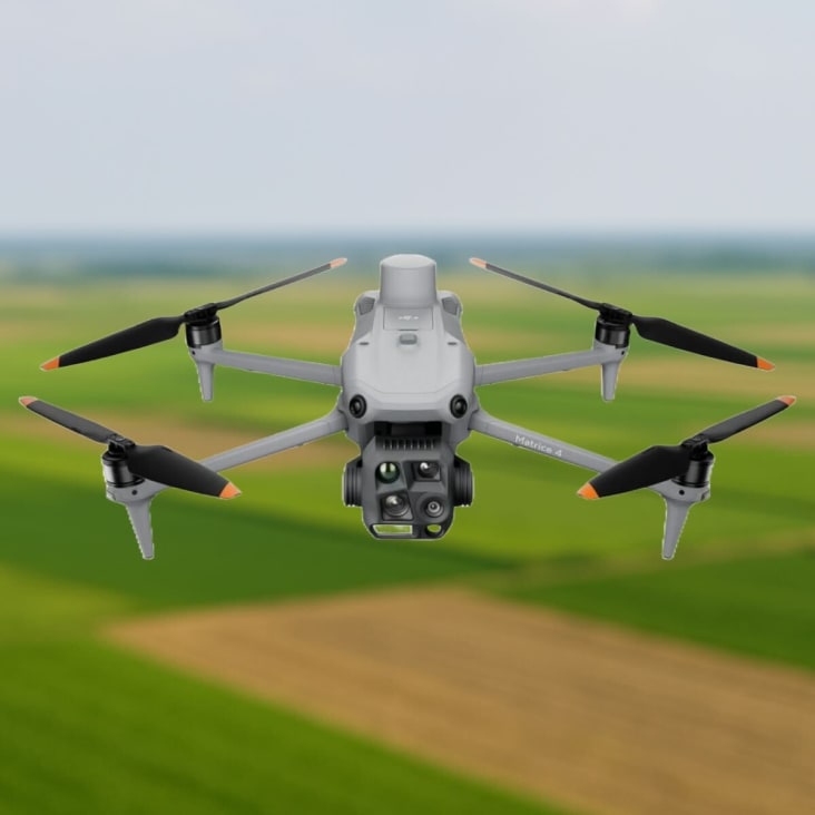
This is the Matrice 4E from the DJI Matrice 4 series designed for enterprise industries. A flagship, intelligent multi-sensor drone designed for geospacial mapping in industries like agriculture, construction and more.
This is the Matrice 4T from the DJI Matrice 4 series. This drone features an infrared thermal camera and NIR auxiliary light for intelligent night scene performance. Designed for the energy sector, emergency response, forestry and more.
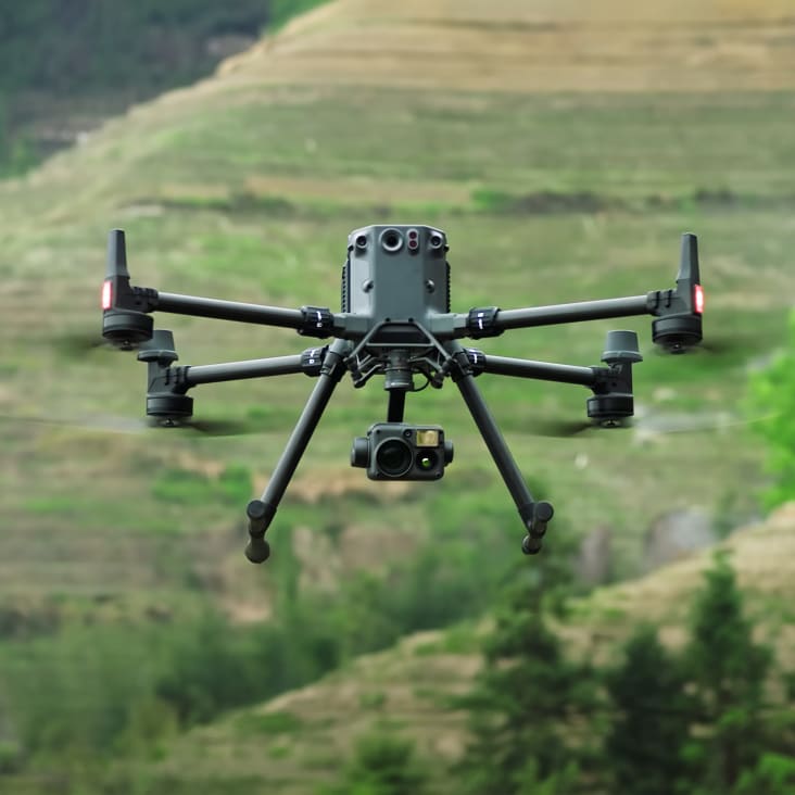
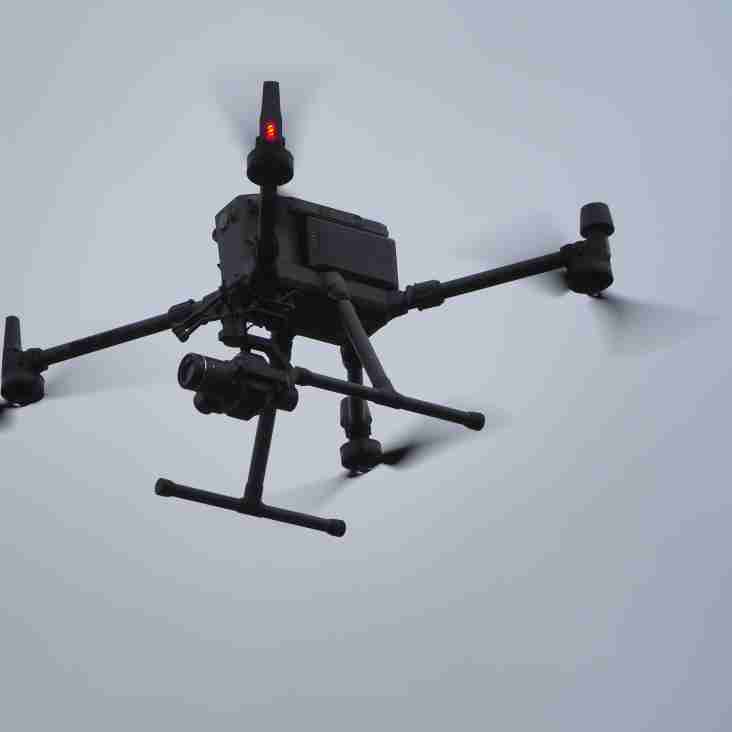
Our flagship drone: The M350 RTK by DJI is the premier enterprise-level inspection drone on the market, an update to our workhorse M300 RTK. With a flight time of up to 55 minutes, lots of built-in redundancy, and a host of payloads to choose from, this is our go-to UAV for inspection work.
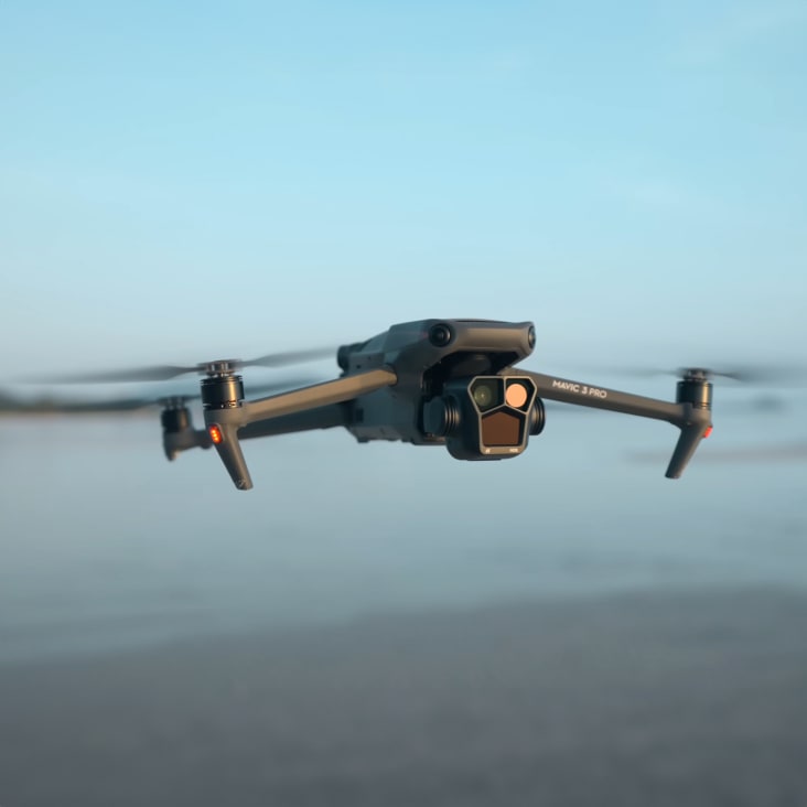
This is our compact but powerful drone from the Mavic Enterprise lineup. Engineered for surveying and inspections, enabling centimetre accurate data collection together with two powerful CMOS sensor cameras; Wide angle 20MP, 4/3 sensor and Tele camera, with 56x Hybrid Zoom.
We can deploy this highly portable and versatile UAV at a moment's notice. It is designed for an array of industries and situations where thermal imaging and speed of work is of the essence; such as identifying heat loss and structural defects, conducting solar plant inspections or any low-light/low-visibility environment survey.
This is a very special tool in our bag, as it comes with a newly upgraded imaging system with one 20MP RGB camera + four 5MP multispectral cameras (green, red, red edge, and near-infrared). Enables us to deploy it in high-precision aerial surveying, crop growth monitoring, and natural resource surveys.
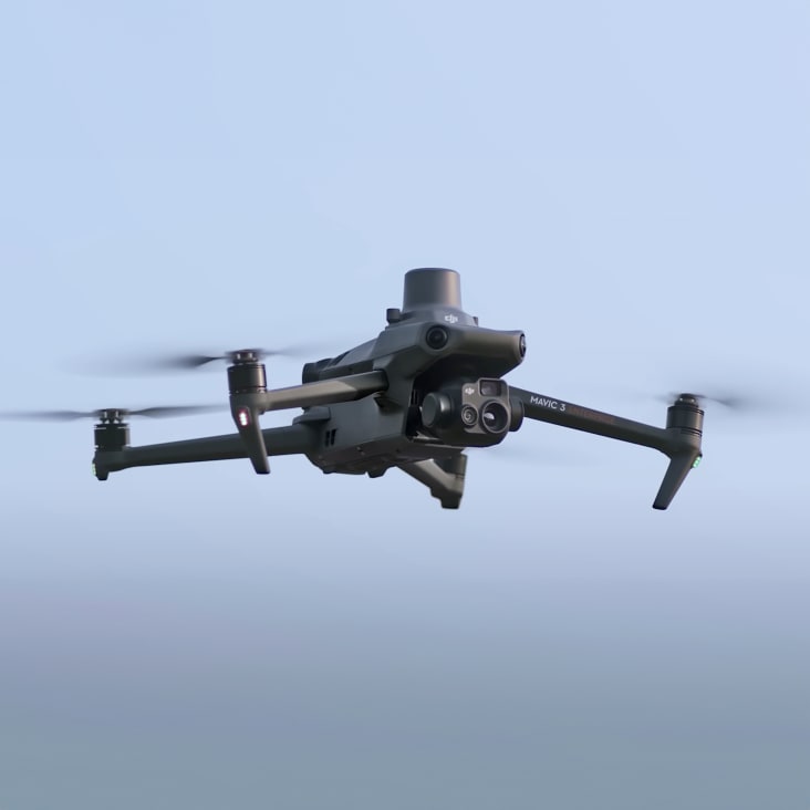
This is the drone we utilise in photography and video missions and projects. With the incorporated payload consisting of three focal-length high-performance cameras, it gives us the option to capture the views around us in a completely different way than with the other payloads.
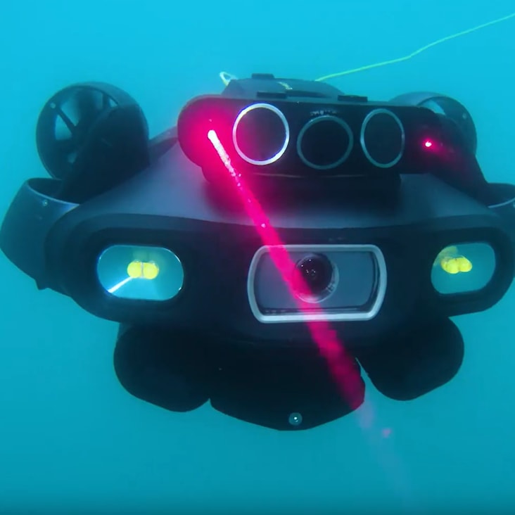
This underwater UAV is our industrial AI underwater robot, engineered for high-precision measurements, inspections, and surveys in complex marine environments. With advanced sensors and sonars, it ensures our projects with accuracy and reliability beyond standards.
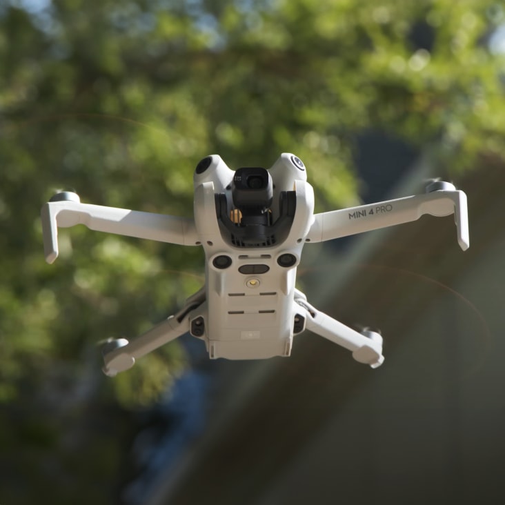
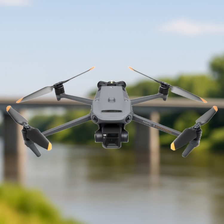
With this high-end Class 0 light-weight drone, we're able to reliably shoot in almost any condition and location, utilising its smaller size and spot-on obstacle avoidance to gather deliverables from more densely populated areas in the safest way possible.
The DJI D-RTK 2 mobile base station helps make accuracy easy. This GNSS receiver supports GPS, GLONASS, Beidou, and GALILEO signals, allowing for centimetre-level positioning. The integrated IMUs monitor movements and calibrate tilt sensors to minimise risks.
LiDAR for everyone. The DJI Zenmuse L1 LIDAR payload features an integrated Livox LiDAR module and a 20mp camera. This combination makes for an excellent all-round package. Covering up to 2km² in a single flight, the L1 carries a highly efficient payload.
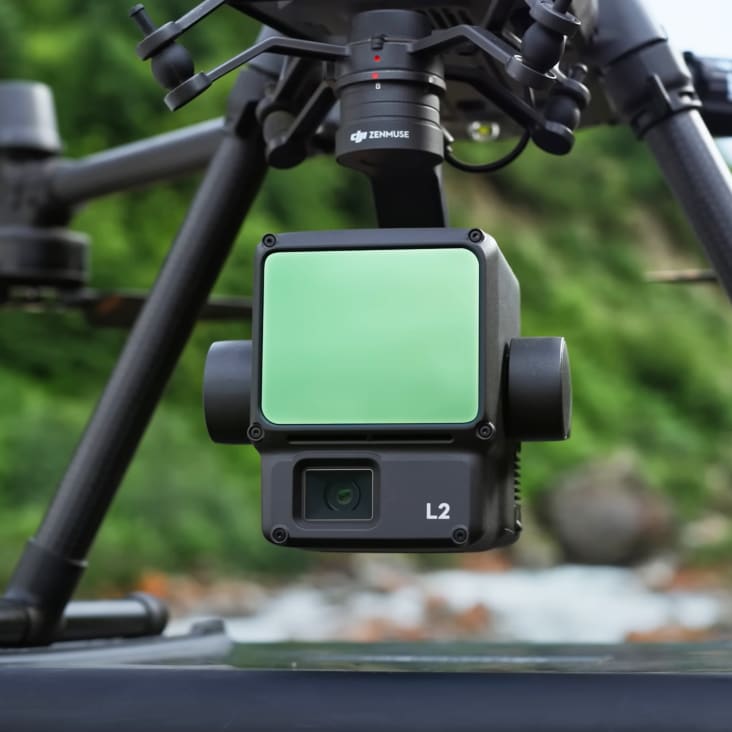
L2 unit with integrated LiDAR and RGB camera is our mapping instrument for efficient, accurate and dependable work. With high-level precision and quick data gathering in the field, we can respond with short turnaround time, high-precision point cloud results and spatial accuracy, matching it with a reliable RTK positioning system.
One payload with a multitude of sensors. The H20T is specifically designed for conducting inspections of high-value assets. When coupled with the Matrice M300 aircraft, the various sensors on the H20T give the operator a wide array of options to get the best imagery possible.
Combined with our flagship drone platform DJI M300 RTK, the DJI Zenmuse P1 camera enables photogrammetry and 3D modelling of the highest standard. There are also interchangeable fixed-focus lenses, on a 3-axis stabilized gimbal, that provide robust versatility to help create stunning 2D, 3D detailed models.
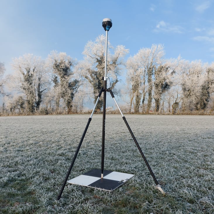
This GNSS receiver helps us in everyday surveying assignments. It has very fast convergence time, which helps us to be quick and efficient in the field. Its five-signal support gives us a better rate of precision, allowing for centimetre-level accuracy. We also love it for the low battery consumption — it gives us 22h hours on one charge.


Engineers With Drones is the first company in Ireland to hold the new EASA Specific Category authorisation. We are authorised by the Irish Aviation Authority (IAA) and the European Union Aviation Safety Agency (EASA) for commercial Unmanned Aerial Vehicle (UAV) operations in both urban and rural environments. Total transparency: our Specific Category Authorisation Number is IRL.UAS.AUTH1002.
All of our operations are insured in the EU and globally. We hold €6.5m public and product liability, €13m employer's liability and €1.3m professional indemnity (base level, coverage raised as required).
We are more than just drone pilots. If you're looking for overhead footage of your wedding reception, we're probably not right for you. Our backgrounds and our primary qualifications are in engineering, and it's here that we think we add the most value. We know what we're looking for, and we know how to find it. If you have a technical engineering problem that a drone can solve, we can understand you. Tell us what you need to see or find out, and our engineers will use their drone piloting skills to make it happen.
Yes. We're a local Irish company, and that's how we can respond so quickly to the needs of our Irish clients. We can be with you in next to no time, with the right equipment and certifications to operate them, whatever your location.
Optical zoom is a feature found in cameras that allows you to change the focal-length of the lens, which in turn magnifies the image. Unlike digital zoom, which simply enlarges the pixels of an image, optical zoom physically moves the lens elements to zoom in or out, resulting in a higher-quality, more detailed image.
Optical zoom is better than digital zoom for several reasons. Firstly, optical zoom maintains the image quality and sharpness because it captures more detail from the subject. In contrast, digital zoom often results in a pixelated, blurry image because it enlarges the existing pixels of an image, which degrades the quality.
Secondly, optical zoom allows you to get closer to your subject without physically moving closer, which can be useful in situations where you cannot or do not want to approach your subject closely. This can be especially helpful for wildlife photography or for taking photos of events from a distance.
Overall, optical zoom is a valuable feature that can help you capture high-quality, detailed images from a distance, making it a must-have for many photographers.

UHD or Ultra High Definition signifies that a camera's resolution is 3840x2160 pixels. This is exactly four time higher than high definition cameras (1920x1080 pixels), and so UHD is often also know as 4K. More about drone photography...