We have worked with some of the biggest names in Ireland's agriculture and extractive sectors. Our engineers have years of experience carrying out inspections and surveys of all kinds of assets, structures and landscapes. They understand the critical need to minimise downtime while guaranteeing the safety of all personnel and operational assets on site. Tell us what you need. It's our job to deliver it for you.
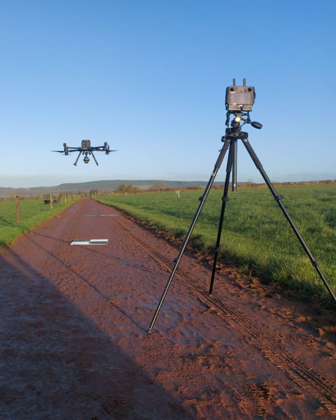
Enhance farming operations with precision drone surveys and inspections. Our engineers use drones equipped with multispectral imaging payloads, thermal cameras and LIDAR to monitor crop health, assess soil conditions and optimise irrigation. Our deliverables can help improve yield and reduce costs while ensuring sustainable and compliant farming practices. Common LIDAR deliverables include point clouds, Digital Elevation Models (DEM), 3D models, contour maps, orthomosaic imagery and volumetric calculations.
Drones equipped with multispectral imaging can monitor crop health by detecting variations in plant reflectance. This data helps identify areas of stress, disease or nutrient deficiency, enabling targeted interventions and improving overall crop yield.
Using LIDAR and photogrammetry, our engineers can create detailed soil maps that highlight variations in soil composition, moisture levels and topography. This information supports precision agriculture practices, optimising planting, fertilisation and irrigation strategies.
Drones equipped with thermal cameras can monitor irrigation systems and identify areas of over- or under-watering. This data helps optimise water usage, reduce waste and ensure crops receive the right amount of water for optimal growth.
Using LIDAR , multispectral imaging and high-resolution cameras, our engineers can assess forest health, track growth and detect signs of disease or pest infestation. Such insights can support sustainable forestry practices and efficient resource management.
Drones equipped with multispectral imaging can monitor forest health by detecting variations in tree reflectance. This data helps identify areas of stress, disease or pest infestation, enabling targeted interventions and promoting overall forest health.
Using LIDAR and photogrammetry, our engineers can create detailed 3D models of forested areas, tracking tree growth and biomass over time. This information supports inventory management, sustainable harvesting practices and long-term forest planning.
Combining multispectral imaging and thermal cameras, our engineers can monitor environmental conditions, such as temperature, humidity and vegetation health. This data helps track ecological changes, identify sources of stress and ensure compliance with environmental regulations.
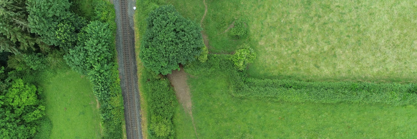
Drones equipped with LIDAR and photogrammetry can create accurate maps and measurements of forested areas. This data helps in planning and managing forestry operations, including tree planting, thinning and harvesting. It also supports environmental impact assessments and compliance with forestry regulations.
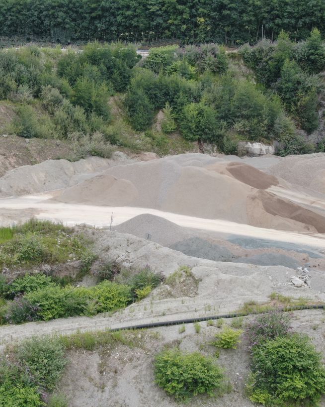
Using drones equipped with LIDAR , photogrammetry and high-resolution cameras, our engineers can assess site conditions, monitor extraction progress, ensure safety compliance and more. The resulting deliverables can help improve efficiency, reduce costs and minimise environmental impact.
Drones equipped with LIDAR and photogrammetry can create detailed topographical maps of quarry sites, highlighting variations in terrain, rock composition and soil conditions. This information supports site planning, resource allocation and extraction strategies.
Using high-resolution cameras and LIDAR , our engineers can monitor extraction progress, track stockpile volumes and assess site stability. This data helps optimise extraction processes, reduce waste and ensure safety compliance.
Drones equipped with multispectral imaging and environmental sensors can monitor the environmental impact of quarrying operations, such as dust levels, water quality and vegetation health. This data supports compliance with environmental regulations and promotes sustainable practices.
Our engineers use drones equipped with LIDAR , photogrammetry and thermal cameras to assess site conditions, monitor extraction progress and ensure safety compliance. The reports and data we deliver can help improve efficiency, reduce costs and minimise environmental impact.
Drones equipped with LIDAR and photogrammetry can create detailed topographical maps of mining sites, highlighting variations in terrain, rock composition and soil conditions. This information supports site planning, resource allocation and extraction strategies.
Using high-resolution cameras and LIDAR , our engineers can monitor extraction progress, track stockpile volumes and assess site stability. This data helps optimise extraction processes, reduce waste and ensure safety compliance.
Drones equipped with multispectral imaging and environmental sensors can monitor the environmental impact of mining operations, such as dust levels, water quality and vegetation health. This data supports compliance with environmental regulations and promotes sustainable practices.
Our engineers use drones equipped with LIDAR , thermal cameras and multispectral imaging to monitor landfill conditions, track waste volumes and ensure regulatory compliance. These data points can help optimise operations, reduce environmental impact and enhance safety.
Drones equipped with LIDAR and photogrammetry can create accurate 3D models of landfill sites, allowing precise measurement of waste volumes and tracking of changes over time. This data supports efficient waste management and capacity planning.
Using multispectral imaging and thermal cameras, our engineers can monitor environmental conditions at landfill sites, such as temperature, gas emissions and vegetation health. This data helps identify potential issues, ensure compliance with environmental regulations and support sustainable practices.
Drones equipped with high-resolution cameras and LIDAR can inspect landfill infrastructure, such as liners, leachate collection systems and drainage channels. These inspections help identify damage, assess structural integrity and plan for maintenance or repairs.
Drones can enhance safety by reducing the need for manual inspections in hazardous areas. Our engineers can provide detailed reports and documentation to support regulatory compliance and ensure safe landfill operations.
We have worked with a wide range of agriculture and extractive sector clients, including big names in farming, forestry, quarrying and mining. Here are just a few of the services our engineers can provide using the latest drone technology.
Capture a high-resolution, photorealistic 3D model of your terrain, accurate to the finest details.
Find out moreMitigate the risk factors of traditional confined space inspections, without compromising on quality.
Find out moreReceive instant and actionable cut-and-fill data, without downtime or the risk of human error.
Find out moreCapture high-quality imagery of your assets from never before seen vantage points.
Find out moreMap the features and topography of your land/space efficiently using drone technology.
Find out moreRecord incredibly detailed elevation data to aid in ultra-precise measurements and calculations.
Find out moreTake accurate stockpile measurements faster and with little to no downtime, at a fraction of the cost.
Find out moreDetect abnormalities within your assets that are otherwise invisible to the naked eye.
Find out more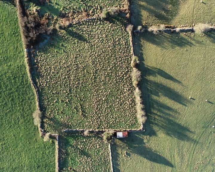
Engineers With Drones used drone-based LiDAR and multispectral sensors to map large areas of farm land across Ireland, providing detailed information about farms and their carbon sequestration potential.
Complex surveys and inspections require more than just a pilot. Our engineers can help you scope your requirements and indentify the right approach.