Scaffolding a multi-storey building for inspection is expensive and slow to erect. The alternative — rope access, cherry pickers, or mobile platforms — adds its own risk and cost. And a physical inspection can only cover what an inspector standing on a platform can see.
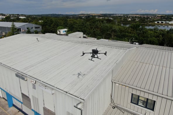
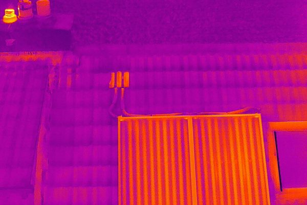
A drone inspection covers every facade and elevation in a single visit. Thermal imaging in the same mobilisation identifies moisture ingress and insulation failure behind cladding — defects invisible to a visual survey.
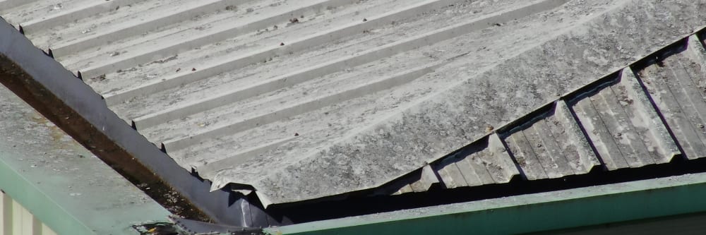
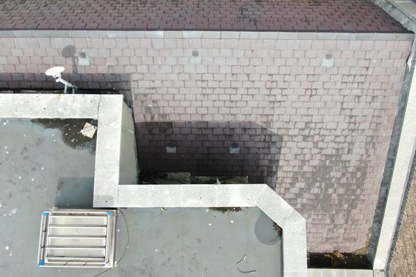
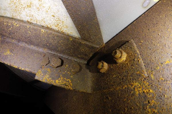
Aerial inspection of all elevations — facade, cladding, curtain walling, and external structural elements — without scaffolding, cherry pickers, or rope access. What we detect: cladding panel failure and displacement; facade cracking, spalling, and joint failure; window seal and frame deterioration; corrosion of metalwork and fixings; moisture ingress and water staining; roof slate and tile condition; chimney cracking and structural integrity.
Thermal imaging identifies moisture ingress and insulation failure behind cladding that is invisible to a visual survey. The optimal window for a building thermal survey is approximately 2–3 hours after sunset on a cold, dry day — at that point solar radiation has fully dissipated and wet or damp areas retain heat energy longer than dry areas, making the differential clearly visible. Daytime thermal surveys are typically unreliable because solar reflection masks the signal.
For buildings too dangerous for human entry, an external photogrammetric 3D model is combined with an internal confined space drone inspection. The 3D model — accessible via a single shareable link — gives architects, engineers, planners, and contractors an accurate view of the full structure. A caged internal drone enters through open windows, doors, or gaps to survey floor condition, roof structure, beam integrity, water damage, and safe access routes — without anyone entering an unsafe building.
The deliverable package includes a full photographic survey of all facades, thermal imagery where applicable, and an annotated condition report with all areas of concern identified and located. GPS-referenced imagery provides timestamped, defensible evidence suitable for insurance submissions, regulatory compliance, and engineering assessments. The report can be shared digitally with any stakeholder who needs access.
Complete facade coverage without scaffolding, cherry pickers, mobile platforms, or rope access teams. No time-consuming setup, no work at height.
Every face of the building — including parapets, upper facades, and areas behind overhangs — is captured in a single mobilisation, regardless of building height.
Thermal imaging identifies wet insulation, moisture ingress, and insulation failure behind cladding — defects invisible to a visual survey and undetectable without specialist equipment.
Drone inspection eliminates the need to put personnel at height, near unstable facades, or in structurally suspect areas. Zero risk to personnel throughout the survey.
Every identified defect is GPS-tagged and mapped on an annotated condition report. Maintenance teams can locate faults precisely without a return visit for location finding.
For structures too dangerous for physical access, an external 3D model combined with an internal confined space inspection delivers a complete condition record without any human entry.
Drone inspection covers all elevations of a building in a single mobilisation — facade, cladding, curtain walling, parapets, chimneys, and roof. What we detect: cladding panel failure and displacement; facade cracking, spalling, and joint failure; window seal and frame deterioration; corrosion of metalwork and fixings; moisture ingress and water staining (visual and thermal); roof slate and tile condition; chimney cracking and structural integrity.
To find the right approach for your building, talk to an engineer today.
For buildings that have been abandoned or are structurally unsafe, the standard facade survey is combined with an internal confined space drone inspection. The photogrammetric 3D model gives every project stakeholder — architects, engineers, planners, contractors — a single shareable link to an accurate model of the structure. A caged internal drone enters through open windows, doors, or gaps to survey interior spaces, capturing floor condition, roof structure, beam integrity, water damage, and safe access routes for follow-on visits. The result is a complete pre-restoration or pre-demolition baseline, often revealing internal features invisible from the road.
Engineers with Drones capture high-definition, aerial photography and footage from unlimited angles and perspectives. Giving you more detailed and professional-looking reports at a fraction of the cost of traditional surveys. This data can be viewed on-site by your team, or it can be shared digitally with anyone else who may require to view it remotely. Just let us know what you need...
We also offer drone roof inspections. If you would like to find out more, please do have a look at our roof inspection page.
Drone roof Inspections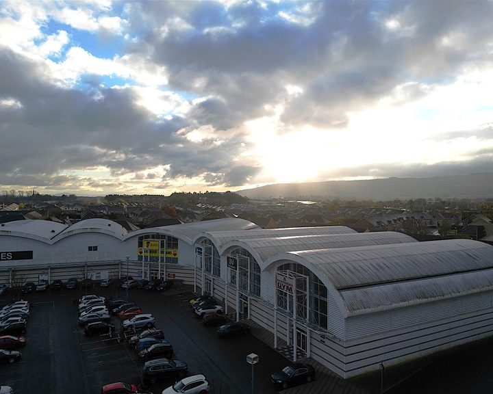
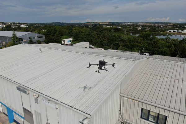
Engineers With Drones inspected seven buildings at a large commercial shopping estate using a sub-250g C0 class drone, completing a full condition survey in a single day while the estate stayed open.
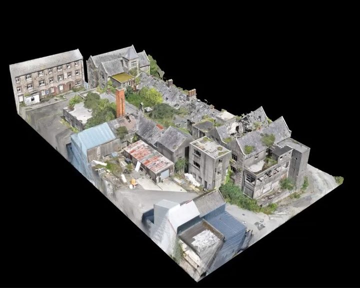
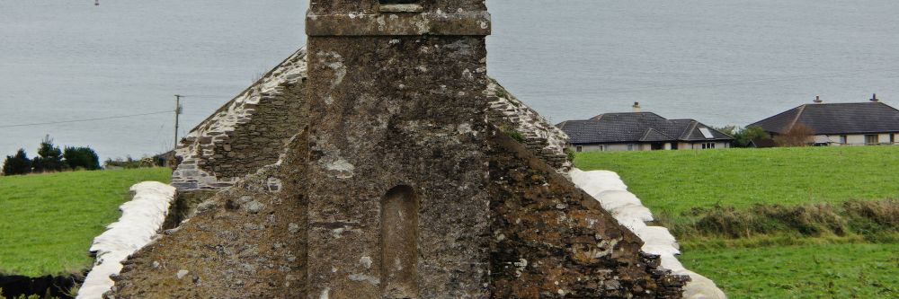
Engineers With Drones used external 3D scanning and internal confined space drones to survey a derelict hospital building in Wexford for restoration feasibility, without placing any personnel at risk.
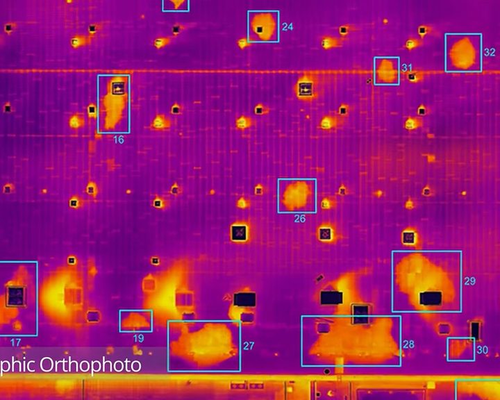
Engineers With Drones combined drone technology, thermography and orthophotos to locate water ingress across 5.2 hectares of flat bitumen roof on a large commercial building.
Complex surveys and inspections require more than just a pilot. Our engineers can help you scope your requirements and indentify the right approach.