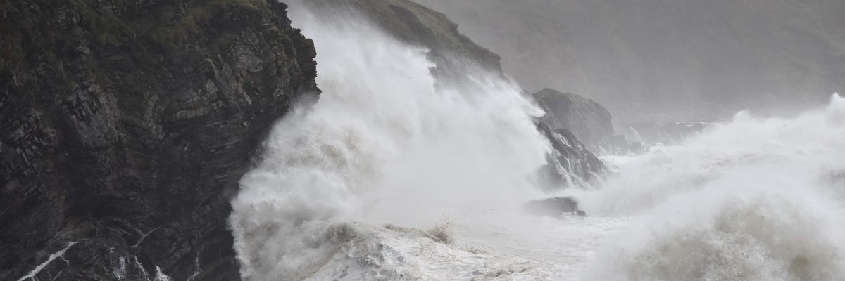
When a storm hits, the priority is understanding the full extent of the damage — quickly and safely. Engineers with Drones can mobilise within hours of a weather event, assessing buildings, roofs, infrastructure, and land from the air without putting engineers inside or on top of compromised structures.
Every image and video clip captured during the inspection is GPS-referenced and timestamped at the point of capture — producing a contemporaneous evidence record suitable for insurance claims submission, repair planning, and loss adjuster assessment. The condition report is structured to give insurers and decision-makers a clear, defensible record of the damage as it was found immediately after the event.
How quickly can a drone be on site after a storm?
Engineers with Drones aims to mobilise within hours of a weather event — often on the same day. During Storm Éowyn in early 2025, approximately 15 drone units were deployed across Ireland within 12 hours of the storm clearing, operating alongside ESB linesmen to assess damage at scale across the national grid network.
The sooner the full extent of the damage is documented, the sooner repairs can begin and insurance claims can be submitted with contemporaneous evidence.
Tell us your site requirements and timelineWhat does GPS-tagged evidence mean for an insurance claim?
GPS-tagged evidence means every photograph and video clip captured during the inspection carries embedded GPS coordinates and a timestamp from the moment of capture. This creates a contemporaneous record — proof of what the damage looked like, exactly where it was, and when it was recorded.
For an insurance claim, this provides loss adjusters with an unambiguous evidence package that is difficult to dispute. The condition report is structured specifically for insurance submission, reducing the risk of challenged claims and speeding up the assessment process.
Discuss your insurance inspection requirementsCan a drone inspect a roof without anyone walking on it?
Yes. A drone can provide complete photographic coverage of the full roof area from the air — no foot access, no ladder, no cherry picker required. This is particularly important after storm damage, when the roof surface may be structurally compromised and unsafe to walk on.
Missing tiles, membrane puncture, flashing failure, and structural deformation are all detectable in a single pass, without risking further damage to the surface and without putting anyone on a damaged structure.
More about building and roof inspections




























Speed after a storm matters. Engineers with Drones aims to mobilise within hours of a weather event — often on the same day. The sooner the full extent of the damage is known, the sooner the site can be made safe, repairs can begin, and insurance claims can be submitted with contemporaneous evidence.
What does same-day mobilisation actually mean?
It means a drone team can be on your site within hours of your call — not days later. During Storm Éowyn, approximately EWD 15 units were operational across Ireland within 12 hours of the storm clearing, assessing damage at scale alongside ESB linesmen.
For single-site or portfolio assessments, typical deployment is within 24 hours of instruction, and often same-day where the site is accessible and conditions allow safe flight.
Tell us about your timeline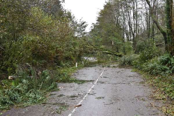
A building that has suffered structural damage in a storm may be unsafe to enter or survey on foot. A drone inspection removes that risk — engineers assess the full extent of damage from a safe standoff distance without putting anyone inside or on top of compromised structures. Large areas or multiple properties can be covered in a single sortie.
What about working at height regulations in Ireland?
The Safety, Health and Welfare at Work (Work at Height) Regulations 2006 (S.I. No. 318 of 2006) require that work at height be avoided where it is reasonably practicable to do so. A drone inspection satisfies this requirement at the first step of the hierarchy of control — the inspection is carried out from a safe standoff distance with no personnel working at height.
Because no one leaves the ground, the duties to provide fall protection, guardrails, or rescue arrangements for work at height do not arise. The regulation’s framework — avoid, prevent, minimise — is satisfied without progressing beyond the first obligation.
More about our regulatory complianceWhere can a drone fly for storm damage assessment in Ireland?
All drone operations in Ireland are regulated by the Irish Aviation Authority under the EASA framework (S.I. No. 24 of 2023). Engineers with Drones holds an EASA Specific Category Operational Authorisation (IRL.UAS.AUTH1002) — the first company in Ireland to receive this level of authorisation — which permits operations beyond Open category limits, including over populated areas and near sensitive infrastructure.
Airspace checks are carried out before every flight via the IAA AirSpace app. For storm-damaged sites, a site-specific Risk Assessment and Method Statement is prepared before fieldwork begins.
More about our operational authorisationsCan a drone inspect the inside of a collapsed or partially collapsed building?
Yes. A cage-protected confined space drone can be flown through openings in a compromised structure to capture interior damage that would be invisible from the outside — collapsed roof members, internal wall failures, water ingress, and structural deformation — without any person entering the building.
The drone transmits 4K video to the pilot in real time, and every defect is recorded for inclusion in the condition report. Because no human enters the structure, there is no confined space entry permit to prepare and no standby rescue team to arrange.
More about confined space drone inspections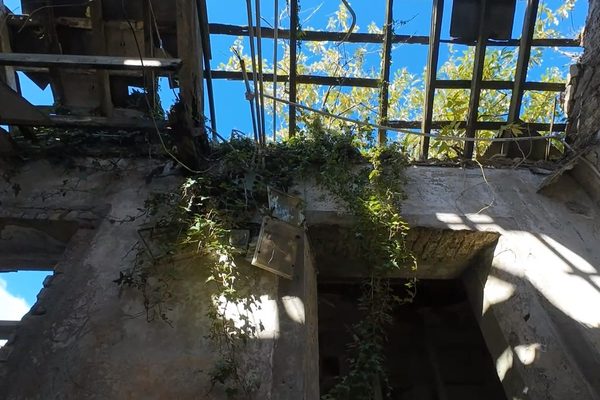
All imagery and video is GPS-referenced and timestamped at capture — creating a contemporaneous record of the damage as it was found immediately after the event. The condition report is structured for insurance submission, giving loss adjusters and insurers a clear evidence package that reduces the risk of disputed claims and speeds up the assessment process.
What makes drone evidence defensible for an insurance claim?
Three factors: GPS coordinates prove exactly where each image was captured; embedded timestamps prove when it was captured; and the structured condition report presents the evidence in a format loss adjusters can work with directly. Together, these create a record that is difficult to dispute.
The contemporaneous nature of the evidence is particularly important — capturing damage immediately after an event, before conditions change or temporary repairs are made, establishes an unambiguous baseline.
Discuss your insurance inspection requirementsCan a drone inspection support a disputed claim?
Yes. GPS-tagged, timestamped imagery provides objective evidence of condition at a specific point in time. Where a claim is disputed — for example, over whether damage pre-existed the storm event — contemporaneous drone imagery can provide the evidence needed to resolve the disagreement.
The structured condition report format is designed to be submitted directly to insurers and loss adjusters, with clear orientation references so every item of damage is unambiguously located.
Discuss your specific situationCan you produce a 3D model or digital twin of the damage?
Yes — where a claim involves complex or high-value damage, a drone can capture the overlapping imagery needed for photogrammetric 3D modelling. The resulting digital twin allows engineers and loss adjusters to take millimetre-accurate measurements directly from the model, inspect the structure from angles that would be physically inaccessible, and pin annotated damage tags to specific locations for repair crews.
If a pre-storm baseline model exists, the post-storm model can be overlaid to automatically highlight structural shifts, deformation, and material loss. This is not a standard part of rapid-response inspection — it is an additional service for claims where precise quantification adds material value.
More about 3D mapping and digital twins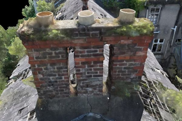
Roofs are especially vulnerable to wind damage, with failures often going unnoticed until they worsen. A drone inspection provides complete photographic coverage of the full roof area — safely, without foot access, and without risk of causing further damage to the surface. Missing tiles, membrane puncture, flashing failure, and structural deformation are all detectable in a single pass.
What types of roof damage can a drone detect after a storm?
A drone inspection can detect missing or displaced tiles and slates, membrane puncture and tearing, flashing failure around chimneys and vents, ridge tile displacement, structural deformation of roof members, and debris impact damage. High-resolution imagery allows the engineer to distinguish between pre-existing wear and fresh storm damage.
The full roof area is covered systematically, producing a complete photographic record rather than a sample. No foot access means no further damage to an already compromised surface.
More about building and roof inspectionsHow does drone roof inspection compare to a manual inspection?
A manual roof inspection requires safe access — ladders, cherry pickers, or scaffolding — and typically involves someone walking the roof surface. After storm damage, the roof may be unsafe to walk on, and foot traffic can worsen existing damage. A drone captures the same visual information from the air in a fraction of the time, with no access equipment and no risk to personnel or to the roof surface.
The drone also captures a systematic, georeferenced record — every part of the roof is photographed, not just the areas someone can safely reach on foot.
Discuss your roof inspection requirementsCan deploy within hours of a weather event clearing — often on the same day — so the full extent of damage is documented before conditions change.
Drone inspection removes the need to put engineers inside or on top of structurally suspect buildings. Assessment happens from a safe standoff distance.
Every image and video clip is georeferenced and timestamped at capture — producing a contemporaneous evidence package suitable for insurance submission.
Full photographic survey of the entire roof area from the air — no walking on damaged surfaces, no risk of causing further damage, no cherry picker required.
Large areas or multiple properties assessed in a single flight — useful for portfolio landlords, facilities managers, and insurers managing multiple affected sites.
Structured damage assessment report with GPS-tagged imagery, severity classification, and orientation reference — ready to submit directly to loss adjusters.
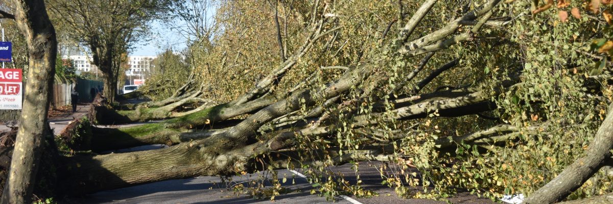
A single drone flight after a storm can capture evidence of damage across multiple categories that would otherwise require separate manual inspections by different trades. Roof damage — missing tiles, membrane puncture, and structural failure — is typically the priority, alongside facade damage from broken cladding, blown-out windows, and debris impact. Tree fall and debris impact zones can be mapped across the site, while flood extent and water ingress evidence are captured before conditions change. Structural deformation and collapse risk indicators are also assessed, giving engineers and loss adjusters a complete picture of the damage in a single pass.
Drone evidence does not just document damage — it directly feeds into the decisions that follow. Contemporaneous GPS-tagged imagery means insurers can assess claims without necessarily visiting the site, repair contractors can quote from the report rather than re-inspecting, and facilities managers can prioritise make-safe works across multiple properties from a single evidence set.
For complex or high-value claims, a 3D photogrammetric model takes this further — enabling engineers and loss adjusters to take millimetre-accurate measurements, inspect the structure from any angle, and overlay pre-storm baseline data to quantify structural movement. Where precise repair quantification matters, the model becomes the reference that everyone works from.
When Storm Éowyn struck Ireland in early 2025 — one of the most severe storm events in the country in a decade — Engineers with Drones mobilised approximately 15 units within 12 hours of the storm clearing. Operating across the country alongside ESB linesmen, drone pilots assessed storm damage at scale across the national grid network. What would otherwise have taken a week to two weeks of walking surveys was compressed to 10-minute drone flights per location, enabling surgical and rapid restoration of power to affected customers.
Tell us what you need to know, and we will work with you to design actionable deliverables that give you the outcomes you need.
A typical storm damage inspection delivers GPS-tagged photographic and video evidence of all identified damage across the affected site. Where the damage is extensive or covers multiple properties, an orthomosaic overview map is also produced — giving you a single georeferenced image of the full affected area with every damage location marked.
The condition report categorises each item of damage by type and assigns a severity level, with clear orientation references. It is designed to be submitted directly to your insurer or loss adjuster without reformatting, and is equally suitable for handing to a repair contractor as a scope-of-works reference.
Every damaged area photographed with GPS coordinates and timestamp — unambiguous evidence of condition immediately after the event.
Full-motion video coverage of affected structures and areas — useful for remote assessment by insurers and off-site decision-makers.
Georeferenced aerial map of the affected area showing damage extent and spatial relationship across multiple structures or land parcels.
Photogrammetric 3D model enabling millimetre-accurate measurements, multi-angle inspection, and pre/post-storm overlay for change detection — available for complex or high-value claims.
Structured damage assessment with severity ratings, orientation reference, and GPS-tagged imagery — ready to submit to your loss adjuster.
Complex surveys and inspections require more than just a pilot. Our engineers can help you scope your requirements and indentify the right approach.