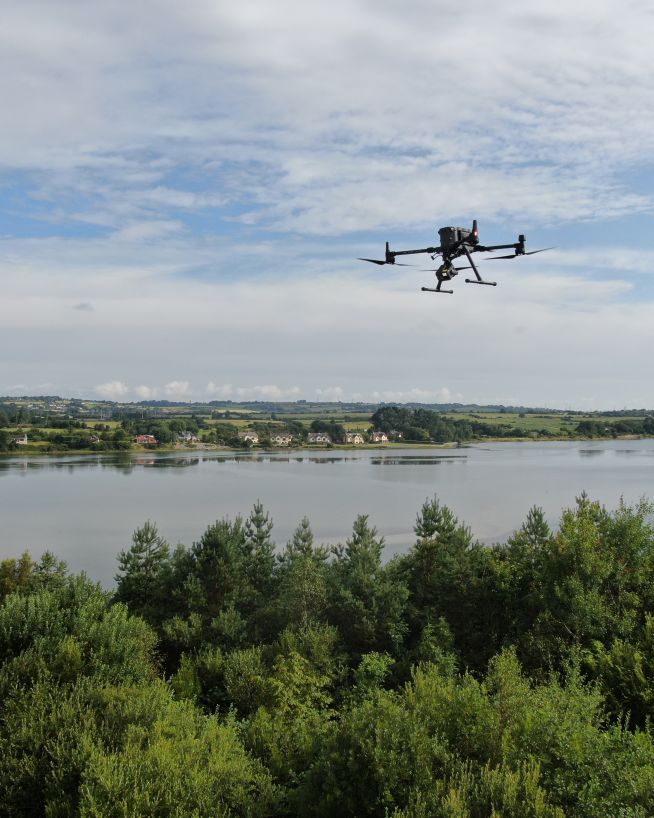
Drone surveys
Topographic mapping, LiDAR, photogrammetry, farm mapping, forestry, and volume measurement. Every survey is conducted by a qualified engineer and delivered with a full accuracy statement.
Let's talkTopographic mapping, LiDAR, photogrammetry, farm mapping, forestry, and volume measurement. Every survey is conducted by a qualified engineer and delivered with a full accuracy statement.
Let's talkWhether you need a georeferenced orthomosaic for a planning submission, a bare-earth Digital Terrain Model for drainage design, a point cloud for structural measurement, or contour plans for a construction tender — the survey method and the workflow both matter. On hardscape, photogrammetry achieves approximately 2 cm accuracy with ground control. On vegetated land, only LiDAR penetrates the canopy and returns the actual ground surface beneath. Every survey is scoped by an experienced engineer who asks the right questions before a drone leaves the ground. Watch our video where our founder Bob Foley explains drone surveys.
A precisely stitched overhead image with GPS coordinates embedded. Used for planning submissions, CAD overlays, site management, and change detection between survey dates.
A DEM captures the bare ground surface (with LiDAR on vegetated land); a DSM captures everything above it — buildings, vegetation, and structures. Both are standard outputs for engineering and planning.
A dense set of GPS-tagged measurement points covering the full site — the foundation for 3D models, structural measurement, and volume calculations.
Generated directly from the elevation model and exported for use in CAD or GIS software. Available at any specified contour interval.
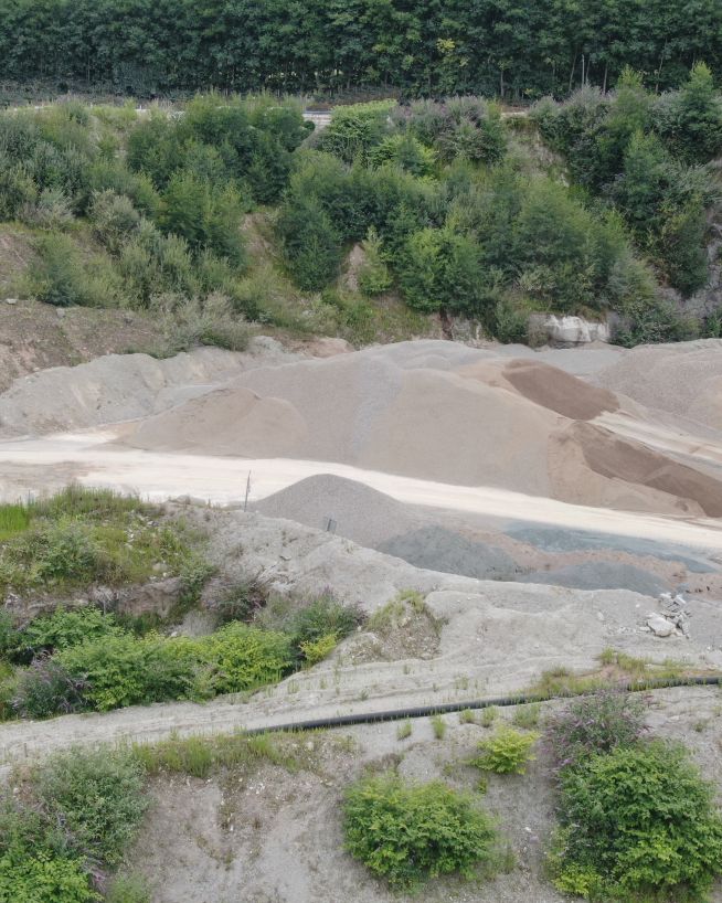
Stockpile inventory, cut/fill earthworks tracking, and material estimates — calculated from the photogrammetric or LiDAR model to survey-grade accuracy.
Every survey is delivered with documented accuracy so the data can be used with confidence for engineering and planning decisions.
Photogrammetry records the top of vegetation as the ground surface. On sites with grass, crops, hedgerows, or woodland, only LiDAR penetrates the canopy and returns the actual ground beneath.
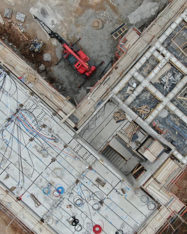
On roads, buildings, gravel, and construction sites, photogrammetry achieves approximately 2 cm accuracy with ground control — at lower cost than LiDAR and with no penetration required.
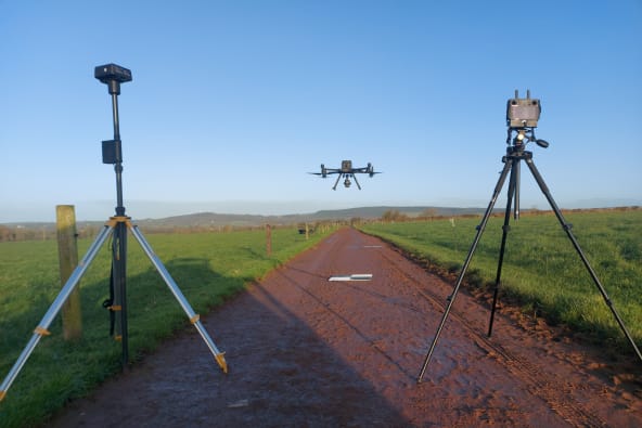
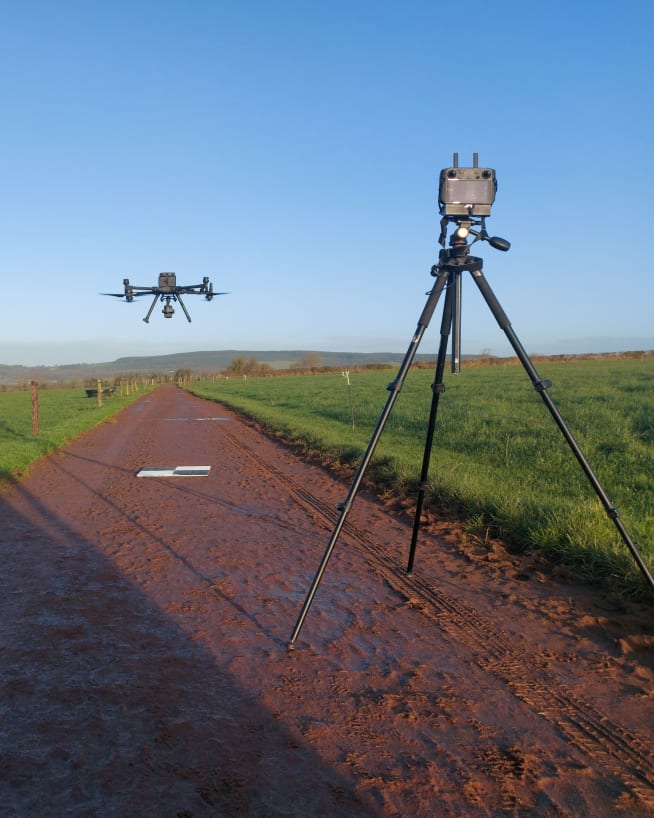
Ground control points are the difference between indicative positioning and certified survey-grade data. RTK-only flying is available for broad overviews; GCPs are required for engineering and planning submissions.
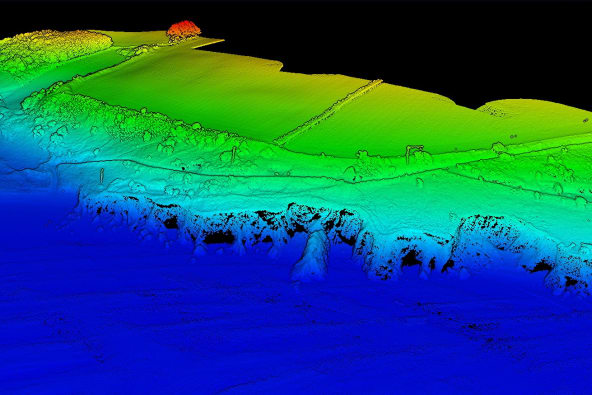
LiDAR’s key differentiator is bare-earth topography — the ability to model the ground as if all vegetation were stripped away. Photogrammetry produces a point cloud too, but cannot see through vegetation.
Ground control setup takes 3–5× as long as the flight itself. The accuracy it delivers is what separates an overview from data that can be taken to planning or used for engineering design.
Talk to an engineer before commissioning your survey. The right method depends on what is on the land and what the data will be used for. Get in touch.
LiDAR is the only drone survey method that recovers bare-earth ground topography beneath vegetation. The laser fires multiple pulses per shot — the later returns find gaps in the canopy and reach the actual ground surface beneath hedgerows, grassland, and woodland. The result is a Digital Terrain Model of the true ground, not the top of the crops. For drainage design, flood plain analysis, corridor mapping, and any application where ground level matters on vegetated land, there is no photogrammetric substitute.
LiDAR surveysOn hardscape — roads, buildings, gravel yards, ploughed fields, and construction sites — photogrammetry achieves approximately 2 cm accuracy with ground control points and delivers a full orthomosaic alongside the elevation model in the same flight. The standard choice for pre-construction topographic surveys, as-built verification, cut-and-fill earthworks tracking, and solar farm pre-design surveys where ground penetration through vegetation is not required.
Photogrammetry surveysIn addition to quadrupling the resolution of an HD camera, 4K also gives you quicker frame rates, incredible contrast variations, and expanded colours. VR video takes the level of immersion and clarity to the next level.
Images & Video


Drone surveys are commissioned across construction, civil engineering, agriculture, and energy. Any project requiring accurate spatial data — for planning, design, tendering, monitoring, or compliance — is a candidate.
Instant, actionable data with no downtime
Accurate and efficient analysis of crops and land
Faster, cheaper and more accurate analysis of land
Aerial mapping and site documentation for planning, development, and land management
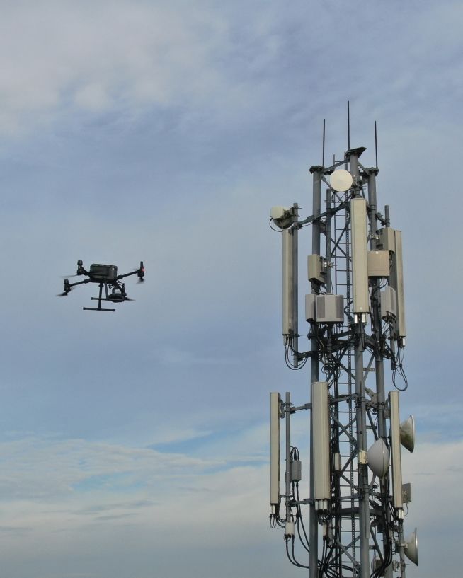
Verify radio path clearance and link feasibility for telecoms infrastructure
Monitor status and progress without downtime
Safer, more precise data collection at a fraction of the cost
We take emails, phone calls, messages, everything! If you are unsure of what's possible we are happy to advise, the most important thing is to get in touch. We'll be happy to answer any questions you may have.
With drones, it's best to begin where you want to end up. What sort of deliverable would you like when it's all finished? If you are not sure then we can advise. We can look at what you would like and work backwards from there.
Once we have agreed on what is to be done, the scope of work is set and a price is agreed upon. We feel it is vital that everyone knows what they are getting and what they are paying for it. There should be no confusion.
Once we have confirmation you are happy to proceed, we start the ball rolling. We organise things like RAMS, site permits, Air Traffic Control clearance and much more. Basically, we generate everything needed to turn up on-site with all our ducks in a row.
Next, we do the work on site. We have the gear, we have the know-how, so now it's time to get the job done. This can sometimes be affected by the weather, but for the most part, we get the job done on the date specified.
This is where we take what we generated in the field and turn it into a final deliverable for you. This can be anything from the raw data itself, to fully processed Orthophotos, condition reports, CAD line work or thermal imagery.
The final step is the handover of the deliverables. We tend to use a cloud-based service, so you can access your data anywhere. We can also tie into your existing systems if that is more convenient.