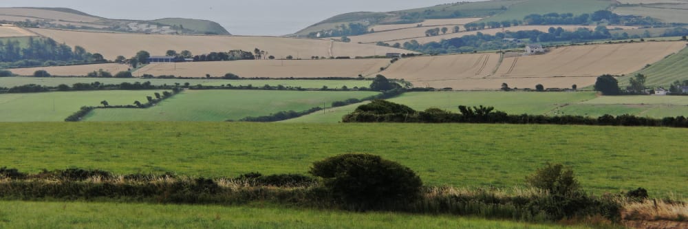
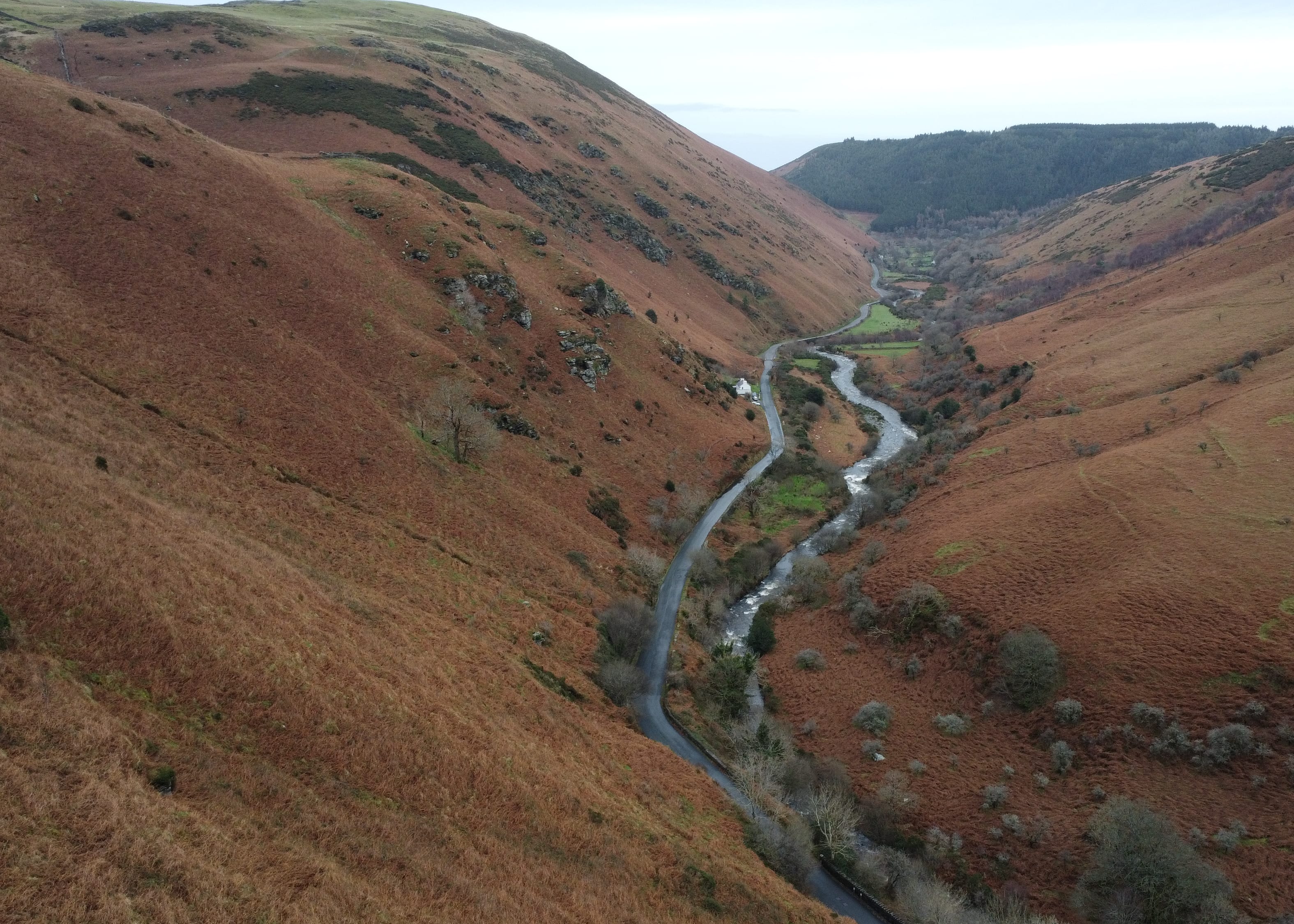
Drones are quickly overtaking other equipment as the most necessary and cost-effective tool for aerial photography and cinematography. Getting off the ground level is essential for effectively showing a landscape's true dimensions and the division of its elements.
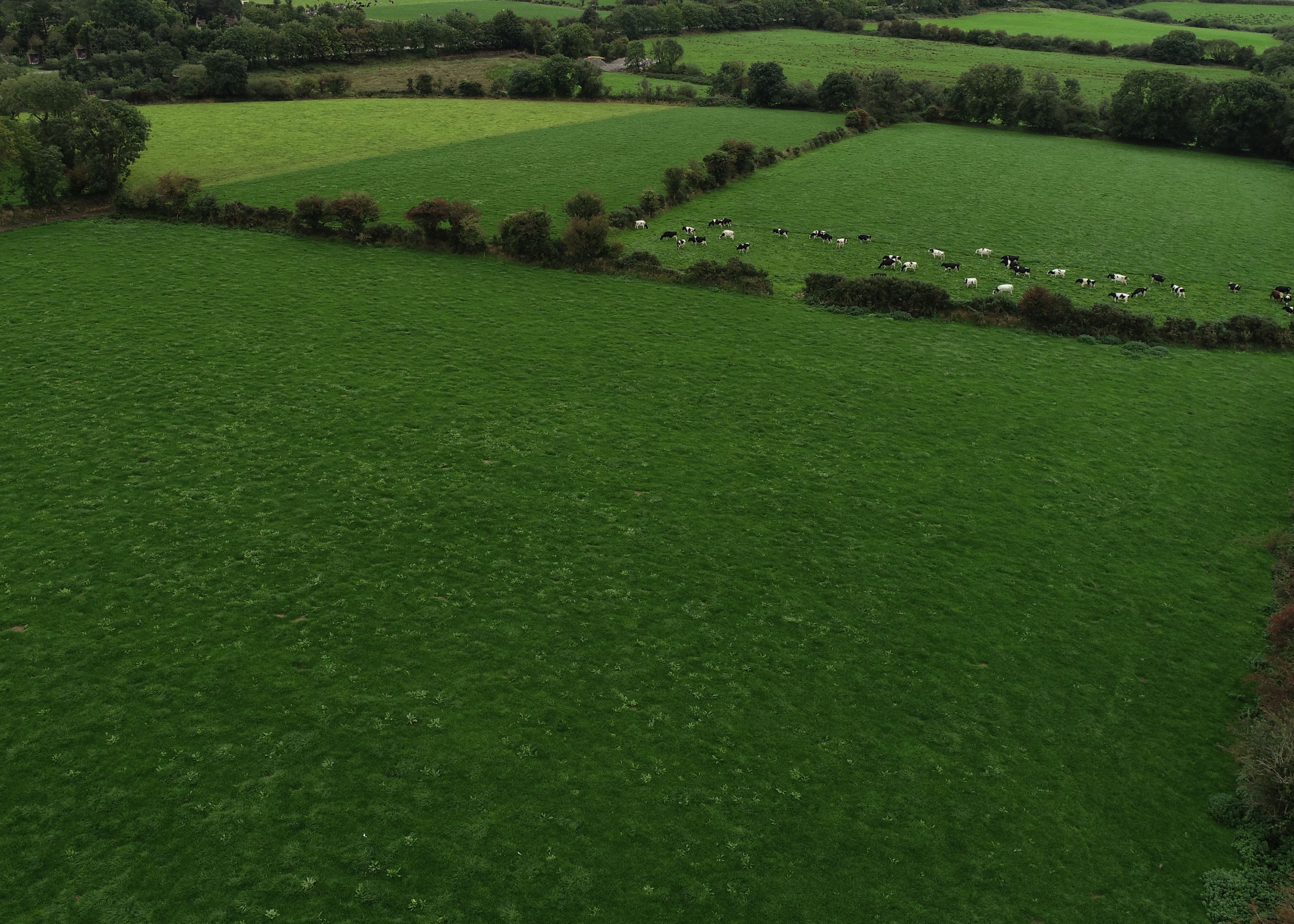
Large areas of land can easily be photographed, examined, and documented by drones to capture an exact reading of their geography, boarders, and vegetation cover. This allows you to record a professional and accurate status of your land at a given point in time, without having to step foot on the ground.
Our drones' thermal cameras and remote sensing technologies, allow issues associated with irrigation, and insufficient or excessive moisture, to be easily rectified. Using this data, together with crystal-clear RGB Imagery of soil and crops, you can identify natural land flow patterns, prevent water-logging and optimise drainage.
Drones with thermal imaging cameras can accurately and quickly analyse the status of soil. Identifying problems with soil quality, fertiliser management, or dead soil zones using precision data capture. This information helps in identifying the best practises for planting, crop management, and soil management.
Using drone photography and orthomosaic technology, allows us to perfectly reflect a geographic area. Giving you a crystal-clear top-down view that has been corrected for geometric distortions — resulting in a pinpoint representation of the Earth's surface. An orthomosaic map is a state-of-the-art measuring device for accurate readings of scale and distance.
The safety of your personnel and our own is paramount, and we place it at the forefront of our company culture. Ask us about our HSSE systems and practices.
We understand that you need answers fast. We can deliver a plain-English report with clear-cut conclusions in days. Then, you can take the steps you need to and get back to doing what you do best.
Drone inspections take up less of your manhours and resources than traditional inspections, giving you a faster and more budget-friendly return on your investment.
Downtime is expensive, unpopular and inconvenient. Using a drone, our engineers can conduct a thorough survey with little to no downtime.
Thermal IR technology and ultra HD allow our engineers to get a view that is not available to the naked eye. From a safe distance, we can find defects and insights that are only visible with a drone.
We use cutting-edge technologies to detect problems that would otherwise be invisible. These include 4K ultra-HD photography/video, LIDAR and thermal imaging.
Need us there in a hurry? No problem. Let us know what you need, and we can be there on the same day. After all, sometimes the problem just won't wait.
Sometimes the brief can change even in real-time. If need be, you can be stood there right next to the drone operator, directing them as the situation develops.
Obtaining aerial imagery of a landscape is challenging and occasionally risky without drones. Erecting hoists, cranes and scaffolding, or reaching a natural high-point overlooking the area is time-consuming and expensive. Or you could board a manned aircraft, which would allow you to record video from restricted angles, again costing time and money.
Engineers With Drones provide limitless compositional options from endless perspectives. With the help of our high-quality footage, which clearly distinguishes the foreground from the backdrop, the environment appears more natural and captivating. Additionally, with less safety hazards and more thorough tracking of progress, our drones provide quicker, more extensive inspections and surveys of landscapes.
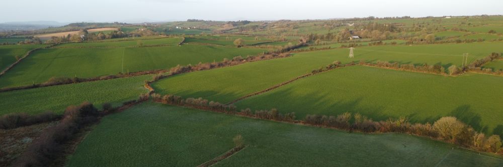
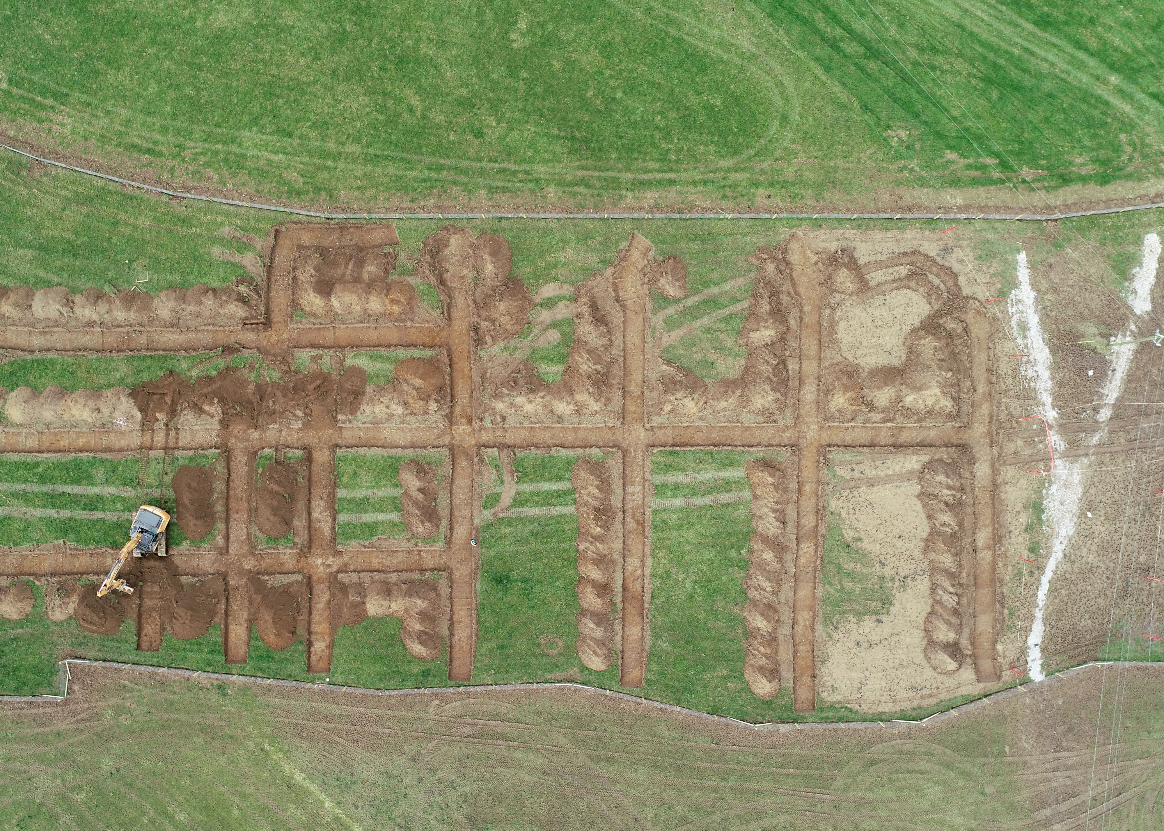
We can provide aerial footage from any imaginable angle. A popular shot in landscape photography today is having the camera directly above an object. This angle gives a great insight into the footprint of a landscape or an asset within it. Getting this vantage point is nearly impossible to achieve with any other method than drones.
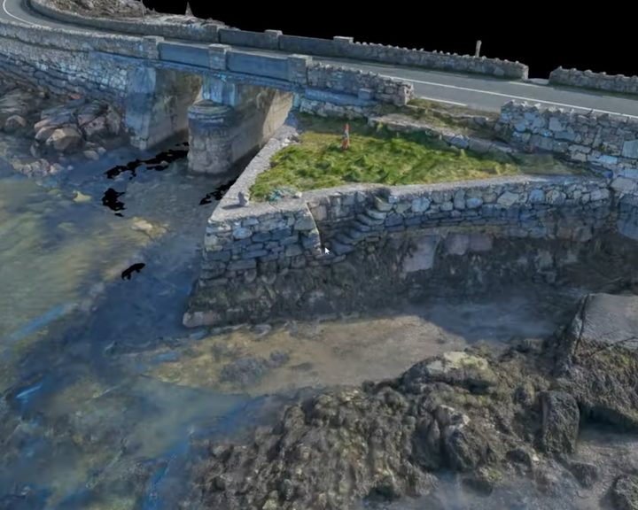
Engineers With Drones surveyed four historic stone causeways in west Galway using photogrammetry to create high-resolution 3D models and technical deliverables.
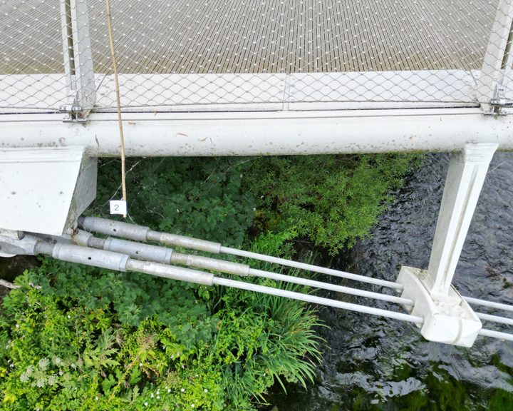
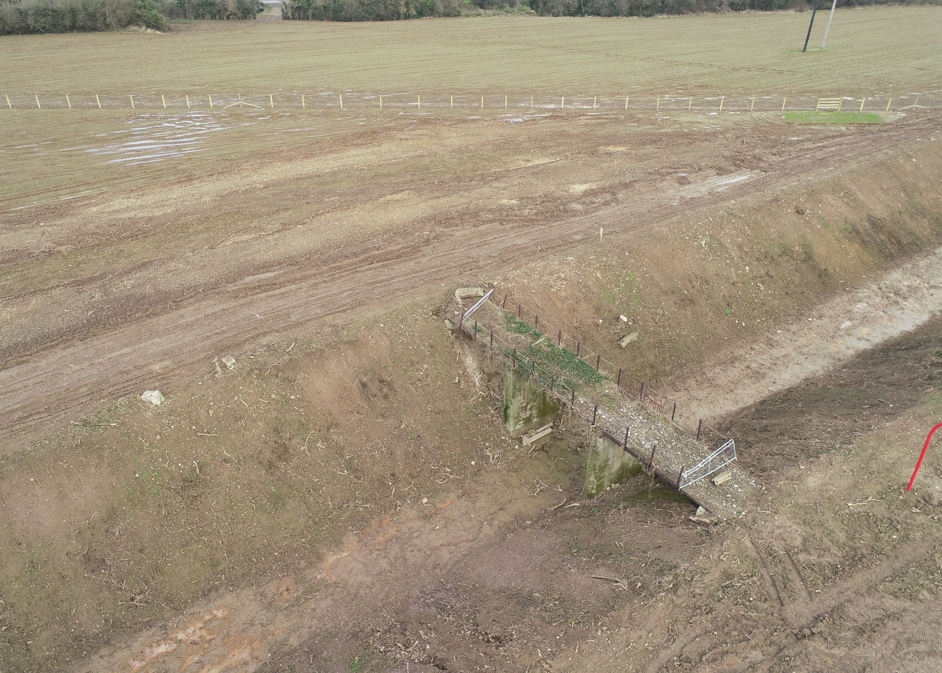
Drone bridge inspection case study — using a drone to conduct a detailed inspection of a 350-metre pedestrian bridge with an intricate cable-truss design that makes thorough manual inspection difficult.
Complex surveys and inspections require more than just a pilot. Our engineers can help you scope your requirements and indentify the right approach.


A digital surface model (DSM) made by a drone refers to a 3D representation of the Earth's surface that is created through the use of remote sensing technology. Drones are equipped with sensors that capture high-resolution images of the ground surface from different angles, which are then processed and stitched together to create a comprehensive 3D map. The DSM is different from other elevation models, as it includes all surface features, including trees, buildings, and other objects on the ground. DSMs have a wide range of applications, including land management, urban planning, environmental monitoring, and disaster response.
A Digital Surface Model (DSM) is a 3D representation of a geographic area that shows the height, shape, and texture of the terrain and any objects on the surface. It is created using digital elevation data obtained from various sources such as aerial photography, LIDAR, or satellite imagery. DSMs can be used in a variety of applications, including urban planning, flood risk assessment, and infrastructure development. They provide a detailed view of the Earth's surface, allowing for accurate measurements of elevation and topography. DSMs are a valuable tool for analyzing and visualizing the landscape and can be used to support a wide range of geospatial analyses.
A digital terrain model (DTM) created by a drone refers to a highly accurate and detailed digital representation of the Earth's surface, generated through the use of unmanned aerial vehicles (UAVs) equipped with advanced sensors and cameras. These sensors collect a vast amount of data, which is then processed using specialized software to create a 3D model of the terrain. The resulting DTM is typically used for various applications such as urban planning, construction, forestry, agriculture, and natural resource management. The advantage of using a drone to create a DTM is its ability to capture data from hard-to-reach areas and produce high-resolution images with incredible accuracy.
A digital terrain model (DTM) is a digital representation of the Earth's surface that captures the elevation data of a particular area, represented in a grid format. It is created by using specialized software that analyzes data from various sources, such as satellite imagery, aerial photography, and ground-based surveys. The DTM accurately portrays the three-dimensional topography of the terrain, including the height and slope of the land, and can be used for a wide range of applications, such as urban planning, flood management, geological analysis, and environmental modeling. DTMs are widely used in the fields of cartography, geology, geography, and remote sensing, among others.
DSM (Digital Surface Model), DTM (Digital Terrain Model), and DEM (Digital Elevation Model) are three commonly used terms in the field of geomatics and remote sensing. These models represent different types of 3D data models that are used to represent the elevation of the Earth's surface. Although they are often used interchangeably, there are some significant differences between these models.
A DSM represents the topmost surface of the Earth's terrain, including any vegetation, buildings, and other objects that may be present on the ground. In other words, a DSM is a digital representation of the Earth's surface with all features and objects included. DSMs are commonly used in applications such as urban planning, flood modelling, and environmental studies, where a detailed representation of the Earth's surface is required.
A DTM represents the bare Earth surface, excluding any objects or features above the terrain such as vegetation, buildings, and other structures. DTMs are used to study the Earth's surface in its natural form, and are commonly used in applications such as topographic mapping, hydrology, and soil mapping. DTMs are created by removing all features from a DSM, leaving only the terrain elevation data.
A DEM represents the elevation of the Earth's surface in a digital format, regardless of whether it is covered by objects or features such as vegetation or buildings. DEMs can be derived from both DSMs and DTMs, and are used in a wide range of applications, such as flood risk assessment, land management, and geological studies.
The main differences between DSMs, DTMs, and DEMs lie in the type of data they represent and the applications they are used for. DSMs represent the topmost surface of the Earth's terrain, while DTMs represent the bare earth.

An orthomosaic is a high-resolution, georeferenced image produced by stitching together multiple overlapping aerial or drone images. Unlike a regular mosaic, an orthomosaic corrects for perspective distortion and terrain variations, resulting in a highly accurate and detailed representation of the area being imaged.
Orthomosaics are used in a variety of fields, including agriculture, construction, urban planning, and environmental monitoring. For example, in agriculture, orthomosaics can be used to create detailed maps of crop health and yield, allowing farmers to optimise their planting and fertilization strategies. In construction, orthomosaics can be used to monitor progress and identify potential safety hazards on a job site. In urban planning, orthomosaics can be used to map out infrastructure and identify areas in need of maintenance or repair. And in environmental monitoring, orthomosaics can be used to track changes in land use, detect changes in water quality, and monitor wildlife habitats.
An orthophoto is a georeferenced aerial or satellite photograph that has been corrected for topographic relief, camera tilt, and other distortions so that it has a uniform scale and can be used for precise measurement and mapping.
To create an orthophoto, multiple overlapping images of an area are captured from different angles and heights. These images are then corrected for distortions, such as perspective and relief displacement, using photogrammetric techniques. The result is an image that has a uniform scale and can be used for accurate measurements of distance, area, and volume.
Orthophotos are used in a variety of applications, including urban planning, land surveying, environmental management, and emergency response. They are particularly useful for identifying and mapping changes in land use, such as the expansion of urban areas or the conversion of natural habitats. Orthophotos can also be used to create detailed terrain models and to plan the placement of infrastructure, such as roads and buildings.
By measuring the reflected and emitted radiation of an area from a distance, remote sensing is the process of identifying and keeping track of the physical features of a location. Remotely sensed images are captured by specialised cameras to form an accurate reading of the Earth.
Real-Time Kinematic (RTK) is a type of satellite-based positioning system that is commonly used in surveying and mapping applications. RTK technology uses a combination of GPS (Global Positioning System) and GLONASS (Global Navigation Satellite System) signals to provide highly accurate and precise location information. Unlike traditional GPS systems that provide accuracy within a few meters, RTK systems can provide Centimetre-level accuracy in real-time. RTK works by using a fixed base station that receives satellite signals and transmits corrections to a mobile rover receiver in real-time. This allows the rover to calculate its precise location relative to the base station with high accuracy and speed.
UHD or Ultra High Definition signifies that a camera's resolution is 3840x2160 pixels. This is exactly four time higher than high definition cameras (1920x1080 pixels), and so UHD is often also know as 4K. More about drone photography...