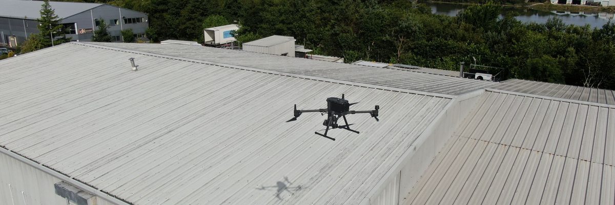
A leaking roof starts costing money long before water appears inside the building: saturated insulation, stained ceilings, disrupted tenants. By the time a leak is visible indoors, the point of ingress can be metres away from the damage it has caused. A drone survey finds the defects that let water in — failed flashings, split seams, cracked membranes — with complete photographic coverage of the roof surface and no one setting foot on it.
On flat roofs, a thermal survey flown after dark maps wet insulation beneath the membrane — the water that has already got in and is quietly degrading the roof build-up. This is the information a visual survey cannot provide, and it tells you exactly where to open up the roof to make repairs.
What can a drone roof survey actually detect?
Membrane blistering, cracking, and split seams; flashing failure at upstands and penetrations; blocked gutters and outlets; pooling water; rooflight cracking and seal failure; and the condition of rooftop plant mountings. On flat roofs, a thermal survey additionally maps wet insulation beneath the membrane.
Every defect is photographed, located, and compiled into a structured condition report rather than left as raw imagery.
See what a visual roof survey coversDoes anyone need to walk the roof?
No. The drone captures the complete roof surface from the air — no scaffolding, no ladders, no foot traffic on the membrane. This removes the fall risk for personnel and avoids the damage that foot access can itself cause to a roof surface.
More about our regulatory complianceHow does thermal imaging find water in a roof?
Water trapped in insulation absorbs heat during the day and releases it slowly after sunset. A thermal survey flown two to three hours after dark reads the surface temperature pattern of the roof — warm patches with no obvious heat source are the signature of wet insulation beneath the membrane.
A thermal camera does not see through the membrane — it reads the heat emitted at the surface, which is why the survey is flown at night on a cold, dry day when the differential is strongest.
More about thermal imaging surveysWhat size of roof do you survey?
Large commercial and industrial roofs — shopping centres, hospitals, warehouses, and distribution facilities. A 5.2 hectare flat roof — larger than most housing estates — has been surveyed in a single mobilisation.
The service is aimed at commercial property, not individual houses.
See a 5.2 hectare roof inspection case study






























A single flight photographs the entire roof surface — membrane, seams, flashings, gutters, outlets, rooflights, and penetrations — at close standoff distance. What a visual survey typically detects: membrane blistering, cracking, and split seams; flashing failure at upstands and penetrations; rooflight cracking and seal failure; and debris or vegetation holding water against the surface.
What about working at height regulations in Ireland?
The Safety, Health and Welfare at Work (Work at Height) Regulations 2006 (S.I. No. 318 of 2006) require that work at height be avoided where it is reasonably practicable to do so. A drone survey satisfies this requirement at the first step of the hierarchy of control — the survey is carried out from ground level with no personnel working at height.
Because no one leaves the ground, the duties to provide fall protection or rescue arrangements for work at height do not arise.
More about our regulatory complianceWhere can a drone fly over commercial buildings in Ireland?
All drone operations in Ireland are regulated by the Irish Aviation Authority under the EASA framework (S.I. No. 24 of 2023). Engineers with Drones holds an EASA Specific Category Operational Authorisation (IRL.UAS.AUTH1002), which permits operations beyond Open category limits — including over populated areas and above buildings.
For active sites, a site-specific Risk Assessment and Method Statement is typically prepared and agreed with the site health and safety officer before fieldwork begins.
More about our operational authorisations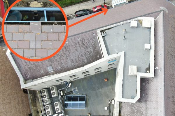
Wet insulation is the damage a leak does before it shows itself. Water trapped beneath a flat roof membrane holds heat long after the sun goes down. A thermal survey flown two to three hours after sunset on a cold, dry day makes those wet zones visible as warm patches on the thermal orthomosaic — the dataset a visual survey cannot provide.
Does a thermal camera see through the roof membrane?
No — this is a common misconception. A thermal camera measures the rate at which different surfaces emit heat. Wet insulation retains heat and warms the membrane above it, and the camera reads that surface pattern. Key indicators of trapped water are inkblot-shaped warm areas with no identifiable surface heat source, and linear warm zones along seams where the membrane may have separated.
More about thermal imaging inspectionsWhen is the thermal survey flown?
The thermal dataset is captured approximately two to three hours after sunset on a cold, dry day — the point at which the temperature difference between dry and wet roof sections is most readable. By early morning the differential equalises and the signal disappears.
If standing water is present on the roof surface, the survey is rescheduled — surface water masks the subsurface signal and produces misleading data.
Discuss your roof survey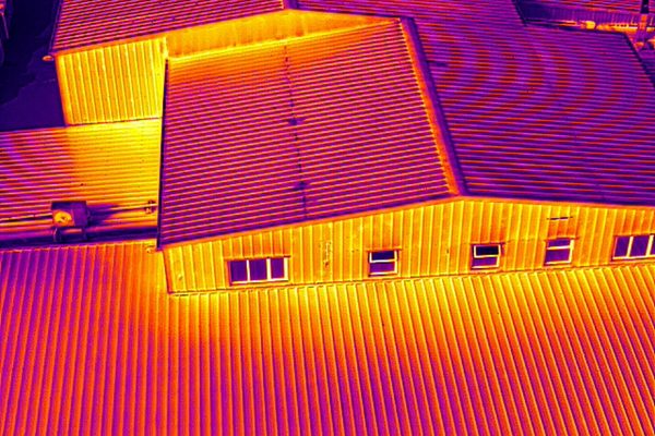
Many flat roof leaks are not membrane failures — they are drainage failures. Blocked gutters and outlets hold water against the roof surface, and pooling water eventually finds a way through. The survey checks drainage paths across the full roof, along with the condition of rooftop plant: unit bases, penetrations, and the flashings around them, which are among the most common points of water ingress.
Why do penetrations cause so many leaks?
Every penetration through the membrane — vents, pipes, cable trays, and plant bases — creates a junction that must be sealed. Flashing failure at upstands and penetrations is one of the most common defects a roof survey finds, and these junctions are checked as part of the standard visual survey.
See what a visual condition survey coversWhat does pooling water mean for the roof?
Pooling water means the drainage is not working — typically blocked gutters or outlets, or a failed fall. Standing water accelerates membrane degradation, and the survey identifies both the pooling zones and the drainage defects causing them.
Discuss your roof survey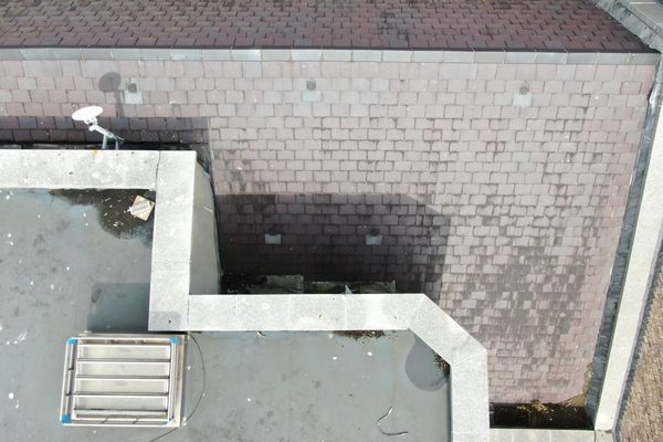
Every defect identified during the survey is compiled into a structured condition report: photographed, described, categorised by defect type, and assigned a severity level. A simple orientation diagram shows where each defect sits on the roof, so a maintenance team can go directly to the marked locations instead of searching the roof. The report is accessible to non-technical stakeholders without specialist software.
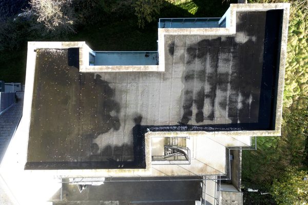
The survey is flown from ground level — no scaffolding, no ladders, no personnel at height. This satisfies S.I. No. 318 of 2006 at the first step of the hierarchy of control.
A thermal survey flown after dark maps the moisture already trapped beneath the membrane, so only the affected areas are opened up for repair.
Every seam, flashing, gutter outlet, rooflight, and penetration photographed in a single mobilisation — a record of the whole roof, not spot checks.
A flat roof of five hectares or more can be surveyed in one visit — one dataset and one report covering the entire building.
Each defect photographed, described, classified, and severity-rated, with its location shown on an orientation diagram of the roof.
Trades can go directly to the marked defect locations, so repair work can be planned and priced accurately from the report.
A traditional roof inspection means walking the surface — which requires access equipment, puts personnel at height, and can itself damage the membrane. A drone survey typically covers the entire roof in a single flight: membrane condition, seams, flashings, gutters, outlets, rooflights, penetrations, and rooftop plant, all photographed at close range from a safe standoff distance.
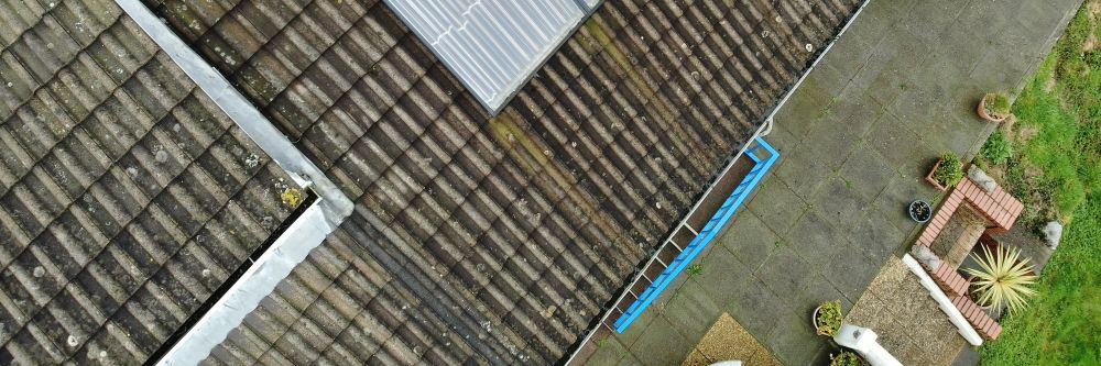
Water already inside the roof build-up is invisible to a visual survey but shows clearly on a thermal survey flown after dark. Wet insulation retains the day’s heat and releases it slowly, producing warm patches on the thermal orthomosaic that mark the extent of moisture ingress. Pinpointing these zones tells you exactly where to open up the roof for repair, rather than stripping large areas to find the problem.
Heat escaping through the same gaps is a secondary concern: energy loss is a different discipline, addressed once the roof is confirmed watertight. The same openings that admit water can also admit insects, so sealing them resolves both.
Tell us what you need to know, and we will work with you to design actionable deliverables that give you the outcomes you need.
A typical roof inspection delivers a full photographic survey of the roof surface and periphery and, for flat roofs, a thermal orthomosaic identifying wet insulation zones. An annotated condition report ties every finding together.
Findings are compiled into a defect classification report: each defect described, categorised by type, and assigned a severity level. A simple orientation diagram shows each defect’s location on the roof, accessible to non-technical stakeholders without specialist software and ready to hand directly to a maintenance or repair team.
Every membrane seam, flashing, and penetration photographed at close range in a single mobilisation.
Wet insulation zones mapped across flat roofs — the moisture ingress a visual survey cannot see.
Every defect described, classified, and severity-rated, with supporting photography of each finding.
Each defect located on the roof plan, so repair work can be targeted precisely and priced accurately.
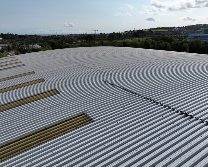
A leaking roof on a large Dublin warehouse that was in full use. Surveyed from the air and verified from inside the building, without closing it or asking anyone to leave.
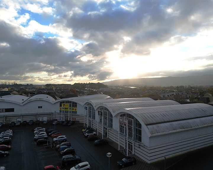
Engineers With Drones inspected seven buildings at a commercial shopping estate using a sub-250g C0 class drone, completing a full condition survey in a single day while the estate stayed open.
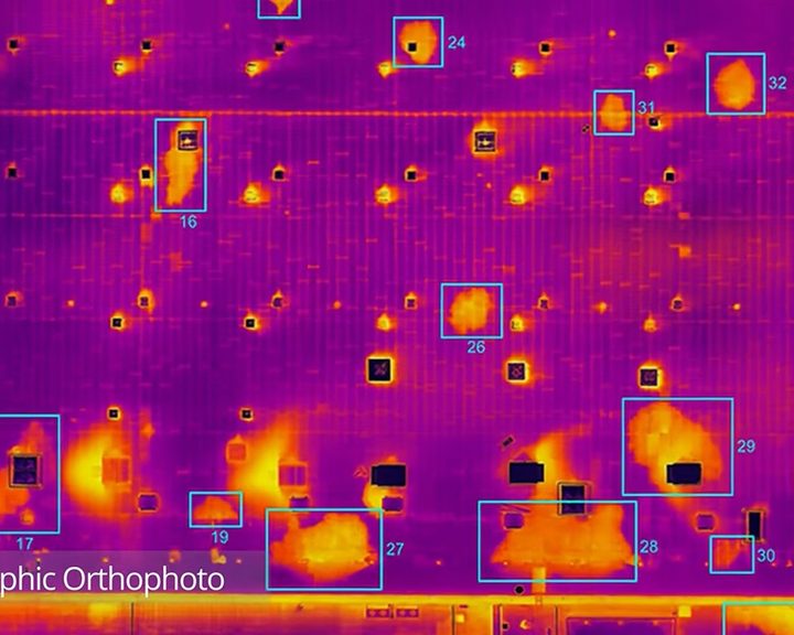
Engineers With Drones combined drone technology, thermography and orthophotos to locate water ingress across 5.2 hectares of flat bitumen roof on a large commercial building.
Complex surveys and inspections require more than just a pilot. Our engineers can help you scope your requirements and indentify the right approach.