Asset Inspections
Reliable, actionable inspections & reports compiled by experienced engineers
Reliable, actionable inspections & reports compiled by experienced engineers
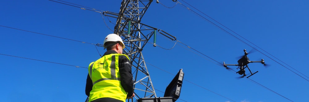
As qualified engineers with extensive industry experience, we provide comprehensive drone inspection services across Ireland. Our state-of-the-art UAV technology combined with engineering expertise delivers detailed, actionable inspections & reports for buildings, bridges, towers, industrial assets, and more.
From thermal imaging to confined space inspections, we offer safer, faster, and more cost-effective solutions than traditional inspection methods. No scaffolding, no downtime, no risk to personnel.
Find and fix air leaks to preserve your building's performance, energy efficiency and air quality.
Find and eliminate moisture intrusion to prevent rot and health problems associated with mould and mildew.
Reduce your energy costs and do your bit for the environment by finding and eliminating gaps in insulation.
Find delamination in concrete structures with little to no downtime. Quick, reliable and cost-effective.
Identify and resolve potential problems with electrical distribution equipment before they lead to failure.
Monitor earthwork changes over time for a fast and cost-effective way to avoid any discrepancies.
Get instant and actionable data on the current status of your asset's fixtures, fittings and structure.
Cold bridges can be responsible for up to 30% of a building's heat loss. With drone technology, they're easy to find.
Keep your photovoltaic array running safely and efficiently by finding and fixing issues in your solar cells.
Easily locate and isolate any areas of your asset that have been affected by erosion or corrosion.
Using thermography, it's easy to detect gas leaks which are harmful to human health and the environment.
The applications of asset inspections in domestic and industrial environments are almost limitless. Ask us what it can do for you.


