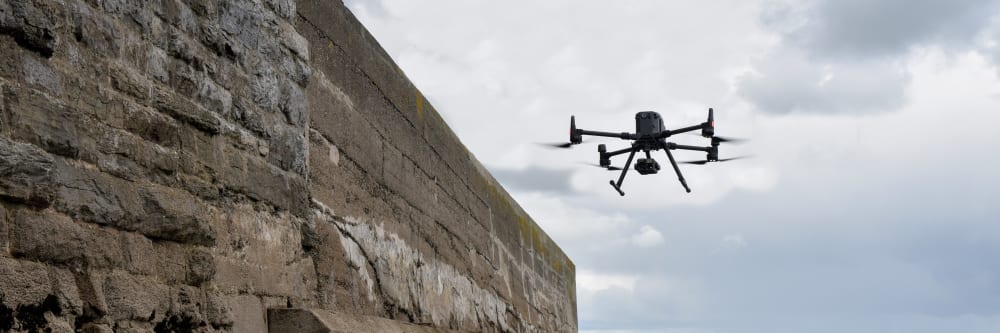
Structures in and around the water wear down over time due to erosion. Surveying coastal structures is difficult because of their location - but necessary to keep them in good condition. Drones simplify this process by capturing high-quality images from a safe distance. As engineers, we know that every structure requires a different approach - and we tailor our services to your needs.
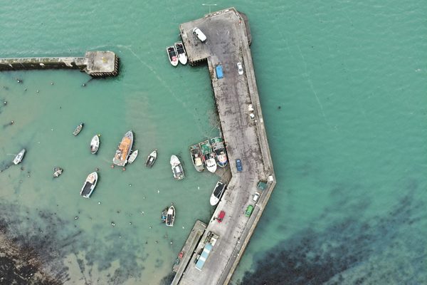
Our drones can monitor huge areas of land in a single flight, something that was previously only possible via satellite. Drones give you higher quality imagery and more useable survey data, faster and with fewer challenges.
The use of drone 3D modelling technologies gives you the opportunity to inspect a digital twin of a coastal area from the comfort of your office. This detailed replica can be inspected at a minute level, allowing you to make a record of any areas that are in need of attention. Issues such as poorly executed repairs, general damage and other potential weaknesses can be shared with your employees, suppliers and other shareholders at the click of a button.
Drones equipped with LIDAR technology produce high-resolution 3D models and maps of your coastal area. LIDAR deliverables allow you to remotely inspect coastal area forensics and assessments at the highest level of detail.
The use of specialist impact-resistance technology deployed with our drones allows us to access areas that are otherwise too hazardous or difficult to reach. Get instant data from confined spaces without the time-consuming, labour-intensive and costly methods of the past, and with zero risk to personnel.
The safety of your personnel and our own is paramount, and we place it at the forefront of our company culture. Ask us about our HSSE systems and practices.
Drone technology is cheaper, safer and more reliable than traditional methods such as scaffolding, cherry-pickers and ropes. It's also quicker and less labour-intensive. We will bring everything we need and be out of your way that same day.
Sometimes the brief can change even in real-time. If need be, you can be stood there right next to the drone operator, directing them as the situation develops.
We use cutting-edge technologies to detect problems that would otherwise be invisible. These include 4K ultra-HD photography/video, LIDAR and thermal imaging.
Drone inspections take up less of your manhours and resources than traditional inspections, giving you a faster and more budget-friendly return on your investment.
We understand that you need answers fast. We can deliver a plain-English report with clear-cut conclusions in days. Then, you can take the steps you need to and get back to doing what you do best.
Need us there in a hurry? No problem. Let us know what you need, and we can be there on the same day. After all, sometimes the problem just won't wait.
Drones aren't just for flying up in the sky. Our specialist drones can fly into confined spaces like chimneys and boilers to look for issues that would otherwise be inaccessible.
One problem with inspecting coastal structures is the difficulty of reaching them. Typical means are boats, which depend on weather conditions. Bad weather puts both personnel and structures at risk. Drones avoid these complications by flying over the water and far away from the structures. The distance at which we fly doesn't affect the quality of our reports - our drones are equipped with a high-resolution cameras.
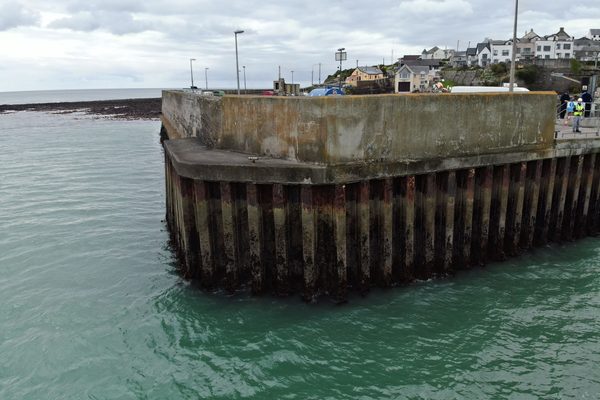
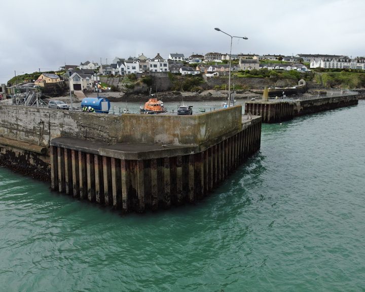
Drones have a wide range of reach, and are able to inspect both wide and tall structures. Piers, docks, and seawalls are inspected efficiently, and the same equipment is needed for the entire inspection. For large objects, it's often important to get a comprehensive picture of the entire area to determine its condition. Our drones can capture these aerial images, as well as detailed close-ups.
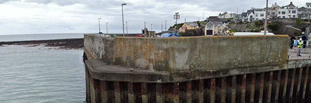
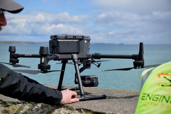
We are both engineers and experienced drone pilots. Our reports and inspections are based on our real-world experience. Piers and offshore platforms often support buildings, machinery and people, and weak points can lead to collapses. We know what to look for when inspecting support structures.
Engineers With Drones are also able to undertake inspections on piers or offshore platforms. Buildings, industrial machinery, oil and gas assets- we have experience with all types of structures.
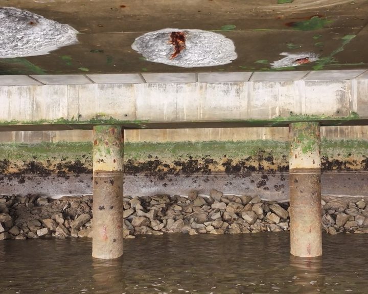
Drone inspection of pier infrastructure at Belview Port — examining the underside of shore-side facilities using UAV technology to assess concrete defects and structural integrity safely.
Engineers With Drones carried out a detailed drone inspection of a harbour pier wall, assessing hot-rolled interlocking steel sheet piles and concrete structure for defects and structural integrity.
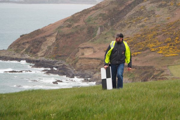
Complex surveys and inspections require more than just a pilot. Our engineers can help you scope your requirements and indentify the right approach.


UHD or Ultra High Definition signifies that a camera's resolution is 3840x2160 pixels. This is exactly four time higher than high definition cameras (1920x1080 pixels), and so UHD is often also know as 4K.