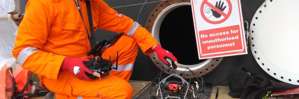
Confined spaces — tanks, silos, industrial chimneys, boilers, culverts — cannot be inspected by a standard drone. Standard drones rely on GPS for stable flight; GPS is unavailable inside enclosed structures. Our purpose-built cage-protected drone uses visual navigation from a live video feed, operating independently of satellite positioning throughout the inspection.
No human entry means no confined space entry permit, no cleaning or decommissioning of the asset before inspection, no atmospheric monitoring, and no standby rescue team. The drone enters through the access hatch, inspects the interior under pilot guidance, and returns — typically completing the work in hours where traditional entry methods would take days of preparation alone.
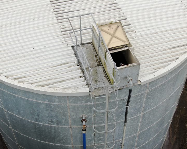
For tall vertical structures — chimneys, stacks, silos — the drone always enters from the base hatch and ascends. The pilot has a clear view of probes, cables, and any constrictions before the drone reaches them. Descending from above removes that advance visibility and is avoided.
Tall structures are divided into inspection sections planned against expected battery life before any flight begins. Each section is documented at its reference height so the full interior record is contiguous.
The cage allows the drone to contact walls without crashing — the core enabler of confined space flight. Its one vulnerability: long thin objects such as probes and dangling cables can penetrate the cage gaps. These are identified on ascent before the drone passes.
Alongside HD video and 4K imagery, the platform generates a SLAM-based LiDAR point cloud of the interior — a dimensioned, measurable 3D record of the space, not just footage.
Visible throughout the interior surface — position, extent, and progression documented in the HD video record and LiDAR point cloud.
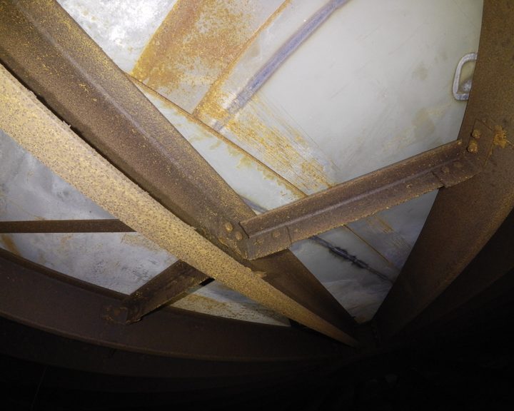
Tanks, pressure vessels, and steel structures — surface corrosion documented by location and extent with 4K imagery, without abrasive preparation or decommissioning.
Delamination, blistering, cracking, or missing sections of refractory lining, paint, or protective coating — identified and located in a single inspection pass.
Internal surfaces subject to flow, abrasion, or thermal cycling — erosion patterns and areas of material loss recorded by position and extent.
The SLAM-based LiDAR point cloud provides a measurable 3D record of internal geometry — detectable against design dimensions or a previous survey to identify deformation or settlement.
Accumulations, deposits, scale, and partial obstructions — identified and located without any human entry into the structure.
“Every asset operator knows what confined space entry involves — whether it's the permits, the atmospheric monitoring, the standby rescue team. All for good reasons. But a drone can eliminate all of it: no person is going in. That changes how the job is scoped, how long it takes to organise, and what it costs.”

Any enclosed structure that cannot safely be entered by a person, or that would require disproportionate preparation to permit human entry, is a candidate for this method:
External shaft survey and internal inspection completed in a single mobilisation — where a chimney survey is already planned, confined space coverage adds minimal extra cost.
Internal condition assessment without cleaning, decommissioning, or atmospheric monitoring procedures.
Structural assessment of interior walls and base without entry or temporary decommissioning.
Internal inspection without cool-down waiting time or confined space entry procedures.
Condition survey of otherwise inaccessible sections without pumping out, shoring, or entry permits.
Internal assessment through windows or openings without anyone entering the structure.


No confined space entry permit, no atmospheric monitoring, no standby rescue team. The drone enters, inspects, and returns.
Assets do not need to be taken offline, cleaned, or purged before inspection. The drone works in the structure as it stands.
Standard drones cannot fly inside enclosed structures — GPS is unavailable. The confined space drone navigates entirely from the pilot's live video feed.
Alongside HD video, the platform generates a SLAM-based LiDAR point cloud of the interior — a dimensioned 3D record of the space.
Preparation for traditional human entry can take days. The drone is typically on site, inside the structure, and delivering footage within hours of arrival.
For structures that cannot safely be entered after fire, flood, or collapse risk, the drone enters through any available opening and navigates internally to assess condition.
Engineers With Drones carried out a detailed inspection of a large above-ground galvanised steel water tank used for fire suppression, using a confined space drone to access the interior.
Engineers With Drones used a confined space drone to inspect a large steel ethanol tank on a natural gas processing facility in Ireland — eliminating the need for scaffolding or personnel entry.
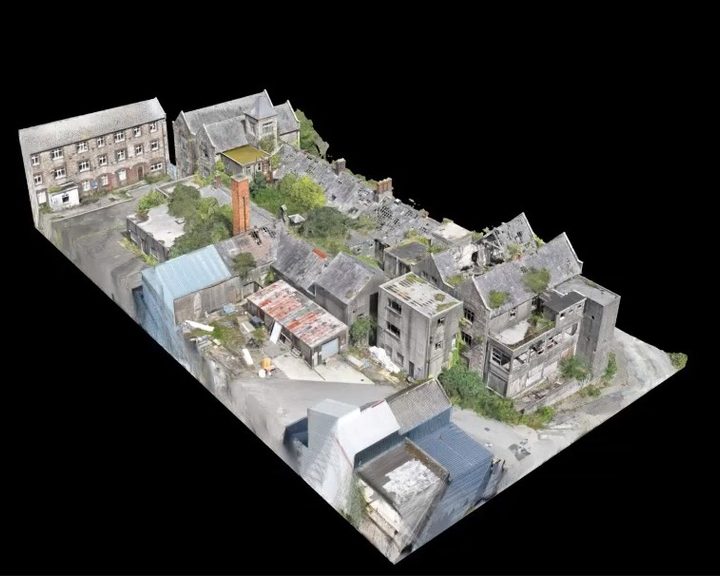
Engineers With Drones used external 3D scanning and internal confined space drones to survey a derelict hospital building in Wexford for restoration feasibility, without placing any personnel at risk.
Complex surveys and inspections require more than just a pilot. Our engineers can help you scope your requirements and indentify the right approach.