We work across the full range of energy assets - wind turbines, utility-scale solar farms, high-voltage power lines, oil and gas facilities, and industrial flare stacks. Our qualified engineers understand both the operational constraints and the inspection requirements of live energy infrastructure.
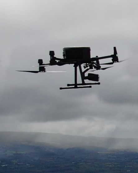
Most inspections require no shutdown and no confined space entry. For time-critical work - post-storm response, pre-construction surveys, or emergency deployment - we can be on site within hours and deploy multiple teams simultaneously.

Wind turbines, solar farms, flare stacks, and high-voltage power lines can all be inspected while fully operational. No lost generation, no process interruption, no downtime cost.
Thermal cameras detect hotspot panels, overheating pylon clamps, delaminated turbine blades, and failing insulators that visual inspection alone will miss — across the full asset in a single sortie.
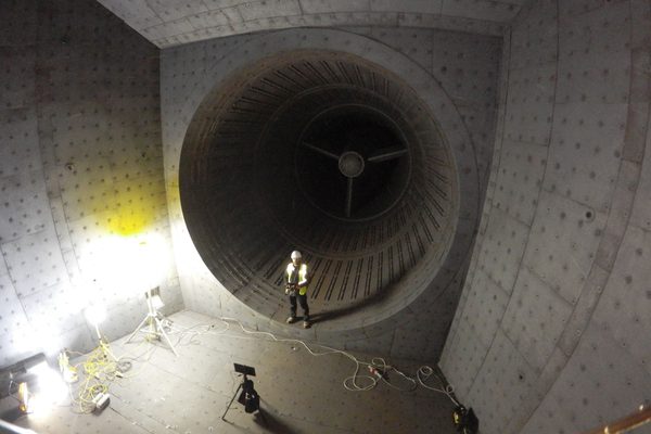
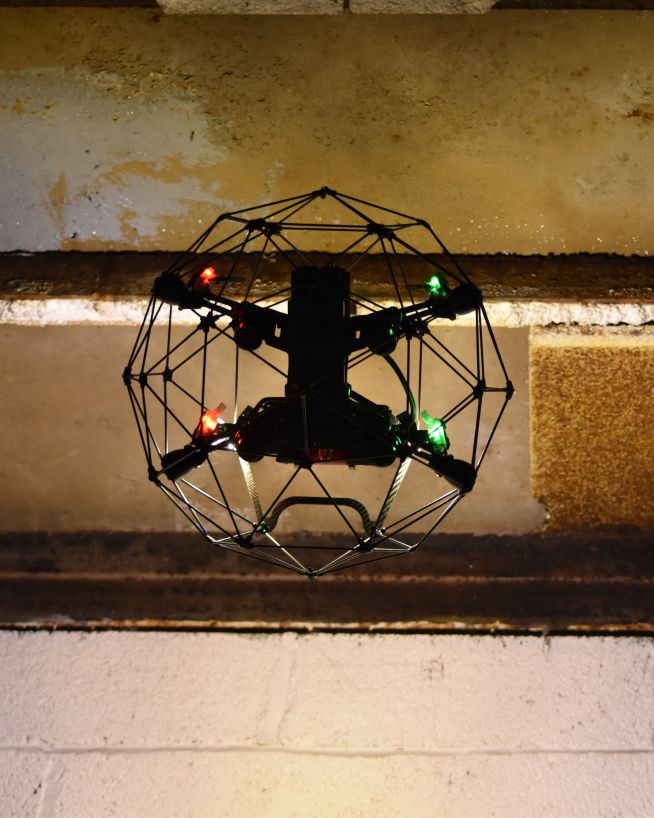
Tanks, vessels, heat exchangers, and chambers can be internally inspected without drain-down, decommissioning, or human entry. No confined space permit, no standby team required.
Every defect is GPS-tagged and mapped to a precise location — whether a cracked turbine blade, a failing insulator, or a panel fault. Maintenance teams act without a return site visit.
For storm response and urgent inspections, we mobilise multiple teams simultaneously. During Storm Éowyn, we deployed approximately 15 units within 12 hours of the storm clearing.
Our personnel are engineers who fly. We understand energy infrastructure and we interpret what we find — delivering condition assessments, not just footage.
We have worked with industry-leading partners at all stages of solar farm project development, from conceptualisation to long-term maintenance. Here's a brief look at what we do for you as you move progress your utitlity-scale solar project through its lifecycle.
For solar developers, accurate topographic data is needed before design can begin. Photogrammetric drone surveys deliver an orthophoto and an elevation model in a single flight - the two outputs that solar design software requires for panel placement, shading analysis, and site suitability. We liaise directly with landowners to arrange access and plan around field conditions. Find out more about our pre-construction survey service for solar developments.
Oversee the construction and installation of your solar panels. Aerial imagery and video offer real-time progress tracking and quality assurance during installation. Join our engineers on site or get tailor-made deliverables direct to your team in HQ.
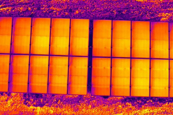
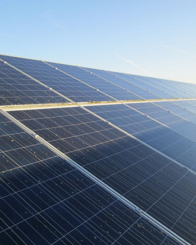
A large solar farm may have tens of thousands of panels. Thermal imaging surveys cover the entire site in a single sortie without removing or de-energising any panels. We detect hotspots, bypass diode failures, string faults, soiling patterns, cracked glass, and delamination - producing a thermal orthomosaic of the full site with panel-level GPS references and a fault classification report.
On an ongoing basis, drones can help ensure and document regulatory compliance in many different areas including: land use and zoning, vegetation clearance, fire and emergency access, component usage, labelling and signage, grid connection compliance and more.
To find out more what we can do for you, visit our solar farm inspection services page.
Our expertise spans the full lifecycle of oil and gas projects, from exploration and development to operations and decommissioning. Here's how our drone services can bring value to your operations at every stage.
Make informed decisions from the start. Drones equipped with advanced imaging and mapping technologies deliver high-resolution terrain analysis, environmental impact assessments, and site suitability evaluations. Identify risks and optimise site layouts with precision data.
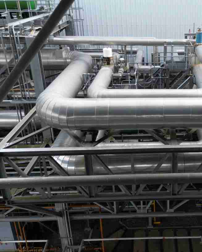
Monitor and manage the construction of pipelines, refineries, and other critical infrastructure. Aerial imagery and video provide real-time updates on progress and quality assurance, enabling faster issue resolution and ensuring your project stays on schedule.
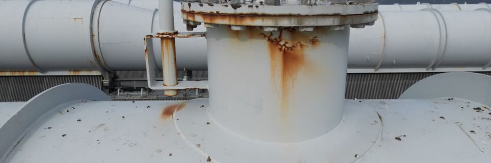
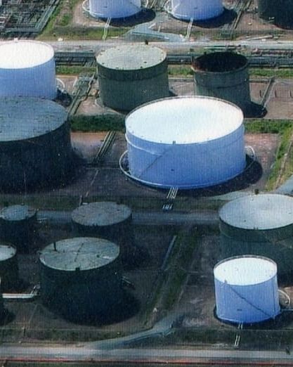
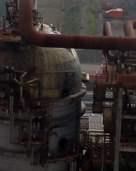
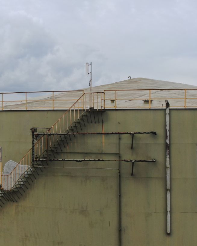
External inspection of pipelines, storage tanks, and processing infrastructure uses visual and thermal imaging to detect corrosion, coating failure, heat anomalies, and structural deformation without taking assets out of service.
For internal vessel inspection, our confined space drone capability allows tanks, vessels, and chambers to be inspected without drain-down, decommissioning, or human entry - no confined space permit, no standby team required.
Industrial flare stacks can be inspected while the flare is live, eliminating the shutdown and cooling time that conventional access requires. We identify corrosion, coating degradation, tip condition, and structural deformation from a safe standoff. Find out more about our flare stack inspection service.
Monitor and reduce environmental impact with precision. Drones equipped with specialised sensors can detect methane leaks, VOC (Volatile Organic Compound) emissions, and other greenhouse gases from pipelines, storage tanks, and facilities. This enables rapid identification and mitigation of emission sources, helping you comply with environmental regulations and meet sustainability goals.
Act swiftly and effectively during emergencies. Drones can quickly assess damage from spills, fires, or natural disasters, providing critical insights to support rapid decision-making. Enhance safety by reducing the need for personnel in hazardous areas.
Stay ahead of compliance requirements with aerial surveys and detailed documentation. Drones can assist in verifying adherence to regulations on environmental impact, pipeline integrity, vegetation management, and site restoration, delivering high-quality evidence for audits and reporting.
You might like to find out more about our work with oil and gas facilities, flares, pipelines, and tanks and silos.
From site selection to ongoing operations, UAV drone solutions can optimise the efficiency, safety and reliability of wind energy projects. Here's how we support your wind farm at every stage of its lifecycle.
Lay the groundwork for success. Using LIDAR , photogrammetry, and other advanced drone technologies, we conduct terrain analysis, wind resource mapping, and environmental assessments to help you select the best locations for your turbine array. Reduce development risks with accurate, actionable data.
Ensure your facility is built to the highest standards. Drones provide real-time aerial imagery and video for progress tracking and quality assurance, helping you oversee construction and verify/document that turbines, foundations, and cables are installed safely and in accordance with regulatory standards.
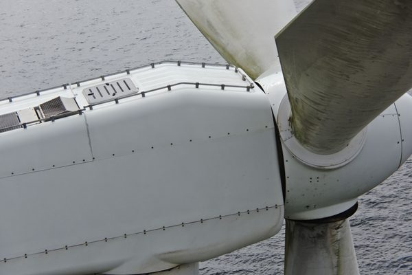
All three blades can be surveyed in a single deployment without taking the turbine offline. We cover the full structure - rotor blades, nacelle exterior, and tower - inspecting for leading edge erosion, surface cracks, delamination, coating failure, lightning strike damage, blade tip damage, and nacelle surface corrosion.
Thermal imaging adds delamination detection capability. Every defect is GPS-tagged and included in an annotated report with a condition rating per blade and per zone, giving maintenance teams a precise and prioritised picture of what needs attention.
Ensure compliance with safety, environmental, and operational regulations. Drones document adherence to requirements for turbine spacing, fire and emergency access, vegetation management, and equipment labelling. We provide detailed reports to support audits and inspections.
To find out more what we can do for you, visit our wind turbine inspection services page.
We work with ESB on ongoing inspection of electrical infrastructure across Ireland, and were among the primary operators deployed during the Storm Éowyn response in early 2025.
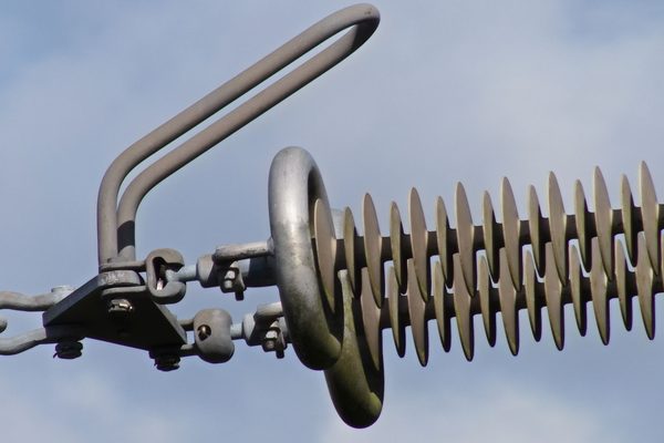
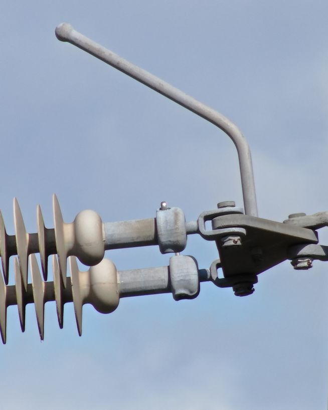
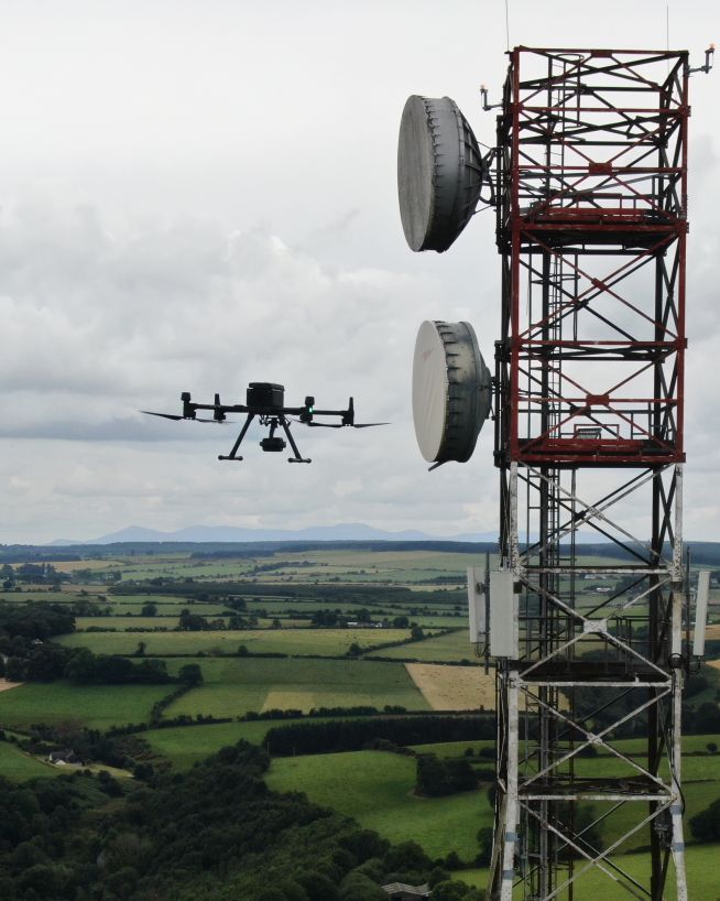
Overheating connections, damaged insulators, and conductor faults are often invisible to visual inspection alone. Drone-mounted thermal cameras identify heat anomalies along transmission corridors safely and quickly, without contact with live infrastructure.
Using LiDAR, we map the full transmission corridor and flag every location where vegetation is within clearance limits. This enables targeted ground works before encroachment becomes a fault or fire risk - the same approach delivered to ESB as part of their Winter Resilience Programme following Storm Éowyn.
When Storm Éowyn caused approximately 700,000 homes to lose power, we deployed approximately 15 units within 12 hours of the storm clearing. Each unit paired a drone pilot with an ESB linesman, compressing weeks of on-foot fault-finding into 10-minute flights per location. Precise fault identification meant sections could be isolated and customers restored on either side while repairs were carried out.
Find out more about our power grid and pylon inspection services.
Whether you are developing a solar farm, siting a wind turbine, or planning a transmission corridor, the single most important dataset you need — before any design work begins — is an accurate topographic model of the ground. A LiDAR survey captures millions of survey-grade measurements in a single flight and produces the digital terrain and surface models that energy project design software requires.
What is the difference between a DSM and a DTM, and why does it matter for energy projects?
A digital surface model (DSM) includes everything on the ground — trees, buildings, hedgerows, existing infrastructure. A digital terrain model (DTM) represents the bare earth with all surface features removed. Both are generated from the same LiDAR point cloud.
For a solar developer, the DTM reveals the slope and aspect of the land itself — essential for panel orientation and row spacing. The DSM shows the trees and structures that will cast shadows across the array, which the shading analysis module in PVsyst needs. For a wind developer, the DTM provides the terrain roughness data that wind resource models require, while the DSM identifies obstacles that affect turbulence at hub height.
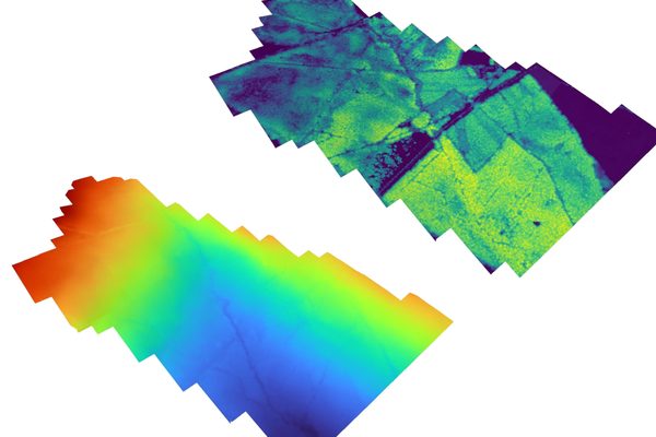
More about LiDAR drone surveysWhat does an elevation heatmap tell me that a site photograph does not?
A photograph can be misleading. Shadows, vegetation, and lighting conditions can hide slope angles and elevation changes. An elevation heatmap replaces colour with absolute height data — every pixel has a known Z-value — so slopes, depressions, and drainage paths are unambiguous.
For energy project feasibility, this is particularly useful for identifying south-facing slopes for solar arrays, locating level ground for substation pads, mapping natural drainage corridors that cable trenches should follow, and verifying that access roads can be built at safe gradients. The heatmap turns a site visit into a measurable dataset.
Discuss terrain analysis for your energy project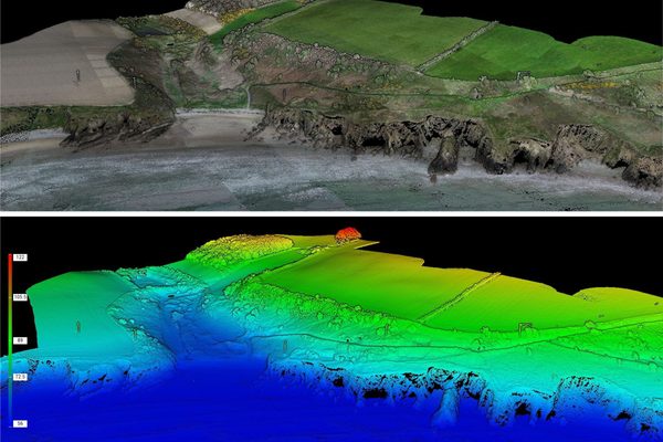
Safer and more cost-efficient flare (oil and gas) inspections
Fast, actionable data without the risks of traditional inspections
Efficient, fast and safe.
Instantly usable data via a safer and more cost-effective process
Safe, precise and instant reports on vessels and infrastructure
Get actionable data on quality and operational health
A more cost- and time-effective way to receive critical data
Get fast, usable data from a safe distance
Eliminate safety concerns, save costs and reduce downtime
Instantly view complex structures, keeping risks to a minimum
Safer and cheaper underwater ROV inspections
We have worked with a wide range of energy sector clients, including big names in oil and gas, utility-scale solar and wind energy. Here are just a few of the services our engineers can provide using the latest drone technology.
Capture a high-resolution, photorealistic 3D model of your terrain, accurate to the finest details.
Find out moreMitigate the risk factors of traditional confined space inspections, without compromising on quality.
Find out moreReceive instant and actionable cut-and-fill data, without downtime or the risk of human error.
Find out moreMap the features and topography of your land/space efficiently using drone technology.
Find out moreRecord incredibly detailed elevation data to aid in ultra-precise measurements and calculations.
Find out moreTake accurate stockpile measurements faster and with little to no downtime, at a fraction of the cost.
Find out moreDetect abnormalities within your assets that are otherwise invisible to the naked eye.
Find out more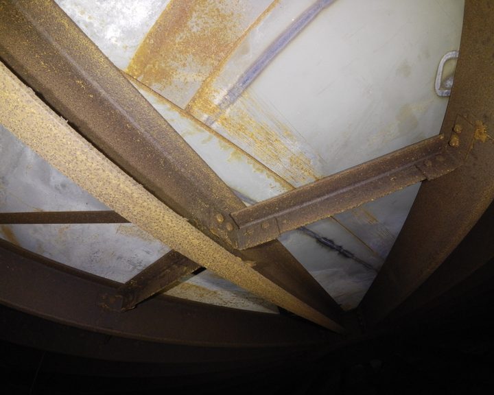
Engineers With Drones used a confined space drone to inspect a large steel ethanol tank on a natural gas processing facility in Ireland — eliminating the need for scaffolding or personnel entry.
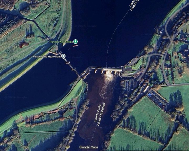
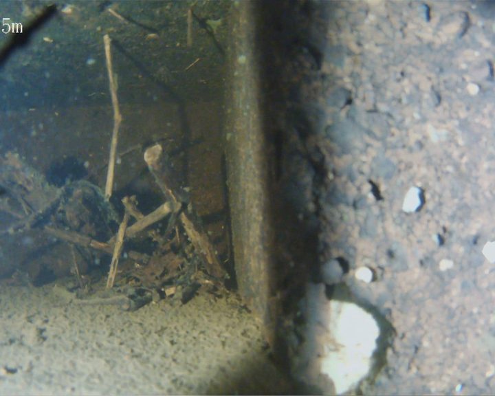
Engineers With Drones used an ROV underwater drone to inspect anomalies in the Ardnacrusha head race canal identified by hydrological survey - historic infrastructure built in the 1920s.
Engineers With Drones deployed an underwater ROV to inspect a live riveted steel penstock, expansion joint, inlet screens, and spiral casing without drain-down or diver entry.
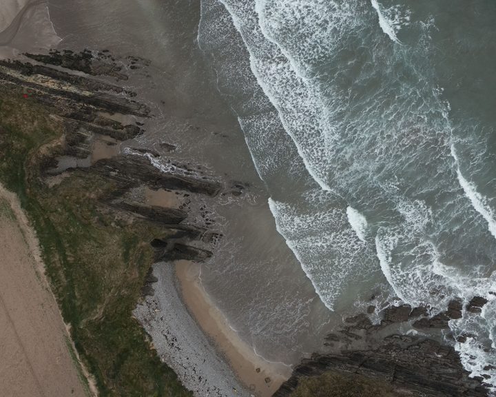
Engineers With Drones surveyed 17 coastal sites across Ireland using drone technology to assess their potential as landfall sites for offshore cables.
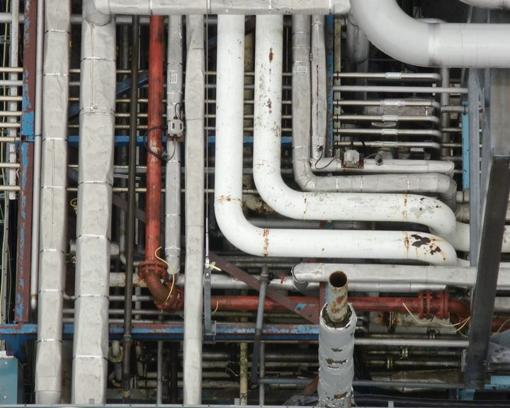
Engineers With Drones used a drone to carry out a detailed inspection of pharmaceutical plant pipe racks, providing complete coverage of upper surfaces without the need for climbers or mobile elevating work platforms.
Complex surveys and inspections require more than just a pilot. Our engineers can help you scope your requirements and indentify the right approach.