We provide a cutting-edge farm mapping service in Ireland for your agricultural land. With our drone mapping services, you will have access to a wealth of data that can help optimise crop yields, improve irrigation and fertilizer efficiency, and reduce costs. We can map your farm using multispectral imaging, LIDAR mapping, topographical mapping and more.
Drones equipped with multispectral cameras can detect early signs of crop diseases and nutrient deficiencies, allowing farmers to take timely corrective measures. With the ability to cover large areas quickly and provide real-time data, drones can also help farmers to precisely target areas requiring treatment, reducing the need for widespread pesticide or herbicide use.
Drones equipped with LIDAR sensors can gather and interpret data regarding the condition of the land and its topographical features including drainage paths. LIDAR drones can also help farmers to identify areas of their land that are in need of remediation or restoration.
Our drones' LIDAR and remote sensing technologies, allow issues associated with irrigation, and insufficient or excessive moisture, to be easily rectified. Using this data, together with crystal-clear RGB Imagery of soil and crops, you can identify natural land flow patterns, prevent water-logging and optimise drainage.
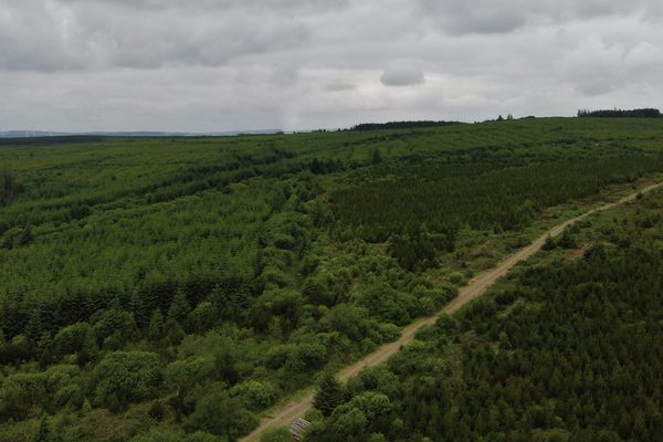
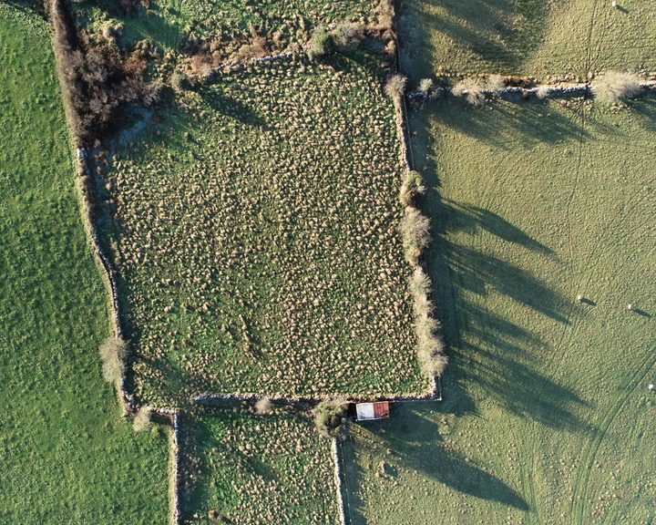
Large areas of land can easily be photographed, examined, and documented by drones to capture an exact reading of their geography, boarders, and vegetation cover. This allows you to record a professional and accurate status of your land at a given point in time, without having to step foot on the ground.


The safety of your personnel and our own is paramount, and we place it at the forefront of our company culture. Ask us about our HSSE systems and practices.
Drone inspections take up less of your manhours and resources than traditional inspections, giving you a faster and more budget-friendly return on your investment.
We use cutting-edge technologies to detect problems that would otherwise be invisible. These include 4K ultra-HD photography/video, LIDAR and thermal imaging.
Drones capture high-quality, impartial information that gives you an exact assessment of the status and needs of your asset.
Thermal IR technology and ultra HD allow our engineers to get a view that is not available to the naked eye. From a safe distance, we can find defects and insights that are only visible with a drone.
We understand that you need answers fast. We can deliver a plain-English report with clear-cut conclusions in days. Then, you can take the steps you need to and get back to doing what you do best.
Need us there in a hurry? No problem. Let us know what you need, and we can be there on the same day. After all, sometimes the problem just won't wait.
Sometimes the brief can change even in real-time. If need be, you can be stood there right next to the drone operator, directing them as the situation develops.
Drones have a wide range of applications in agriculture. One of the main benefits of drones in farming is their ability to gather data quickly and accurately. This information can be used to optimise crop yields, identify areas of pest infestation, and monitor plant health. Drones can also be used to apply fertilizers and pesticides precisely, reducing the amount of chemicals needed and minimizing environmental damage. Overall, drones are a valuable tool for modern farming, offering increased efficiency, accuracy, and productivity.
The time invested in planning pays off year after year. Up-to-date and detailed aerial imagery of your land is priceless. Drone farm surveying can create these images for you in a fraction of the time, so you can plan with confidence and move on to the next phase.
Clear images simplify road and access planning and help you use your land efficiently. Up-to-date images are invaluable in boundary disputes. Our topographic maps of your property make it easier to plan crops, paddocks, drainage and irrigation. When you know the lay of the land, you can irrigate more efficiently and avoid flooding. We take care of this in a single flight, streamlining the process.
Aerial photographs show variations in health and density that aren't visible from a human perspective. Inspection efficiency allows for more frequent crop monitoring. Our drone is equipped with a high-resolution camera that capture detailed images without endangering crops. Intervention before health is poor enough to be visible from the ground often saves entire areas of crops from failure.
Multispectral imaging provides information about the health of plants, and can detect pests or diseases. Fertilisation is also more efficient when you can pinpoint exactly where it's needed. With multispectral imaging we can detect pests and diseases before the situation is bad enough to be obvious.
Livestock is tracked down easily. Drones cover larger areas and difficult terrain faster than a human, and with a sharper eye. Thermography is used to pinpoint lost livestock.
Buildings of all types are also inspected using a drone, giving you peace of mind that your livestock is safe. Including silos, tanks, and vessels.
Multispectral imagery show crop density, allowing you to estimate yield more accurately. Planning sales and distribution is made more efficient, and can be done at an earlier stage.
Agricultural drone surveys have many benefits for farmers and agriculture professionals. Firstly, they can quickly and accurately collect data about crop health, soil moisture, and plant growth, allowing farmers to make informed decisions about irrigation, fertilization, and pest management. Secondly, drones can cover large areas of land in a short amount of time, reducing the need for manual labour and increasing efficiency. Additionally, drone surveys can detect and identify crop diseases, allowing farmers to take proactive measures to prevent the spread of disease and increase yields. Finally, drone surveys can also assist in monitoring livestock and managing water resources, making them a valuable tool for sustainable agriculture practices.
Farm GPS mapping is a technology that uses Global Positioning System (GPS) to map out and track various aspects of a farm. The benefits of this technology are many. For instance, it allows farmers to accurately measure and manage their fields, making it easier to track crop growth and monitor soil health. Additionally, it helps farmers to save time and resources by optimizing the use of fertilizers and other inputs. This, in turn, reduces the cost of production and increases yield. Furthermore, farm GPS mapping provides farmers with detailed records of their farm activities, making it easier to make informed decisions and plan for the future. Overall, the use of farm GPS mapping is an excellent tool that helps farmers to increase their productivity and profitability while also promoting sustainable farming practices.
Our multispectral imaging technology is an advanced technique that utilizes drones to capture high-resolution images of your land in various spectral bands. These images provide valuable information about the health and vigour of your crops by revealing subtle differences in reflectance across different bands. By analysing these images, we can detect stress factors in your crops such as disease, nutrient deficiencies, and water stress, allowing for timely interventions to maximise yield and minimise losses. Additionally, our technology allows for accurate weed detection and mapping, which enables the precise application of herbicides, thereby reducing the use of harmful chemicals.
Crop monitoring and mapping: Multispectral cameras mounted on drones or other aerial platforms can capture high-resolution images of crops in multiple wavelengths. These images can be used to generate accurate maps of crop health, identifying areas of stress, disease, or pest infestations.
Multispectral imaging can help farmers optimise their use of resources, such as water, fertilizer, and pesticides. By analysing crop images, farmers can identify which areas of their fields require more or less attention, enabling them to apply inputs more efficiently.
Multispectral imaging can be used to estimate crop yields by measuring biomass, plant height, and canopy cover. This information can be used to adjust management practices and optimise crop production.
Multispectral imaging can identify specific plant diseases and pests by analysing the spectral signature of affected crops. This can enable farmers to take corrective action before the disease or pest infestation spreads.
Multispectral imaging can also be used to map soil properties, such as nutrient content, moisture, and pH. This information can help farmers tailor their management practices to the specific needs of their soil, optimizing crop growth and health.
Lidar, which stands for Light Detection and Ranging, is a remote sensing technology that uses lasers to measure distances and create highly accurate 3D maps of terrain and objects. Lidar can be used to accurately map farmland and provide highly detailed topographic data. This can help farmers better understand the terrain and make informed decisions about where to plant crops and how to manage water and soil resources. Overall, lidar technology offers farmers a powerful tool for improving efficiency and maximizing yields.
Topographic Mapping: Lidar can be used to create high-resolution topographic maps of farmland. These maps can be used to identify areas of elevation changes, slope, and water runoff, which can help farmers optimise crop yields.
By analysing lidar-derived DEMs, it is possible to identify the flow direction and accumulation of water across an area. This can help in mapping the drainage patterns, identifying areas of standing water, and detecting potential flood zones.
Lidar can help farmers monitor crop health by measuring the height, density, and structure of vegetation. This data can be used to identify areas of stress or disease in crops, allowing farmers to take corrective action before significant damage occurs.
Lidar can help farmers create detailed maps of their fields, which can be used to guide precision farming practices such as variable rate fertilization and irrigation. This can help farmers save time and money while improving crop yields.
Lidar can be used to create detailed maps of fields that can be used by autonomous farming equipment, such as self-driving tractors, to navigate fields more efficiently and accurately. This can help reduce labor costs and improve the precision of farming operations.
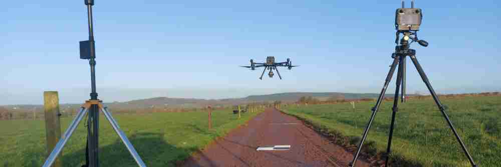
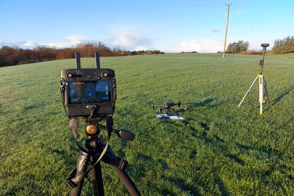
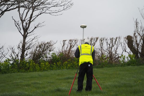
Engineers With Drones used drone-based LiDAR and multispectral sensors to map large areas of farm land across Ireland, providing detailed information about farms and their carbon sequestration potential.
Complex surveys and inspections require more than just a pilot. Our engineers can help you scope your requirements and indentify the right approach.
Multispectral aerial mapping is a process of using aerial sensors to collect data on a specific geographic area in multiple spectral bands beyond what the human eye can see. This method of mapping can capture various types of data such as visible light, infrared, thermal, and others. The captured data is then analyzed to create high-resolution maps that reveal detailed information about the area, such as vegetation health, water quality, land cover, and temperature. This mapping technique is commonly used in agriculture, forestry, environmental monitoring, urban planning, and disaster management. It provides valuable insights and helps to make informed decisions by accurately assessing and managing natural resources and land use.
By measuring the reflected and emitted radiation of an area from a distance, remote sensing is the process of identifying and keeping track of the physical features of a location. Remotely sensed images are captured by specialised cameras to form an accurate reading of the Earth.
UHD or Ultra High Definition signifies that a camera's resolution is 3840x2160 pixels. This is exactly four time higher than high definition cameras (1920x1080 pixels), and so UHD is often also know as 4K.