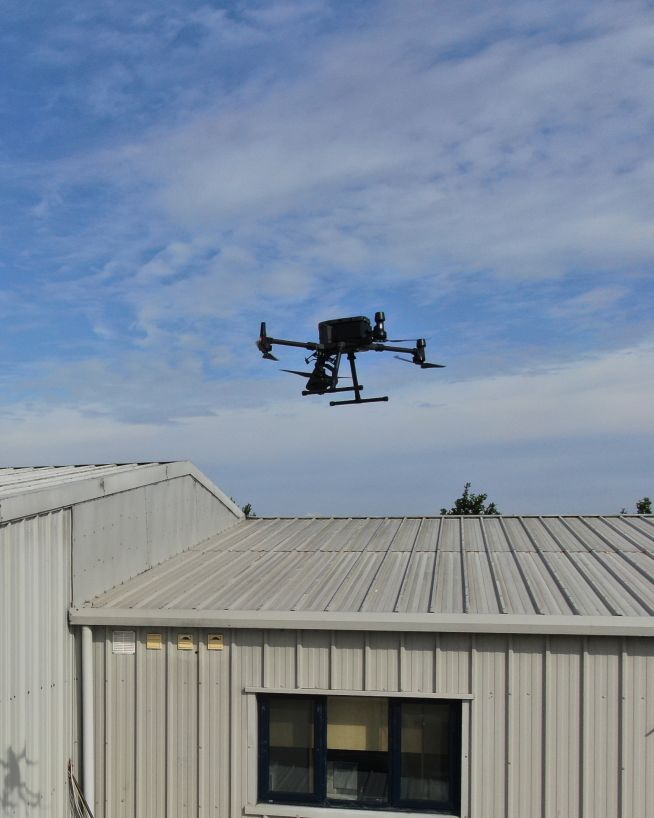
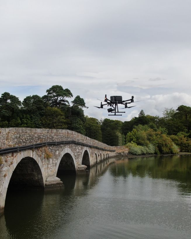
From initial planning and surveying, to onsite logistics and completion, our engineers have worked with some of the biggest names in Ireland's construction and real estate sectors. Using all the latest drone technologies, our engineers have years of experience carrying out inspections and surveys of all kinds of buildings, structures and landscapes. They understand the critical need for speed and accuracy while minimising downtime and guaranteeing the safety of all personnel and operational assets on site. Tell us what you need. It's our job to deliver it for you.

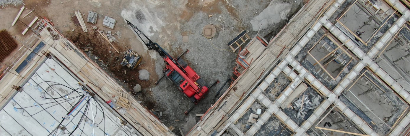
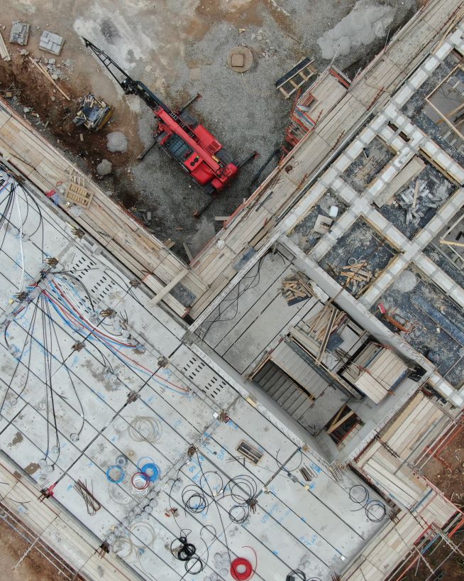
Monitor construction projects before, during and after build with advanced drone technology. Our engineers use drones equipped with LIDAR , photogrammetry and high-resolution cameras to assess site conditions, track progress and ensure HSSE compliance. These insights can help improve efficiency, reduce costs and ensure timely project completion.
Drones equipped with LIDAR and photogrammetry can create detailed topographical maps of construction sites, highlighting variations in terrain, soil conditions and potential challenges. This information supports site planning, resource allocation and project design.
Using high-resolution cameras and LIDAR , our engineers can monitor construction progress, track material usage and assess site safety. This data helps ensure projects stay on schedule, meet quality standards and comply with safety regulations.
After project completion, drones can perform detailed inspections to verify that all work has been completed to the required standards. High-resolution imagery and 3D models provide a comprehensive record of the finished project, supporting final approvals and documentation.
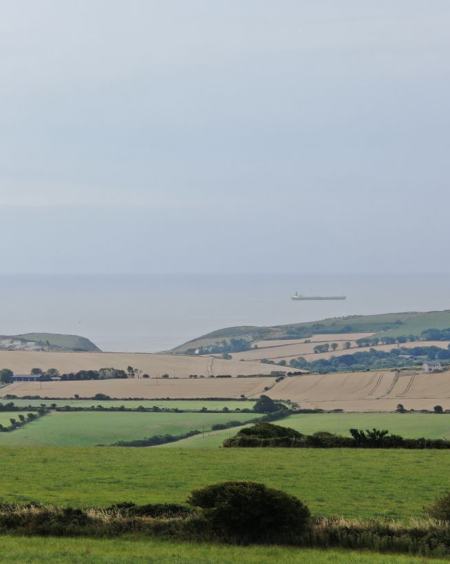
Conduct precise land surveys with advanced drone technology. Our engineers use drones equipped with LIDAR , photogrammetry and high-resolution cameras to create detailed topographical maps, evaluate soil conditions and identify any potential areas of concern. Such data can help improve site planning, resource allocation and project design.
Drones equipped with LIDAR and photogrammetry can create detailed topographical maps of land areas, highlighting variations in terrain, soil conditions and potential obstacles. LIDAR can digitally strip the landcape of all vegetation to reveal the precise topography beneath. Such insights can support better site planning, resource allocation and project design.
Using LIDAR and photogrammetry, our engineers can create detailed soil maps that highlight variations in soil composition, moisture levels and topography. This information supports precision agriculture practices, optimising planting, fertilisation and irrigation strategies.
A LiDAR survey produces two complementary terrain models from the same flight. A digital surface model (DSM) captures everything on the ground — trees, hedgerows, buildings, and site machinery. A digital terrain model (DTM) digitally strips all surface features away to reveal the bare earth beneath. For a construction or development project, the DTM is what tells you where the ground is naturally level enough for a building platform, where a slope would need retaining, and where water will drain. The DSM shows what needs to be cleared to get there.
The same survey also produces an elevation heatmap: a colour-coded map where every pixel has a known height value rather than a photographic colour. Unlike a site photograph — where shadows, grass, and lighting can hide slope angles and depressions — the heatmap makes topography unambiguous. For a developer, this means identifying the natural drainage corridors before design begins, verifying that finished floor levels work with the existing terrain, and locating low points where surface water would pool around foundations.
Discuss a topographic survey for your siteEnhance real estate marketing and property management with advanced drone technology. Our engineers use drones equipped with high-resolution cameras, thermal imaging and 3D modelling technologies to capture stunning aerial imagery, assess property conditions and create detailed virtual tours. These insights support commercial, residential and large land sales.
Drones equipped with high-definition cameras can capture stunning aerial imagery and video of properties, showcasing their features and surroundings. This visual content enhances marketing materials, attracting potential buyers and investors.
Using high-resolution cameras and thermal imaging, our engineers can assess the condition of properties, identifying structural issues, energy inefficiencies and other concerns. These insights support property management, maintenance planning and investment decisions.
Drones equipped with photogrammetry and LIDAR technologies can create detailed 3D models and virtual tours of properties. These models provide potential buyers and investors with an immersive experience, allowing them to explore properties remotely and make informed decisions.
Preserve and protect historical landmarks with non-invasive drone surveys. Our engineers can use drones equipped with high-resolution cameras, thermal imaging and LIDAR technology to monitor structural changes, identify areas of concern and support restoration projects. These solutions ensure accurate assessments while minimising disruption to these culturally significant sites.
Drones equipped with high-definition cameras capture intricate details of monuments and historical sites, allowing our engineers to detect surface cracks, weathering and other signs of deterioration. Drone inspections like this can be carried out without physical contact (or even close proximity) that could risk damage to the artefacts.
By leveraging LIDAR and photogrammetry, our engineers can create highly detailed 3D models and digital twins of monuments and historical buildings. These models are invaluable for restoration planning, structural analysis and long-term preservation strategies. They can also be used to produce interactive multimedia exhibits or virtual tours.
Thermal cameras can reveal subsurface anomalies, such as moisture ingress, voids or hidden cracks, which are not visible to the naked eye. Our engineers can use this data to identify and address underlying issues before they lead to significant structural damage.
Drone inspections reduce the need for scaffolding or invasive access, ensuring minimal disruption to high-sensitivity sites. Our engineers can safely capture accurate data from difficult-to-reach areas, preserving the integrity and aesthetics of the landmark.
Specialist drones can access confined internal spaces, such as church spires, bell towers or crypts, to capture detailed imagery and data. Giving access to interior spaces which may not be safe or easily accessible to personnel, confined space drones can aid with structural assessments, restoration planning and conservation efforts.
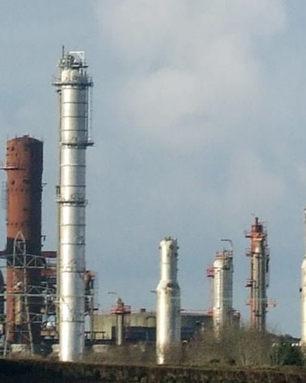
Survey roofs for structural integrity, thermal inefficiencies and damage. Our drones are equipped with high-definition cameras, thermal imaging and 3D modelling technologies. From residential to commercial buildings, our drone inspections deliver accurate insights while reducing the need for slow and costly scaffolding, improving safety and minimising disruption.
Drones equipped with high-definition cameras can capture detailed imagery of roofs and other hard-to-reach areas. These images identify cracks, surface damage, water ingress and other structural concerns with precision, enabling timely maintenance and repairs.
Using advanced thermal cameras, our engineers can detect heat loss, insulation failures, cold bridges and other thermal inefficiencies in building envelopes. These insights allow our clients to address energy wastage, reduce operational costs and meet sustainability goals.
Drones eliminate the need for manual roof access by providing aerial surveys with high-resolution and thermal imaging. Used in this way, drones can identify leaks, weather damage and structural weaknesses quickly and safely, saving time and reducing risk to personnel.
Add "Wow Factor" to residential and commercial property listings
Instant, actionable data with no downtime
Accurate, safe and instantly actionable data collection
Actionable data from a safe distance, with less downtime
Safer, more cost-efficient, with less downtime
Faster, cheaper and more accurate analysis of land
We have worked with a wide range of construction and real estate sector clients, including big names in roof inspections, construction, land surveys, historic buildings and real estate services. Here are just a few of the services our engineers can provide using the latest drone technology.
Capture a high-resolution, photorealistic 3D model of your terrain, accurate to the finest details.
Find out moreMitigate the risk factors of traditional confined space inspections, without compromising on quality.
Find out moreReceive instant and actionable cut-and-fill data, without downtime or the risk of human error.
Find out moreMap the features and topography of your land/space efficiently using drone technology.
Find out moreRecord incredibly detailed elevation data to aid in ultra-precise measurements and calculations.
Find out moreTake accurate stockpile measurements faster and with little to no downtime, at a fraction of the cost.
Find out moreDetect abnormalities within your assets that are otherwise invisible to the naked eye.
Find out more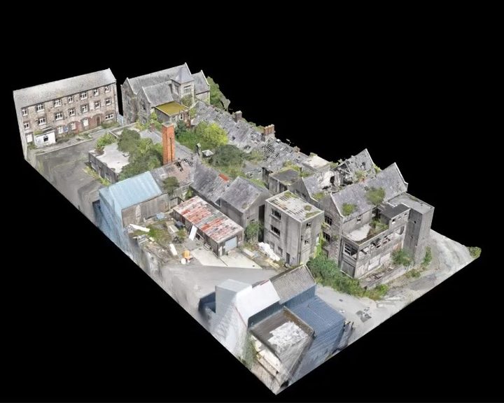
Engineers With Drones used external 3D scanning and internal confined space drones to survey a derelict hospital building in Wexford for restoration feasibility, without placing any personnel at risk.
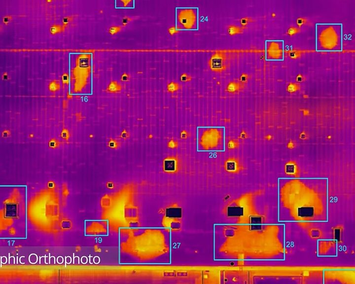
Engineers With Drones combined drone technology, thermography and orthophotos to locate water ingress across 5.2 hectares of flat bitumen roof on a large commercial building.
Complex surveys and inspections require more than just a pilot. Our engineers can help you scope your requirements and indentify the right approach.