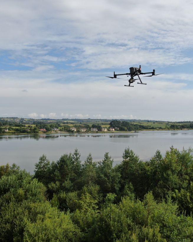
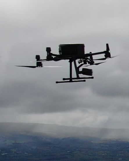
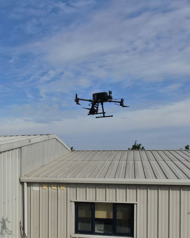
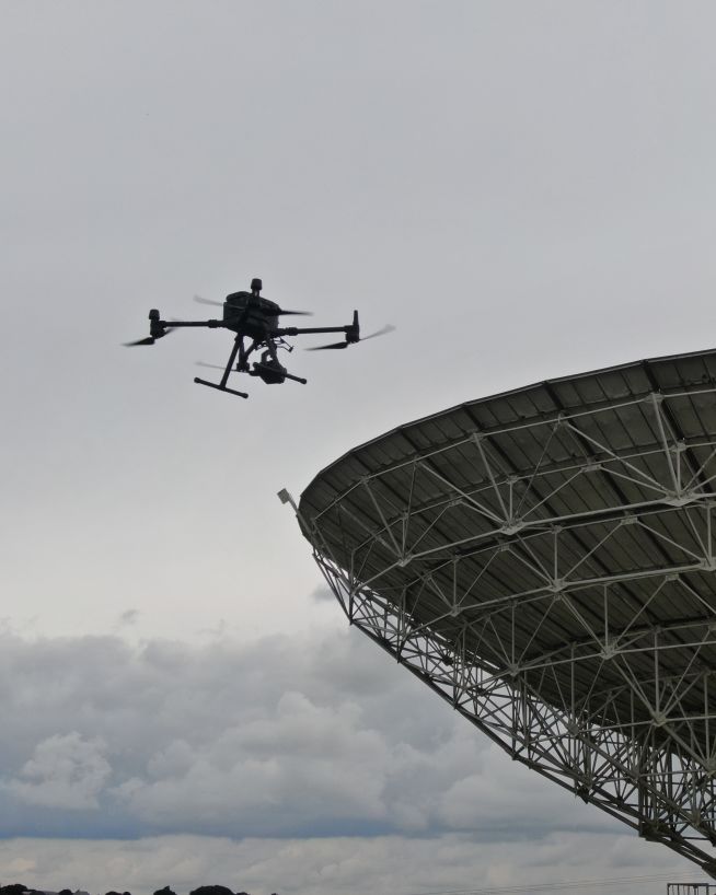
Our team all come from specialist engineering backgrounds, and they use all the very latest drone technologies and capabilities to deliver expert analysis on all types of commercial, civil and industrial assets. If you have a space or asset which needs to be inspected using cutting-edge technology such as LIDAR, 3D video, thermal imaging, or just ultra hi-res photography, you're in the right place.
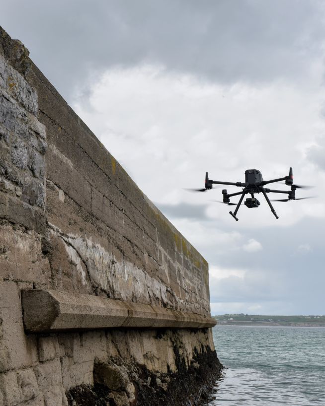
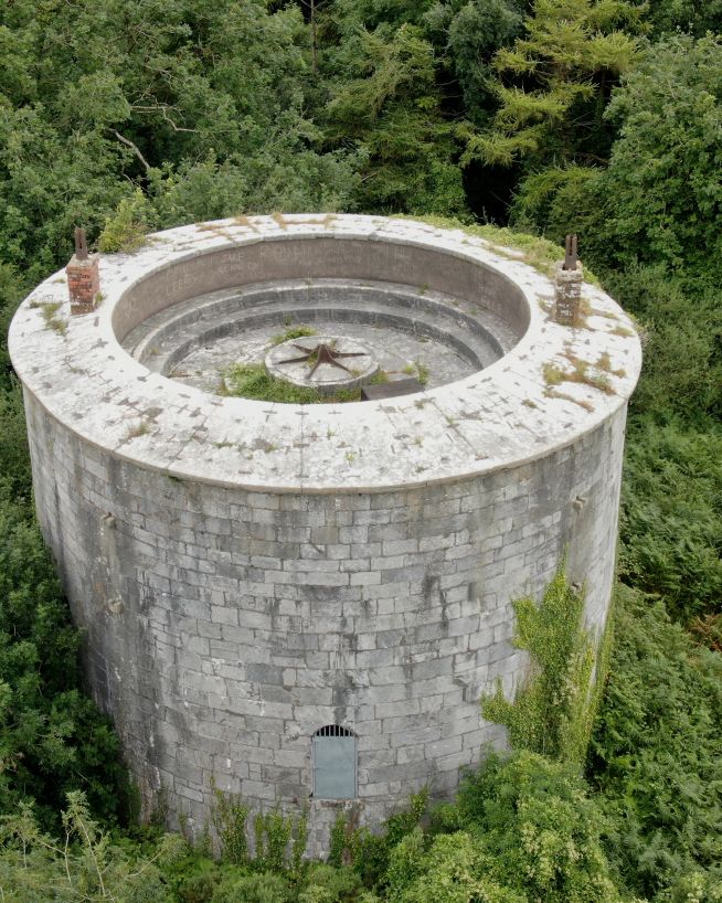
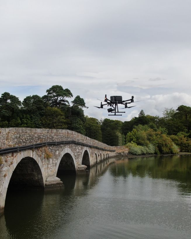
A detailed 360 inspection by a professional engineer.
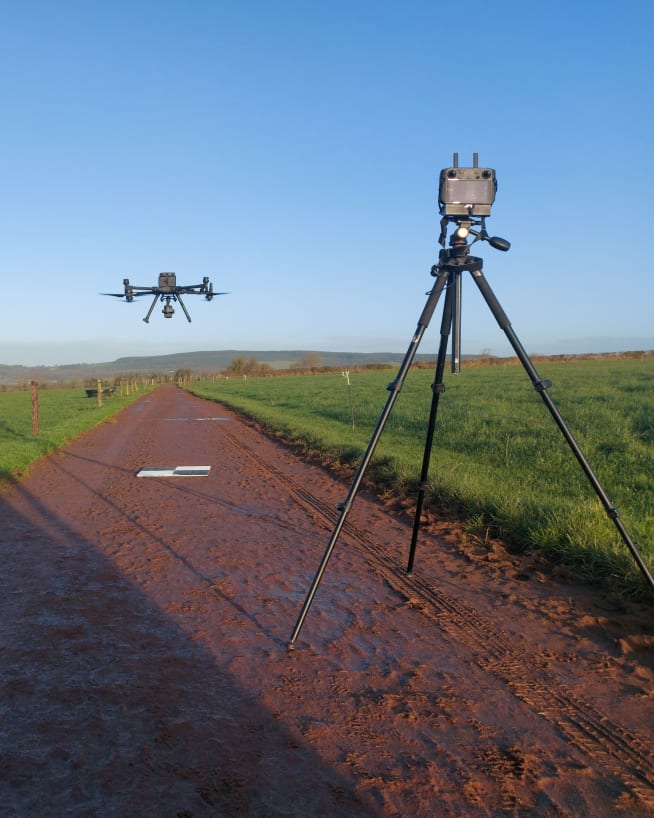
Full disclosure: this is not just photos taken from the sky. Our operators are all experienced, professional engineers who can work to a brief to give you the information you need. Industrial, commercial, agricultural or residential assets. Just tell us what you need to know and we will deliver comprehensive deliverables customised to your precise specifications. Working silently overhead, drones are very safe and require little to no downtime.
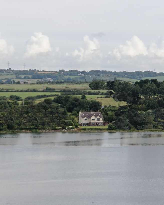
A drone survey delivers similar (albeit more accurate) results to a traditional land or property survey. The main difference is that the process is conducted from above using an unmanned aerial vehicle UAV or 'drone'. Photographing and measuring the terrain from multiple angles, our drones take thousands of highly accurate measurements before tagging the resulting images with coordinates. Using this data, we use specialist software to produce high-resolution maps, geo-referenced orthomosaics or 3D models.
Not just photos Our Inspection Services
Our team all come from specialist engineering backgrounds, and they use all the very latest drone technologies and capabilities to deliver expert analysis on all types of commercial, civil and industrial assets. If you have a space or asset which needs to be inspected using cutting-edge technology such as LIDAR, 3D video, thermal imaging, or just ultra hi-res photography, you're in the right place.
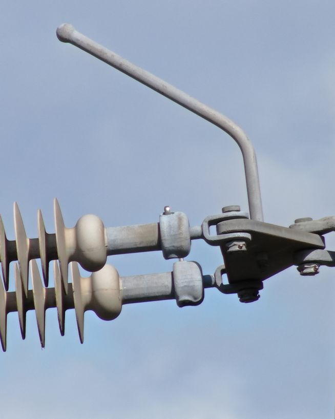
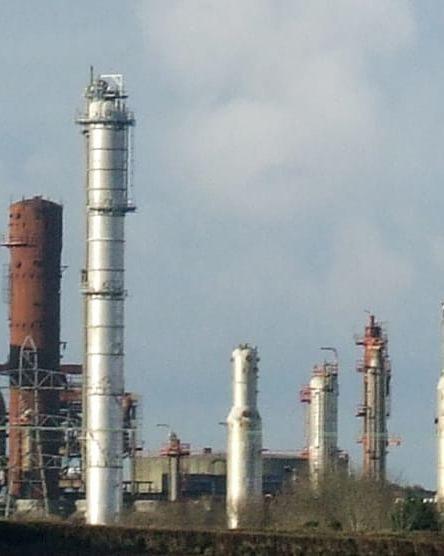
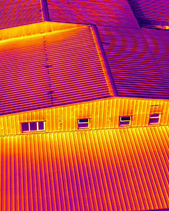
Thermal Imaging
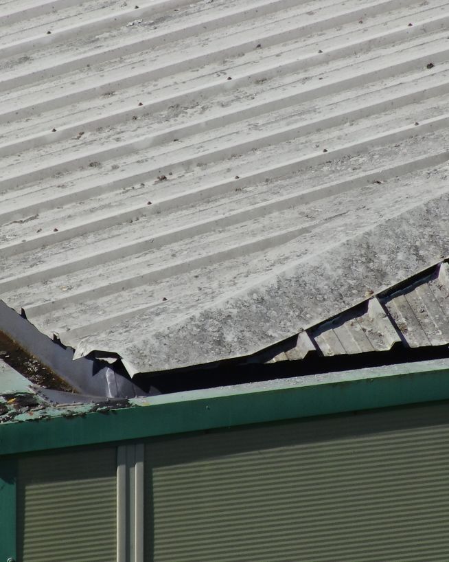
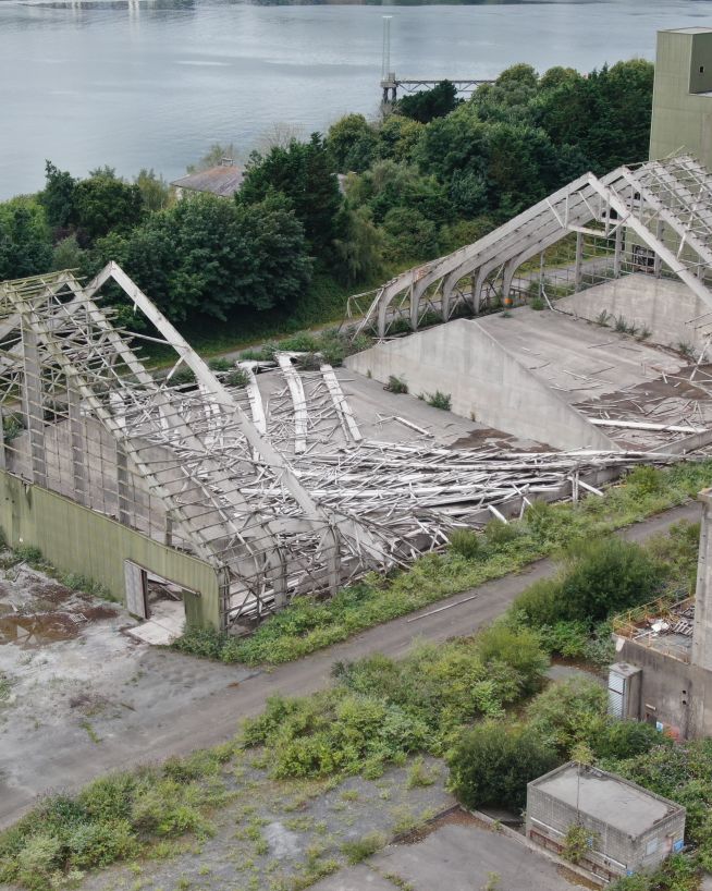
Detect abnormalities within your assets that are otherwise invisible to the naked eye.
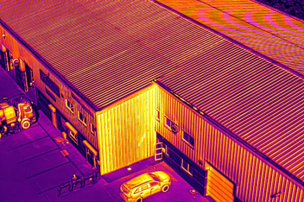
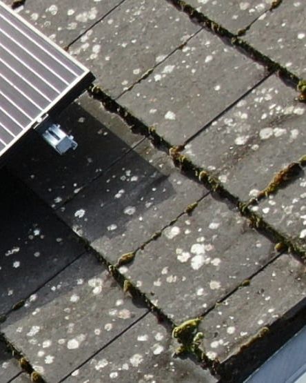
Typically, the source of water damage, heat loss, cold spots, etc, is not immediately apparent, and can often be totally invisible to the human eye. Using drones equipped with thermal imaging capabilities allows you to uncover these flaws while saving time and money, and avoiding disastrous repercussions.
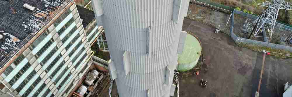
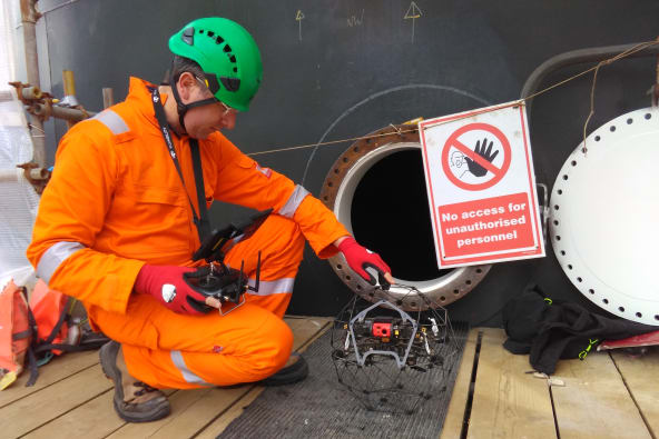
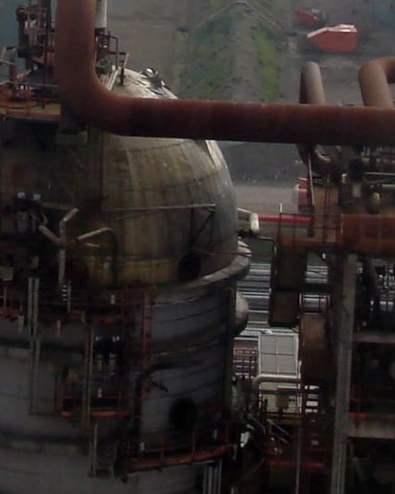
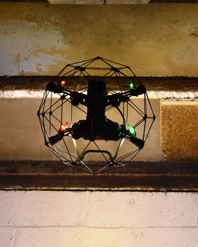
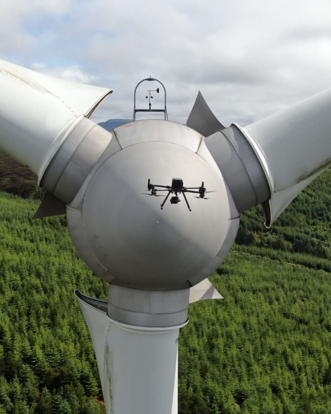
We have state-of-the-art drones which are designed to fly in small, internal spaces where it is difficult, dangerous or costly for humans to gain access. Using cutting-edge technology, these confined space drones will not touch any internal surface, but can give a detailed high-definition view of what can be seen inside.
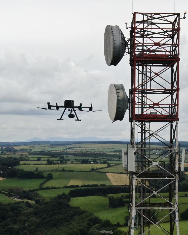
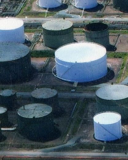
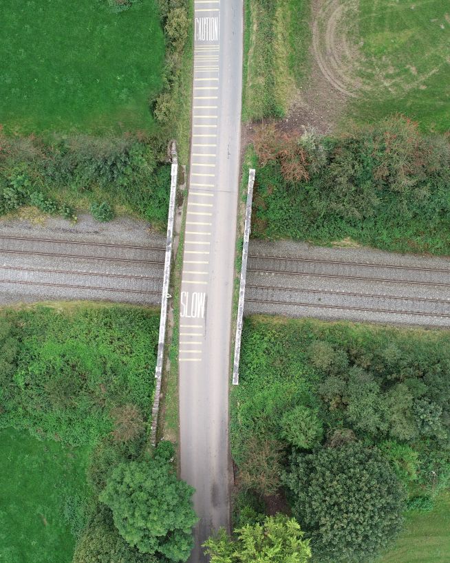
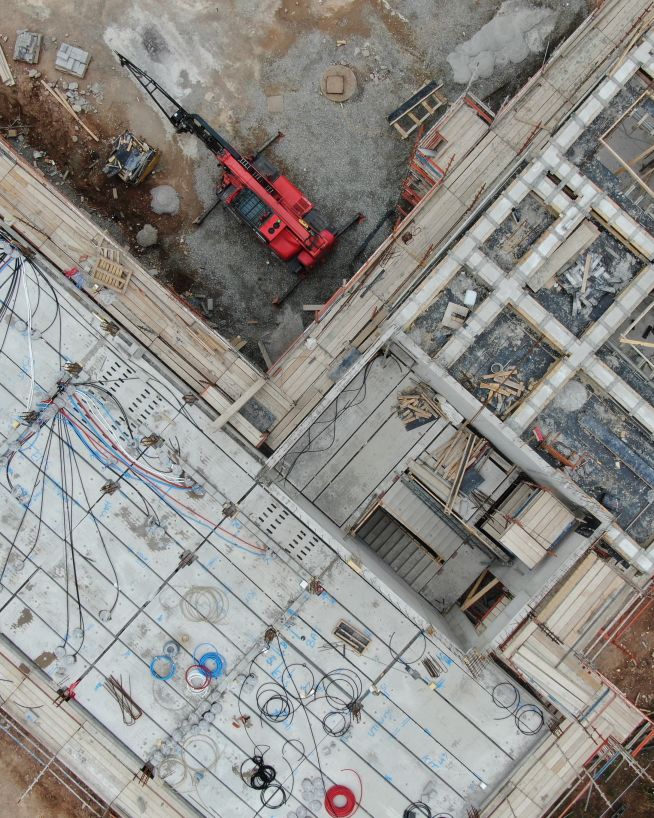
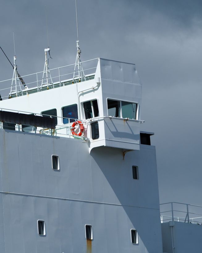
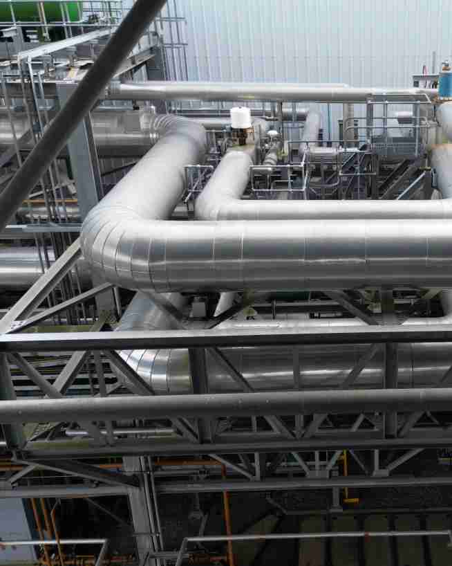
Drone inspections are quick, safe and require little to no downtime. What's more, they're highly versatile, with applications across many different industries. Here are just some of the assets which we are now using drones to inspect.
We take emails, phone calls, messages, everything! If you are unsure of what's possible we are happy to advise, the most important thing is to get in touch. We'll be happy to answer any questions you may have.
Start at the end
With drones, it's best to begin where you want to end up. What sort of deliverable would you like when it's all finished? If you are not sure then we can advise. We can look at what you would like and work backwards from there.
Scope of work and set a price
Once we have agreed on what is to be done, the scope of work is set and a price is agreed upon. We feel it is vital that everyone knows what they are getting and what they are paying for it. There should be no confusion.
Permits and other paperwork
Once we have confirmation you are happy to proceed, we start the ball rolling. We organise things like RAMS, site permits, Air Traffic Control clearance and much more. Basically, we generate everything needed to turn up on-site with all our ducks in a row.
Field Operations
Next, we do the work on site. We have the gear, we have the know-how, so now it's time to get the job done. This can sometimes be affected by the weather, but for the most part, we get the job done on the date specified.
Post Processing
This is where we take what we generated in the field and turn it into a final deliverable for you. This can be anything from the raw data itself, to fully processed Orthophotos, condition reports, CAD line work or thermal imagery.
Handover
The final step is the handover of the deliverables. We tend to use a cloud-based service, so you can access your data anywhere. We can also tie into your existing systems if that is more convenient.
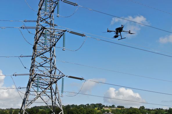
Engineers With Drones is the first company in Ireland to hold the new EASA Specific Category authorisation. We are authorised by the Irish Aviation Authority (IAA) and the European Union Aviation Safety Agency (EASA) for commercial Unmanned Aerial Vehicle (UAV) operations in both urban and rural environments. Total transparency: our Specific Category Authorisation Number is IRL.UAS.AUTH1002.
What about insurance?
All of our operations are insured in the EU and globally. We hold €6.5m public and product liability, €13m employer's liability and €1.3m professional indemnity (base level, coverage raised as required).
Why use engineers?
We are more than just drone pilots. If you're looking for overhead footage of your wedding reception, we're probably not right for you. Our backgrounds and our primary qualifications are in engineering, and it's here that we think we add the most value. We know what we're looking for, and we know how to find it. If you have a technical engineering problem that a drone can solve, we can understand you. Tell us what you need to see or find out, and our engineers will use their drone piloting skills to make it happen.
Are you based in Ireland?
Yes. We're a local Irish company, and that's how we can respond so quickly to the needs of our Irish clients. We can be with you in next to no time, with the right equipment and certifications to operate them, whatever your location.
A digital surface model (DSM) made by a drone refers to a 3D representation of the Earth's surface that is created through the use of remote sensing technology. Drones are equipped with sensors that capture high-resolution images of the ground surface from different angles, which are then processed and stitched together to create a comprehensive 3D map. The DSM is different from other elevation models, as it includes all surface features, including trees, buildings, and other objects on the ground. DSMs have a wide range of applications, including land management, urban planning, environmental monitoring, and disaster response.
A Digital Surface Model (DSM) is a 3D representation of a geographic area that shows the height, shape, and texture of the terrain and any objects on the surface. It is created using digital elevation data obtained from various sources such as aerial photography, LIDAR, or satellite imagery. DSMs can be used in a variety of applications, including urban planning, flood risk assessment, and infrastructure development. They provide a detailed view of the Earth's surface, allowing for accurate measurements of elevation and topography. DSMs are a valuable tool for analyzing and visualizing the landscape and can be used to support a wide range of geospatial analyses.
×
What is a digital terrain model (DTM)?
A digital terrain model (DTM) created by a drone refers to a highly accurate and detailed digital representation of the Earth's surface, generated through the use of unmanned aerial vehicles (UAVs) equipped with advanced sensors and cameras. These sensors collect a vast amount of data, which is then processed using specialized software to create a 3D model of the terrain. The resulting DTM is typically used for various applications such as urban planning, construction, forestry, agriculture, and natural resource management. The advantage of using a drone to create a DTM is its ability to capture data from hard-to-reach areas and produce high-resolution images with incredible accuracy.
A digital terrain model (DTM) is a digital representation of the Earth's surface that captures the elevation data of a particular area, represented in a grid format. It is created by using specialized software that analyzes data from various sources, such as satellite imagery, aerial photography, and ground-based surveys. The DTM accurately portrays the three-dimensional topography of the terrain, including the height and slope of the land, and can be used for a wide range of applications, such as urban planning, flood management, geological analysis, and environmental modeling. DTMs are widely used in the fields of cartography, geology, geography, and remote sensing, among others.
×
What is a DSM / DTM / DEM?
DSM (Digital Surface Model), DTM (Digital Terrain Model), and DEM (Digital Elevation Model) are three commonly used terms in the field of geomatics and remote sensing. These models represent different types of 3D data models that are used to represent the elevation of the Earth's surface. Although they are often used interchangeably, there are some significant differences between these models.
Digital Surface Model (DSM)
A DSM represents the topmost surface of the Earth's terrain, including any vegetation, buildings, and other objects that may be present on the ground. In other words, a DSM is a digital representation of the Earth's surface with all features and objects included. DSMs are commonly used in applications such as urban planning, flood modelling, and environmental studies, where a detailed representation of the Earth's surface is required.
Digital Terrain Model (DTM)
A DTM represents the bare Earth surface, excluding any objects or features above the terrain such as vegetation, buildings, and other structures. DTMs are used to study the Earth's surface in its natural form, and are commonly used in applications such as topographic mapping, hydrology, and soil mapping. DTMs are created by removing all features from a DSM, leaving only the terrain elevation data.
Digital Elevation Model (DEM)
A DEM represents the elevation of the Earth's surface in a digital format, regardless of whether it is covered by objects or features such as vegetation or buildings. DEMs can be derived from both DSMs and DTMs, and are used in a wide range of applications, such as flood risk assessment, land management, and geological studies.
Key Differences
The main differences between DSMs, DTMs, and DEMs lie in the type of data they represent and the applications they are used for. DSMs represent the topmost surface of the Earth's terrain, while DTMs represent the bare earth.
This diagram shows the difference between a DEM and DSM. A DSM captures the surface of the earth and all items on it. A DEM captures the bare earth only and excludes organic and man made items.
×
What is an orthomosaic?
An orthomosaic is a high-resolution, georeferenced image produced by stitching together multiple overlapping aerial or drone images. Unlike a regular mosaic, an orthomosaic corrects for perspective distortion and terrain variations, resulting in a highly accurate and detailed representation of the area being imaged.
Orthomosaics are used in a variety of fields, including agriculture, construction, urban planning, and environmental monitoring. For example, in agriculture, orthomosaics can be used to create detailed maps of crop health and yield, allowing farmers to optimise their planting and fertilization strategies. In construction, orthomosaics can be used to monitor progress and identify potential safety hazards on a job site. In urban planning, orthomosaics can be used to map out infrastructure and identify areas in need of maintenance or repair. And in environmental monitoring, orthomosaics can be used to track changes in land use, detect changes in water quality, and monitor wildlife habitats.
×
What is orthophoto?
An orthophoto is a georeferenced aerial or satellite photograph that has been corrected for topographic relief, camera tilt, and other distortions so that it has a uniform scale and can be used for precise measurement and mapping.
To create an orthophoto, multiple overlapping images of an area are captured from different angles and heights. These images are then corrected for distortions, such as perspective and relief displacement, using photogrammetric techniques. The result is an image that has a uniform scale and can be used for accurate measurements of distance, area, and volume.
Orthophotos are used in a variety of applications, including urban planning, land surveying, environmental management, and emergency response. They are particularly useful for identifying and mapping changes in land use, such as the expansion of urban areas or the conversion of natural habitats. Orthophotos can also be used to create detailed terrain models and to plan the placement of infrastructure, such as roads and buildings.
×
What is Real-Time Kinematic (RTK)?
Real-Time Kinematic (RTK) is a type of satellite-based positioning system that is commonly used in surveying and mapping applications. RTK technology uses a combination of GPS (Global Positioning System) and GLONASS (Global Navigation Satellite System) signals to provide highly accurate and precise location information. Unlike traditional GPS systems that provide accuracy within a few meters, RTK systems can provide Centimetre-level accuracy in real-time. RTK works by using a fixed base station that receives satellite signals and transmits corrections to a mobile rover receiver in real-time. This allows the rover to calculate its precise location relative to the base station with high accuracy and speed.
We use cookies to enhance your experience on our website. By continuing to browse, you agree to our use of cookies. Learn more...