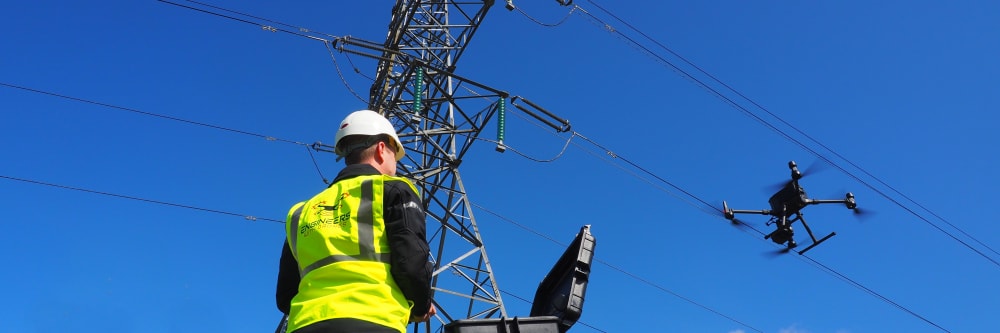
We have specialised drones in our fleet below for every environment. Whether it's an electricity pylon, a bridge, roof or confined tunnel system - our drones are equipped to handle a wide range of use cases. Our drone fleet includes models equipped with AI underwater robotics, thermal imaging, LiDAR, and other advanced sensors. You can browse the list below or just contact us to discuss your project needs.
For complex marine environments
To create a 3D model
Perfect for agricultural land
Large data over long distances
Stabilised with thermal imaging
Identify leakages, heat loss and more
Not sure which drone is right for your project?
Our drone fleet below is complimented by our wider range of survey and inspection equipment. Here at Engineers with Drones we meet the highest standard of UAV security requirements.
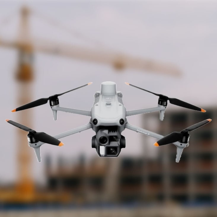
This is the Matrice 4E from the DJI Matrice 4 series designed for enterprise industries. A flagship, intelligent multi-sensor drone designed for geospacial mapping in industries like agriculture, construction and more.
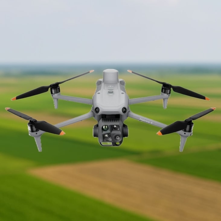
This is the Matrice 4T from the DJI Matrice 4 series. This drone features an infrared thermal camera and NIR auxiliary light for intelligent night scene performance. Designed for the energy sector, emergency response, forestry and more.
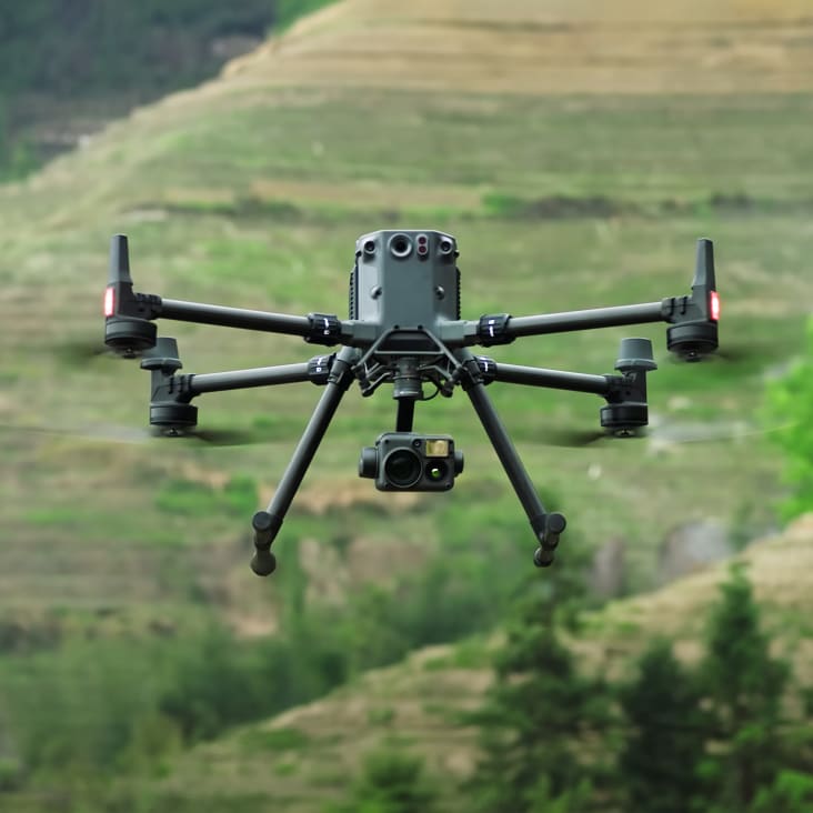
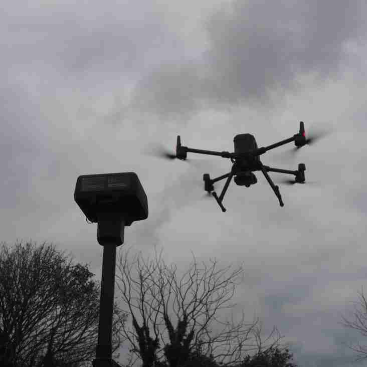
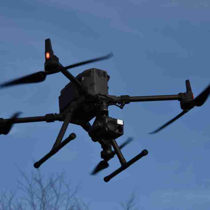
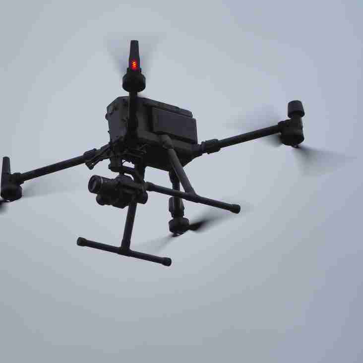
Our flagship drone: The M350 RTK by DJI is the premier enterprise-level inspection drone on the market, an update to our workhorse M300 RTK. With a flight time of up to 55 minutes, lots of built-in redundancy, and a host of payloads to choose from, this is our go-to UAV for inspection work.
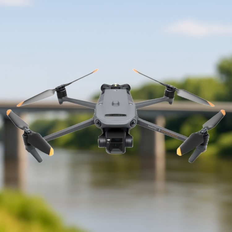
This is our compact but powerful drone from the Mavic Enterprise lineup. Engineered for surveying and inspections, enabling centimetre accurate data collection together with two powerful CMOS sensor cameras; Wide angle 20MP, 4/3 sensor and Tele camera, with 56x Hybrid Zoom.
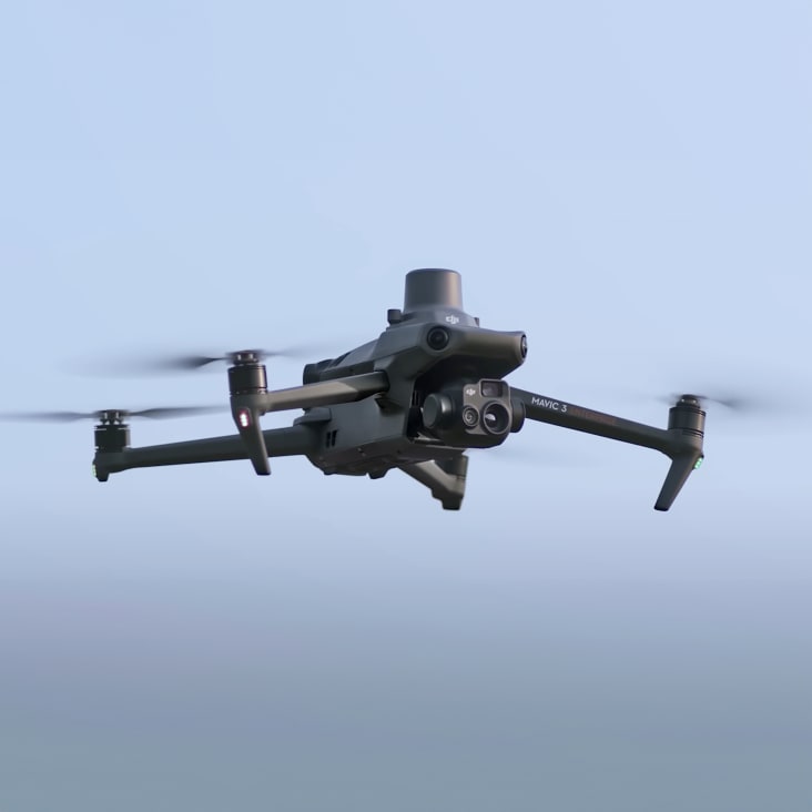
We can deploy this highly portable and versatile UAV at a moment's notice. It is designed for an array of industries and situations where thermal imaging and speed of work is of the essence; such as identifying heat loss and structural defects, conducting solar plant inspections or any low-light/low-visibility environment survey.
This is a very special tool in our bag, as it comes with a newly upgraded imaging system with one 20MP RGB camera + four 5MP multispectral cameras (green, red, red edge, and near-infrared). Enables us to deploy it in high-precision aerial surveying, crop growth monitoring, and natural resource surveys.
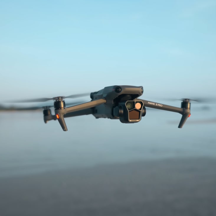
This is the drone we utilise in photography and video missions and projects. With the incorporated payload consisting of three focal-length high-performance cameras, it gives us the option to capture the views around us in a completely different way than with the other payloads.
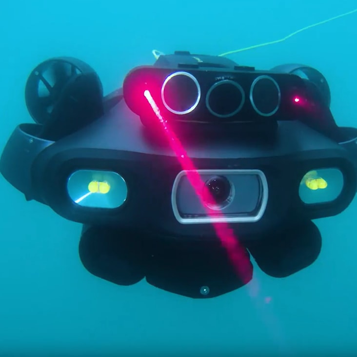
This underwater UAV is our industrial AI underwater robot, engineered for high-precision measurements, inspections, and surveys in complex marine environments. With advanced sensors and sonars, it ensures our projects with accuracy and reliability beyond standards.
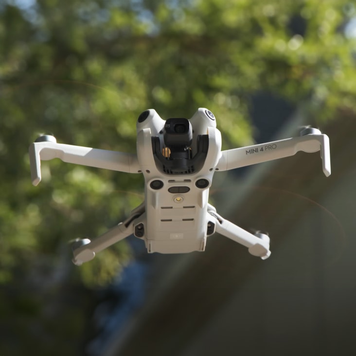
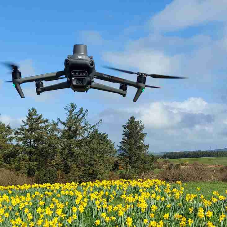
With this high-end Class 0 light-weight drone, we're able to reliably shoot in almost any condition and location, utilising its smaller size and spot-on obstacle avoidance to gather deliverables from more densely populated areas in the safest way possible.
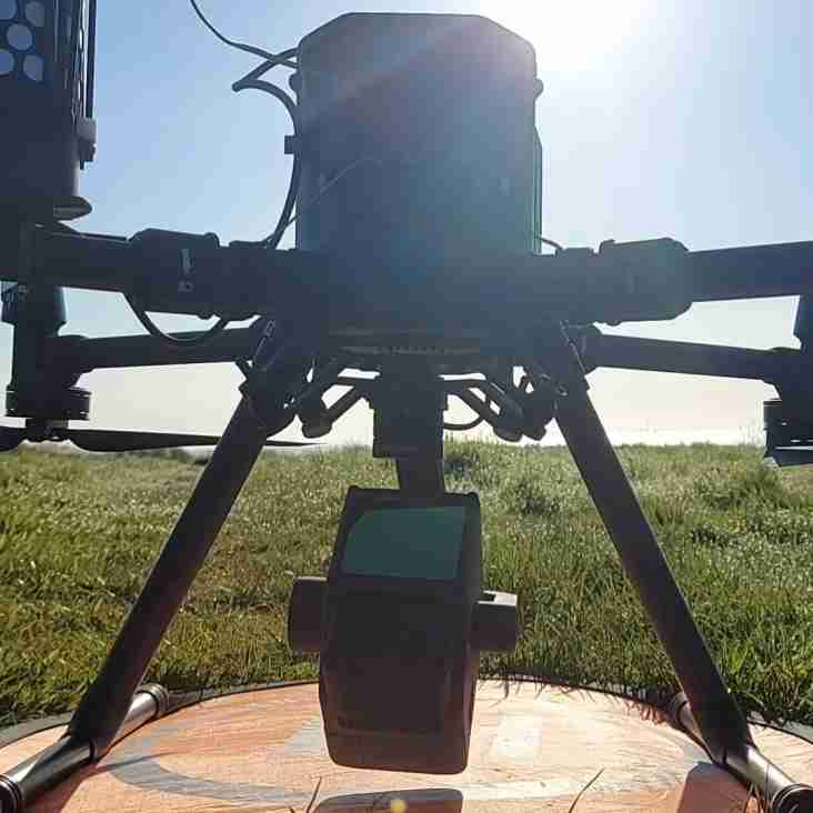
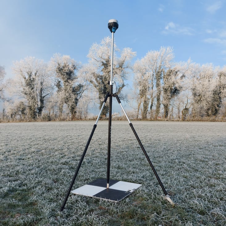
The DJI D-RTK 2 mobile base station helps make accuracy easy. This GNSS receiver supports GPS, GLONASS, Beidou, and GALILEO signals, allowing for centimetre-level positioning. The integrated IMUs monitor movements and calibrate tilt sensors to minimise risks.
LiDAR for everyone. The DJI Zenmuse L1 LIDAR payload features an integrated Livox LiDAR module and a 20mp camera. This combination makes for an excellent all-round package. Covering up to 2km² in a single flight, the L1 carries a highly efficient payload.
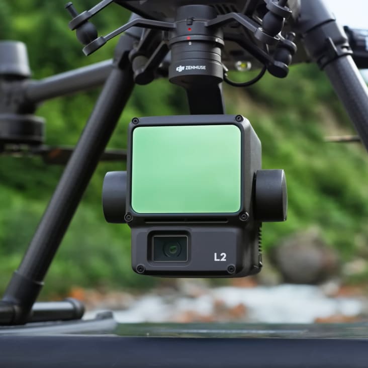
L2 unit with integrated LiDAR and RGB camera is our mapping instrument for efficient, accurate and dependable work. With high-level precision and quick data gathering in the field, we can respond with short turnaround time, high-precision point cloud results and spatial accuracy, matching it with a reliable RTK positioning system.
One payload with a multitude of sensors. The H20T is specifically designed for conducting inspections of high-value assets. When coupled with the Matrice M300 aircraft, the various sensors on the H20T give the operator a wide array of options to get the best imagery possible.
Combined with our flagship drone platform DJI M300 RTK, the DJI Zenmuse P1 camera enables photogrammetry and 3D modelling of the highest standard. There are also interchangeable fixed-focus lenses, on a 3-axis stabilized gimbal, that provide robust versatility to help create stunning 2D, 3D detailed models.
This GNSS receiver helps us in everyday surveying assignments. It has very fast convergence time, which helps us to be quick and efficient in the field. Its five-signal support gives us a better rate of precision, allowing for centimetre-level accuracy. We also love it for the low battery consumption — it gives us 22h hours on one charge.