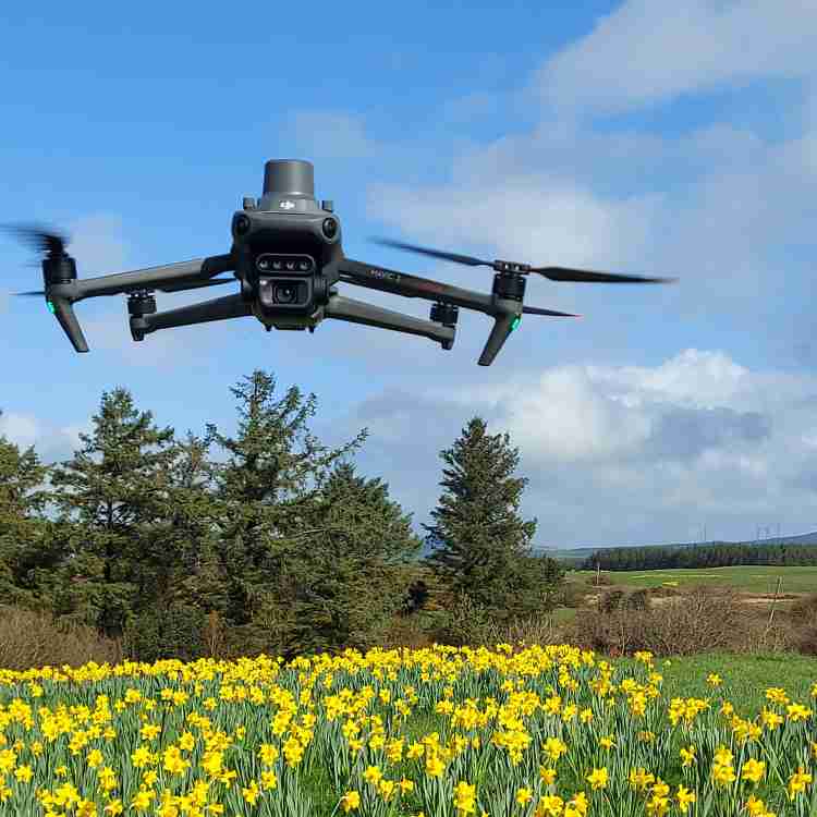
DJI Mavic 3 Multispectral
This is a very special tool in our bag, as it comes with a newly upgraded imaging system with one 20MP RGB camera + four 5MP multispectral cameras (green, red, red edge, and near-infrared). Enables us to deploy it in high-precision aerial surveying, crop growth monitoring, and natural resource surveys.
With a built-in sunlight sensor we can capture solar irradiance and later show it in an image file - this data is very helpful when crop or vegetation health and density assessment is needed.
| Website | dji.com |
| @djiglobal | |
| @dji | |
| 𝕏 (X, formerly Twitter) | @djiglobal |
| YouTube | @djiinnovations |
Flight time
Up to 45 minutesRange (CE)
Up to 8 kmAnti-collision
Omnidirectional binocular vision system + IRHybrid Zoom
56x Zoom CameraResolution
20MP RGB camera + four 5MP multispectral camerasLow-Noise
Low-Noise design for operations in urban and farmland areasDual Frequency
2.4&5.8Ghz Dual Frequency Control Signal