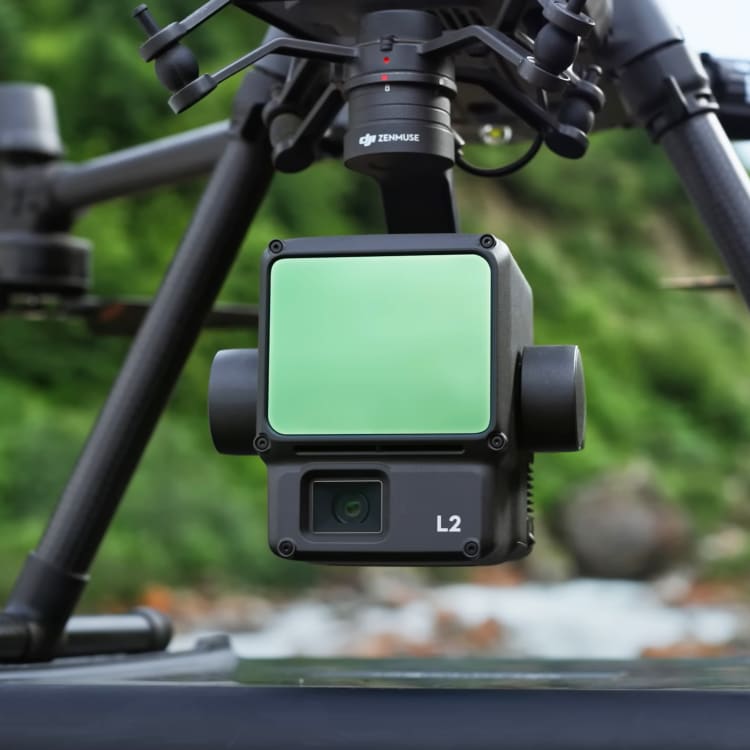
DJI Zenmuse L2
L2 unit with integrated LiDAR and RGB camera is our mapping instrument for efficient, accurate and dependable work. With high-level precision and quick data gathering in the field, we can respond with short turnaround time, high-precision point cloud results and spatial accuracy, matching it with a reliable RTK positioning system.
| Website | dji.com |
| @djiglobal | |
| @dji | |
| 𝕏 (X, formerly Twitter) | @djiglobal |
| YouTube | @djiinnovations |
Waterproof
IP5 rated for work in wet environmentDetailed Point-cloud results
Up to 1,200,000 points per second laser emission returnRange
Ranging Accuracy of 2cm @150m with 450m Detection RangeResolution
20 Megapixel one-inch camera with Global shutter