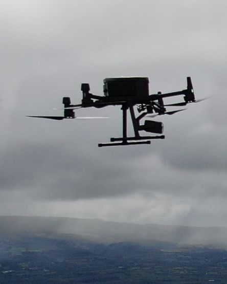
We have worked with some of the biggest names in Ireland's coastal and marine sector. Our engineers have years of experience carrying out inspections and surveys of all kinds of assets, structures and landscapes. They understand the critical need to minimise downtime while guaranteeing the safety of all personnel and operational assets on site. Tell us what you need. It's our job to deliver it for you.
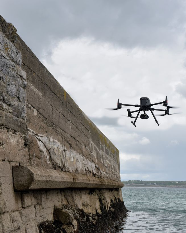
Drones can inspect, survey and map critical port and harbour infrastructure with precision and speed. Using the latest technologies, our engineers can conduct aerial and underwater drone surveys of piers, docks, cranes and other maritime facilities. Whether you're looking to identify corrosion, assess structural damage or streamline operational inefficiencies, our engineers can produce quick, accurate and actionable deliverables in a format that enables optimal decision-making for you.
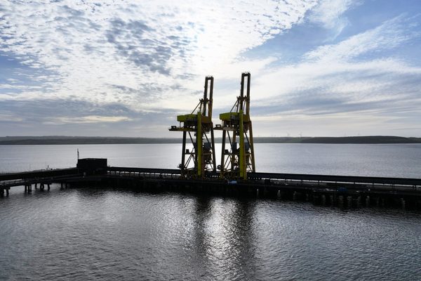
Fitted with the latest high-definition cameras, our UAVs can inspect cranes, docks and above-water infrastructure for signs of corrosion, cracks or other structural wear. This reduces the need for scaffolding or manual inspections, improving safety and minimising disruption.
With sonar and high-resolution imaging payloads, our submersible drones can gather data on the condition of submerged structures like pilings, sea walls and mooring points. Carried out by experienced engineers, these inspections can detect erosion, marine growth and structural damage in areas that are difficult or hazardous to access manually.
Drones equipped with multispectral imaging and water quality sensors allow our engineers to monitor sediment movement, water pollution and ecological impact near ports and harbours. We can give you raw data or expert analysis. Either way, this data can support compliance with environmental regulations and sustainable operation.
By capturing real-time aerial data, drones can provide insights into cargo handling, traffic flow and overall operational efficiency. Such insights can help to optimise workflows and identify potential bottlenecks in port operations.
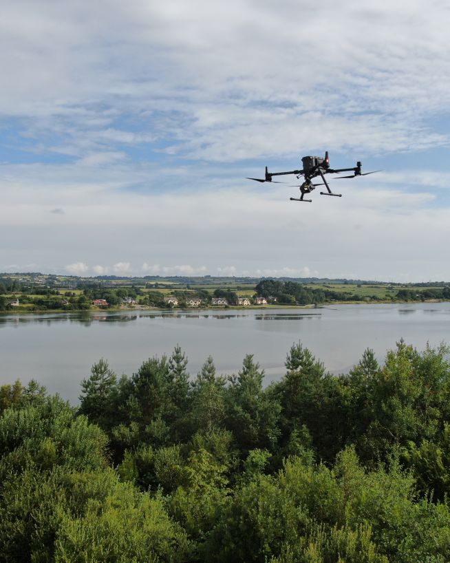
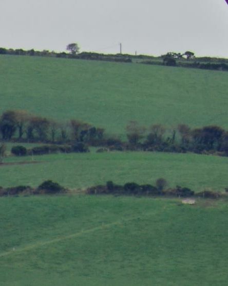
Monitor the condition and performance of critical coastal defence infrastructure, including embankments, sea walls and barriers. Using LIDAR , photogrammetry and thermal imaging, our experienced engineers can assess erosion, structural damage and potential weak points. This data enables proactive maintenance and supports effective coastal risk mitigation.
Drones equipped with LIDAR and photogrammetry payloads provide detailed topographical surveys of coastal defence structures and surrounding terrain. Our engineers can use this data to detect soil displacement, erosion or uneven settlement that might compromise the integrity of embankments or sea walls.
Thermal imaging technology can identify subsurface anomalies in coastal defences, such as moisture penetration, cracks or voids. This allows our clients to detect early signs of failure and address them before they escalate.
Using drones with multispectral imaging and water quality sensors, our engineers can monitor sediment accumulation and water flow near coastal barriers or spillways. This information helps identify blockages or imbalances that could impact the effectiveness of the coastal defences.
During and after coastal events, drones can rapidly survey affected areas to assess damage and guide emergency response efforts. Our engineers can work with you in the field to guide the recovery process and provide expert analysis of any damage.
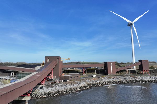
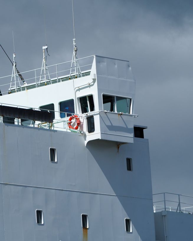
Inspect marine structures such as offshore platforms, wind turbines, and underwater pipelines with advanced drone technology. Our engineers use a combination of aerial and underwater drones equipped with high-resolution cameras, sonar and thermal imaging to detect structural issues, corrosion and other potential problems.
Drones equipped with high-definition cameras can capture detailed imagery of offshore platforms, identifying corrosion, structural damage and other issues. This reduces the need for manual inspections, improving safety and efficiency.
Submersible drones equipped with sonar and high-resolution cameras can inspect underwater structures, such as pipelines and wind turbine foundations, for damage, corrosion and blockages. This technology provides critical insights without the need for divers or costly shutdowns.
Thermal imaging technology can identify subsurface anomalies in marine structures, such as moisture penetration, cracks or voids. This allows our clients to detect early signs of failure and address them before they escalate.
Monitor coastal and marine environments with advanced drone technology. Our engineers use drones equipped with multispectral imaging, thermal cameras and water quality sensors to track ecological changes, identify sources of contamination, and ensure compliance with environmental regulations.
Drones equipped with multispectral imaging or LIDAR can monitor vegetation growth, water quality and pollution levels in coastal and marine environments. This data helps track ecological changes and identify sources of contamination.
Thermal cameras can detect temperature anomalies in water bodies, helping to identify sources of pollution and monitor the health of marine ecosystems.
Drones equipped with water quality sensors can monitor parameters such as pH, turbidity and dissolved oxygen levels, providing critical data for environmental assessments and regulatory compliance.
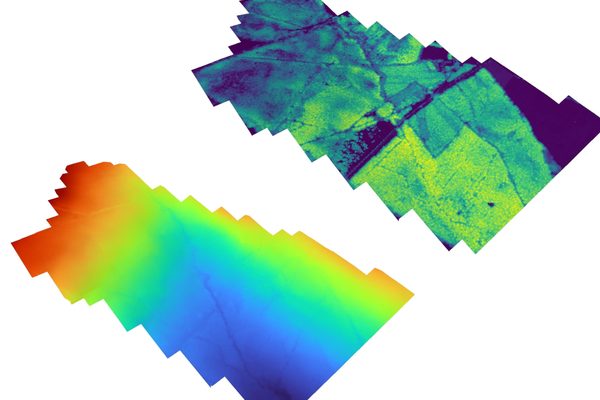
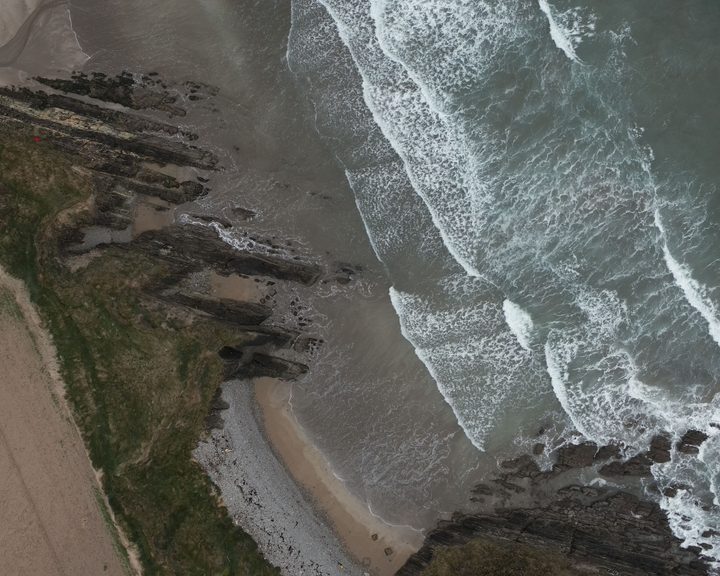
Coastal environments change continuously — erosion, accretion, storm surge, and sea level rise reshape the shoreline with every tide. A LiDAR survey captures millions of survey-grade measurements across the coastal zone in a single flight, producing a digital terrain model that can be compared against future survey dates to quantify exactly how much material has moved and where.
What is the difference between a DSM and a DTM for coastal assessment?
A digital surface model (DSM) includes everything on the ground — vegetation on dunes, structures on the shoreline, rock armour on breakwaters. A digital terrain model (DTM) represents the bare earth with all surface features removed. Both are generated from the same LiDAR point cloud.
For coastal engineers, the DTM reveals the underlying profile of dunes, cliffs, and beaches without vegetation obscuring the true slope. Comparing a DTM from before and after a storm event quantifies the volume of sand lost from a beach or dune system. The DSM captures the condition of coastal defence structures — rock armour displacement, seawall deformation, breakwater settlement — that a photograph alone cannot reliably measure.
More about LiDAR drone surveysWhat does an elevation heatmap tell me that a photograph of the coast does not?
A photograph of a coastline can be misleading. Shadows from cliffs, reflections off wet sand, and vegetation on dunes can hide the true shape of the terrain. An elevation heatmap replaces colour with absolute height data — every pixel has a known Z-value — so dune crest lines, cliff edge retreat, and beach profile changes are unambiguous.
For coastal management, this is particularly useful for mapping the Mean High Water Mark for legal boundary purposes, identifying sections of dune system that have been eroded below a critical threshold, and tracking longshore drift patterns by comparing beach profiles between survey dates. The heatmap turns a shoreline walkover into a measurable engineering dataset.
Discuss coastal elevation mapping for your site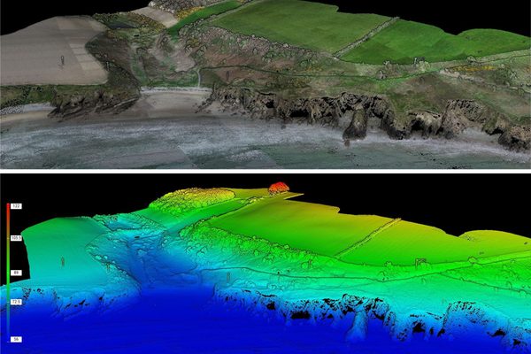
Monitor coastal assets safely and with more precision
Safer, more precise data collection at a fraction of the cost
Safe, precise and instant reports on vessels and infrastructure
Safer and cheaper underwater ROV inspections
Critical, pinpoint details with none of the risk
A more cost- and time-effective way to receive critical data
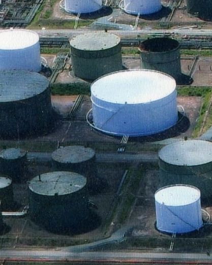
Safer and more cost-efficient flare (oil and gas) inspections
We have worked with a wide range of coastal and marine sector clients, including big names in ports and harbours, coastal defences and marine structures. Here are just a few of the services our engineers can provide using the latest drone technology.
Capture a high-resolution, photorealistic 3D model of your terrain, accurate to the finest details.
Find out moreMitigate the risk factors of traditional confined space inspections, without compromising on quality.
Find out moreSee the condition and health of crops and vegetation with multispectral imagery.
Find out moreMap the features and topography of your land/space efficiently using drone technology.
Find out moreRecord incredibly detailed elevation data to aid in ultra-precise measurements and calculations.
Find out moreDetect abnormalities within your assets that are otherwise invisible to the naked eye.
Find out more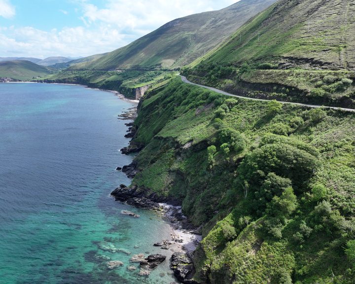
Engineers With Drones captured high-resolution imagery of a 2km section of cliffside road at Mountain Stages, Kerry, replicating exact angles from a 2018 survey to provide a like-for-like comparison of coastal erosion and landslide activity for Kerry County Council.
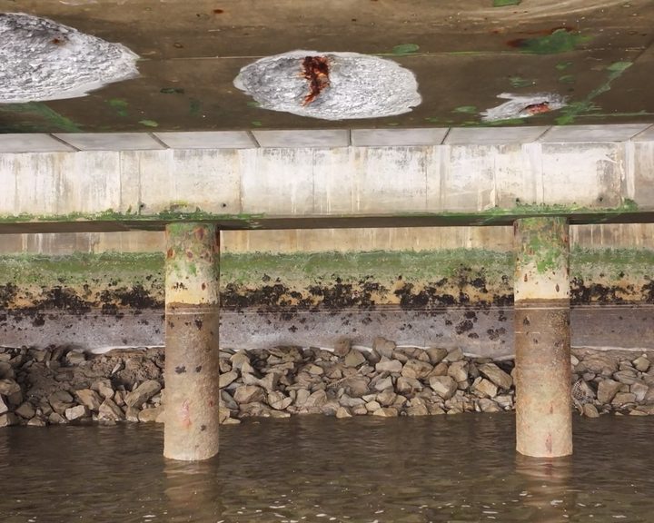
Drone inspection of pier infrastructure at Belview Port — examining the underside of shore-side facilities using UAV technology to assess concrete defects and structural integrity safely.
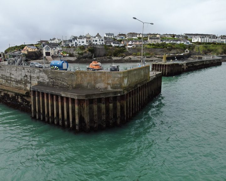
Engineers With Drones carried out a detailed drone inspection of a harbour pier wall, assessing hot-rolled interlocking steel sheet piles and concrete structure for defects and structural integrity.
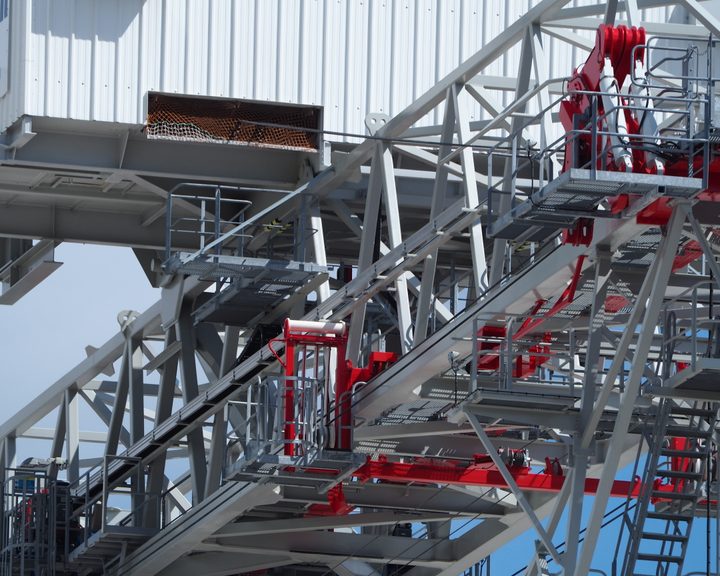
Engineers With Drones used a high-optical-zoom drone to inspect a derelict crane at a Cork port terminal ahead of decommissioning.
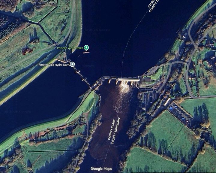
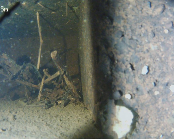
Engineers With Drones used an ROV underwater drone to inspect anomalies in the Ardnacrusha head race canal identified by hydrological survey - historic infrastructure built in the 1920s.
Engineers With Drones deployed an underwater ROV to inspect a live riveted steel penstock, expansion joint, inlet screens, and spiral casing without drain-down or diver entry.
Engineers With Drones surveyed 17 coastal sites across Ireland using drone technology to assess their potential as landfall sites for offshore cables.
Complex surveys and inspections require more than just a pilot. Our engineers can help you scope your requirements and indentify the right approach.