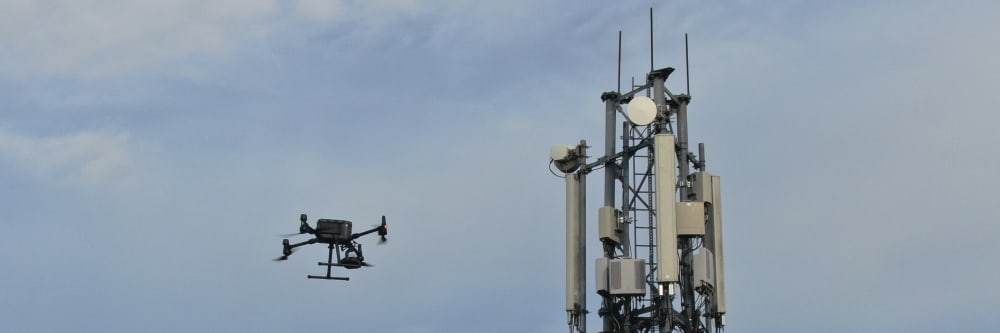
If radio frequency (RF) paths are obstructed, telecom towers can't function. Outdated survey methods delay work and frustrate everyone involved. Completing a line-of-sight (LOS) survey with drones is a low-risk, no-fuss way of ensuring your next tower site is a success. Engineers With Drones establish LOS and minimum tower height for you — allowing you to expedite this stage of the process.
Drone inspections take up less of your manhours and resources than traditional inspections, giving you a faster and more budget-friendly return on your investment.
Drones capture high-quality, impartial information that gives you an exact assessment of the status and needs of your asset.
We understand that you need answers fast. We can deliver a plain-English report with clear-cut conclusions in days. Then, you can take the steps you need to and get back to doing what you do best.
Need us there in a hurry? No problem. Let us know what you need, and we can be there on the same day. After all, sometimes the problem just won't wait.
Sometimes the brief can change even in real-time. If need be, you can be stood there right next to the drone operator, directing them as the situation develops.
We use cutting-edge technologies to detect problems that would otherwise be invisible. These include 4K ultra-HD photography/video, LIDAR and thermal imaging.
Thermal IR technology and ultra HD allow our engineers to get a view that is not available to the naked eye. From a safe distance, we can find defects and insights that are only visible with a drone.
The safety of your personnel and our own is paramount, and we place it at the forefront of our company culture. Ask us about our HSSE systems and practices.
Our method of surveying can be completed in a fraction of the time when compared to common methods. All that’s required is to fly the drone straight up, point it in the correct direction, and zoom in until the tower is located. Risks of injury, damage to towers, and delays are all minimised, while personnel stay firmly on the ground.
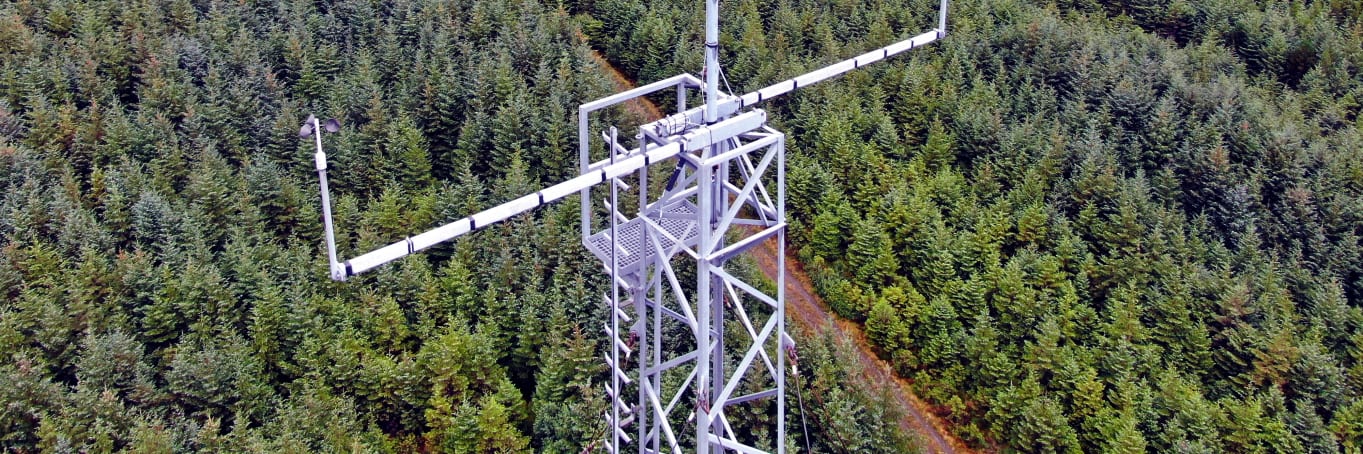
Determining minimum build height for new towers is equally painless — our drone takes photos at regular intervals on the flight back down, and we record the moment LOS is lost.
One flyover with a drone can take in the entirety of a bridge, both above and below. Traffic remains unaffected. Because there is no need for structural support, the whole process is completed in a fraction of the time, and at a fraction of the cost. With the added mobility of a drone, we can view a bridge from previously impossible angles and access confined spaces with ease.
A standard line of sight survey tells you whether you can see Tower B from Tower A. But it does not tell you what the ground is doing between them — and that is what determines whether a signal path will actually work once both towers are built. A LiDAR elevation survey captures the full terrain profile between two points, producing a digital terrain model that reveals every ridge, slope, and depression along the path.
What does an elevation heatmap tell me that a visual LOS check does not?
A visual line of sight check confirms that there is nothing visibly blocking the path between two points at the time of the survey. It does not tell you whether the ground rises between them in a way that would intrude into the Fresnel zone, whether seasonal vegetation growth will cause diffraction, or whether a building that is not yet constructed could block the path from a different location on the same site.
A LiDAR-derived digital terrain model gives you the exact ground profile along any proposed link. Combined with a digital surface model that includes vegetation and structures, you can model the signal path in RF planning software and confirm that the link will work before a single foundation is poured. This is the difference between confirming what you can see and proving what will work.
Discuss an elevation survey for your LOS requirementsComplex surveys and inspections require more than just a pilot. Our engineers can help you scope your requirements and indentify the right approach.


UHD or Ultra High Definition signifies that a camera's resolution is 3840x2160 pixels. This is exactly four time higher than high definition cameras (1920x1080 pixels), and so UHD is often also know as 4K.