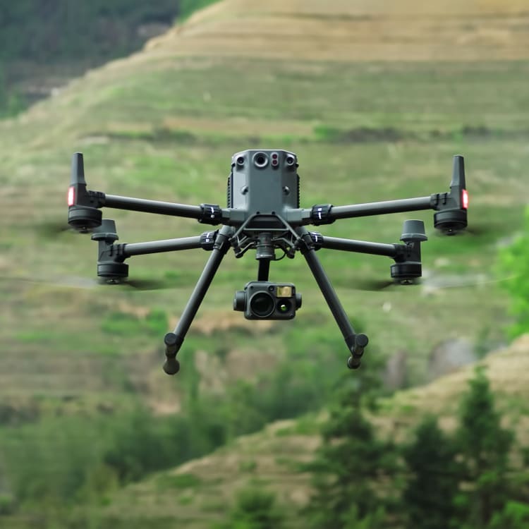
DJI Matrice M350 RTK
Our flagship drone: The M350 RTK by DJI is the premier enterprise-level inspection drone on the market, an update to our workhorse M300 RTK. With a flight time of up to 55 minutes, lots of built-in redundancy, and a host of payloads to choose from, this is our go-to UAV for inspection work.
When coupled with the Zenmuse H30T camera, it is capable of safely inspecting high-value assets at a stand-off range. This is due to the stabilised optically zoomed high-resolution cameras. They also feature a thermal camera to see what the naked eye cannot.
There are lots of payload options, and it flies with precision down to sub-Centimetre. We've had the chance to use it in high winds and rain, without it getting so much as a scratch. We love using this UAV for our commercial inspections!
| Website | dji.com |
| @djiglobal | |
| @dji | |
| 𝕏 (X, formerly Twitter) | @djiglobal |
| YouTube | @djiinnovations |
Flight time
Up to 55 minutesRange
Dual RTK receivers for greater accuracy. 20km range for EVLOS missionsLightweight
Lightweight carbon fibre frameAnti-collision
Anti-Collision Beacon for nighttime operations. 360° collision sensors for enhanced safetyStrategy
Dual controllers for hand-off missionsCapacity
Up to three independent payloadsWaterproof
IP55 rated for work in wet weatherWindproof
Rated up to 12m/s wind speedEfficiency
Hot-swappable batteries for enhanced uptimeSafety
ADS-B Receiver for enhanced airspace safety