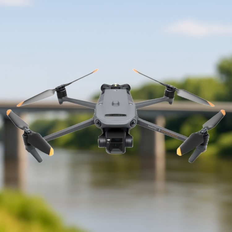
DJI Mavic 3 Enterprise RTK
This is our compact but powerful drone from the Mavic Enterprise lineup. Engineered for surveying and inspections, enabling centimetre accurate data collection together with two powerful CMOS sensor cameras; Wide angle 20MP, 4/3 sensor and Tele camera, with 56x Hybrid Zoom.
Due to its mechanical shutter, it represents a great tool for photogrammetry and is one of our favourite tools. With it, we are very efficient in a short timeframe; surveying up to 2 square kilometres in one flight.
| Website | dji.com |
| @djiglobal | |
| @dji | |
| 𝕏 (X, formerly Twitter) | @djiglobal |
| YouTube | @djiinnovations |
Flight time
Up to 45 minutesRange (CE)
Up to 8kmAnti-collision
Omnidirectional binocular vision system + IRHybrid Zoom
56x Zoom CameraResolution
4/3 CMOS, Effective pixels: 20 MPLow-Noise
Low-Noise design for urban operationsDual Frequency
2.4 & 5.8 GHz Dual Frequency Control Signal