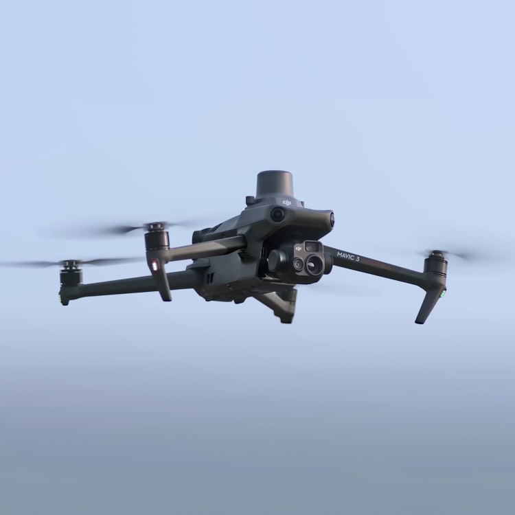
DJI Mavic 3 Thermal
We can deploy this highly portable and versatile UAV at a moment's notice. It is designed for an array of industries and situations where thermal imaging and speed of work is of the essence; such as identifying heat loss and structural defects, conducting solar plant inspections or any low-light/low-visibility environment survey.
Its thermal data gathered provides us with essential information and input for detailed analysis that other payloads couldn't produce, and in most cases — with no downtime. Having the same two cameras as Mavic 3E, its payload also comprises thermal camera with a 61° DFOV (with a 40mm focal-length) and resolution of 640×512 px.
| Website | dji.com |
| @djiglobal | |
| @dji | |
| 𝕏 (X, formerly Twitter) | @djiglobal |
| YouTube | @djiinnovations |
Flight time
Up to 45 minutesRange (CE)
Up to 8 kmAnti-collision
Omnidirectional binocular vision system + IRHybrid Zoom
56x Zoom + Thermal imaging cameraResolution
4/3 CMOS, Effective pixels: 20 MP. Thermal camera: 640×512 px, 61° DFOVLow-Noise
Low-Noise design for urban operationsDual Frequency
2.4 & 5.8Ghz Dual Frequency Control Signal