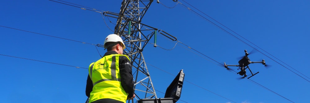
Every pylon, every conductor, every insulator — imaged at a resolution that reveals a cracked porcelain shell or a corroded bolt head before either becomes a fault. Our drones capture the full transmission corridor in a single sortie, producing GPS-referenced high-resolution imagery across hundreds of structures in a day. That data is compiled into a structured inspection report: each component assessed, each defect located and classified, each finding traceable to a confirmed coordinate and a confirmed time of capture. The output is not raw footage — it is an evidence-grade condition record ready to feed directly into a maintenance programme.
Supporting that visual record, thermal imaging detects overheating connections and clamps invisible to the naked eye, and LiDAR corridor surveys map vegetation clearance distances at every point along the line — critical intelligence for Irish terrain where growth is fast and storm seasons are unforgiving.
What does high-resolution actually mean from a drone?
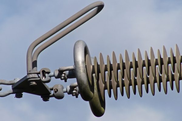
The short answer: it is not about megapixels. It is about the combination of sensor quality, optical zoom lens, and distance to the subject. A drone carrying a 20MP sensor with a high-grade optical zoom lens can resolve a cracked porcelain insulator or a corroded bolt head from 50–100 metres away — the kind of detail that would be a blur on a phone camera or a handheld SLR at the same distance.
But the more important distinction is not the sharpness of one image — it is the coverage. A person with a good camera can take a great photograph of a single pylon from the ground. A drone captures every pylon, every conductor, and every insulator across the full transmission corridor in a single sortie — systematically, with every frame GPS-tagged and every component assessed, located, and recorded. The output is a structured condition report in which no component has been missed. That is the resolution that matters to the clients we work with.
What does thermal imaging detect on power lines?
The most common failure point on transmission infrastructure — overheating connections, clamps, and joints — is completely invisible to a visual inspection. A failing connector on a 110kV line can look identical to its neighbour but be running 30°C hotter. Thermal imaging detects that temperature differential before the component fails, and the survey runs alongside the visual inspection in the same flight — no additional flight time, no extra cost, and no line shutdown required.
The output is a georeferenced thermal map with every anomaly located by GPS coordinates, classified by severity, and explained in a plain-English report. A maintenance team can navigate directly to each flagged component rather than scanning hours of raw footage.
Find out more about our thermal imaging servicesHow does LiDAR help with vegetation management?
Encroaching vegetation is Ireland’s single biggest cause of storm-related line damage. A LiDAR corridor survey does not simply flag “trees near the line.” It produces a precise 3D point cloud of every tree, branch, and hedgerow relative to every conductor, with clearance distance measured to the centimetre at every point along the route.
Irish softwood forestry and hedgerows grow fast — a clearance that was adequate 18 months ago may not be now. The LiDAR output is a georeferenced encroachment map that maintenance teams schedule against, rather than relying on visual estimates from a ground walk. And because the dataset is digital and repeatable, the same flight profile can be re-flown to produce a directly comparable survey a year later — so growth rate between inspections is measured, not guessed.
Find out more about our LiDAR surveysOverheating connections and clamps are among the most common causes of power infrastructure failure — and they are completely invisible to a visual inspection. Our drones carry thermal imaging cameras that detect heat anomalies across the full corridor in a single sortie, pinpointing failing components before they cause an outage. The thermal survey runs alongside the visual inspection with no additional flight time and no line shutdown required.
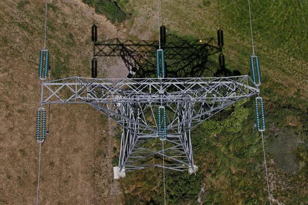
Encroaching vegetation is a leading cause of power line damage in storm events. Using LiDAR corridor scanning, we map precise clearance distances between conductors and surrounding vegetation at every point along the line — identifying not just current violations but trees approaching the safety margin. The output is a georeferenced encroachment map that maintenance teams can act on directly, before a risk becomes a fault.
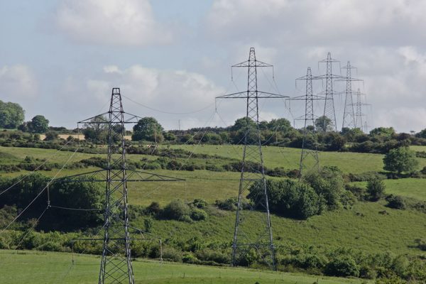
Conventional pylon inspection requires either a line shutdown or specialist crews operating under strict safety exclusion zones. Our drones operate at safe standoff distances as a matter of course — the line stays fully energised, no downtime is incurred, and no personnel approach live equipment. Optical zoom lenses capture close-up detail of insulators, conductor joints, and steelwork from a distance that keeps every crew member safely on the ground.
When a storm damages the network, the time between outage and restoration directly affects customers and revenue. Because EWD is fully onboarded with ESB's systems, operations, and protocols, we can mobilise inspection units within hours of a storm clearance — reaching remote, forested, and difficult terrain that a ground crew may take hours to access on foot. Precise fault location means network sections can be isolated and the rest of the line re-energised while the specific fault is addressed.
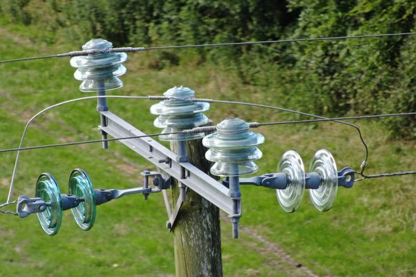
Storm Éowyn was one of the largest storm events in Ireland in a generation, leaving approximately 700,000 homes and businesses without power at peak — compared to 10,000–30,000 in a typical winter storm. The damage was concentrated across the rural northwest: heavily forested, difficult terrain with poor road access, where a ground crew can take days to walk to a fault.
We mobilised drone inspection units within approximately 12 hours of the storm clearing, scaling to approximately 15 units operating simultaneously across the country. Each unit — a pilot, a Mavic-class zoom-lens drone, and a self-contained portable power station — was paired directly with a network linesman. The linesman directed where to fly and what to examine, drawing on decades of network knowledge; the pilot executed safely and legally. Fault locations that would have taken field crews a full week of walking surveys were identified in 10-minute flights, enabling surgical re-energisation: the damaged section isolated, the rest of the network restored to customers while the specific repair was underway.
Our drones inspect from a safe standoff — the line stays fully energised throughout. For transmission operators, avoiding planned outages means no loss of network capacity and no impact on customers.
Our pilots operate at safe standoff distances as a matter of course. No exclusion zone crews, no working-at-height exposure, no risk to anyone near energised equipment.
Overheating connections and clamps are invisible to the naked eye. Thermal imaging runs alongside the visual survey in the same sortie — identifying failing components before they cause an outage, at no additional flight time.
Every image and data point is GPS-tagged at the moment of capture. The output is a time-stamped, georeferenced record of your network's condition — ready for maintenance planning, regulatory reporting, and asset management systems.
For emergency response, we deploy inspection units within hours of a storm clearing — reaching remote, forested, and difficult terrain that a ground crew may take days to access on foot. Precise fault location enables surgical re-energisation while repairs are underway.
Transmission corridors spanning hundreds of kilometres are surveyed rapidly, without road access to every tower. What would take weeks of ground survey is completed in days, with no access infrastructure required.
No cherry-pickers, no tower climbing, no specialist access teams. Our drones reach every component — conductor, insulator, earthing connection — from the ground, at a fraction of the cost and time of conventional methods.
For large-scale events, we deploy multiple units simultaneously across different parts of the network. Whether you need one inspection team or fifteen, we can scale to match the size of the task.
Each inspection combines three data streams: thermal imaging to identify overheating connections invisible to the naked eye; optical zoom cameras for close-up capture of insulators, conductor joints, and steelwork at safe standoff distances; and 4K video for overall structural condition of each tower. All imagery is GPS-tagged at the moment of capture — giving you a precise, time-stamped record of your network's condition that is suitable for maintenance planning, regulatory records, and insurance purposes.
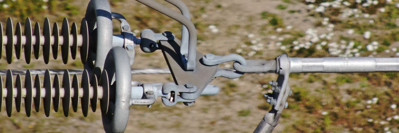
Beyond reactive fault-finding, we provide proactive corridor vegetation management surveys — mapping all forested and tree-lined sections along power line routes to identify every location where encroaching vegetation poses a risk to conductors. The output is a georeferenced dataset that maintenance teams can use to prioritise and schedule clearance work before the next storm season, not after it.
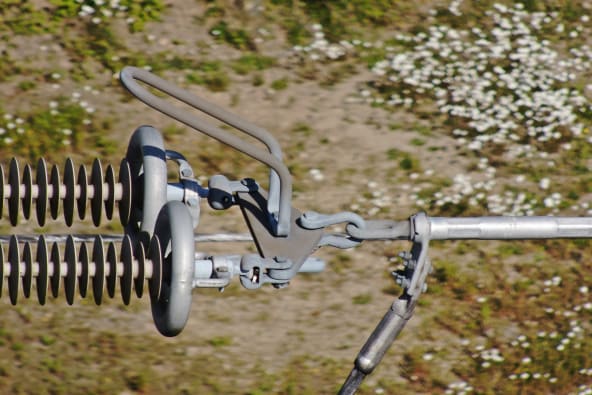
Every inspection delivers a georeferenced photographic survey of the full corridor, a thermal imaging report identifying overheating connections and clamps, an annotated defect report per tower, a vegetation encroachment map with clearance distances, and GPS-tagged imagery suitable for maintenance planning, regulatory records, and asset management systems.
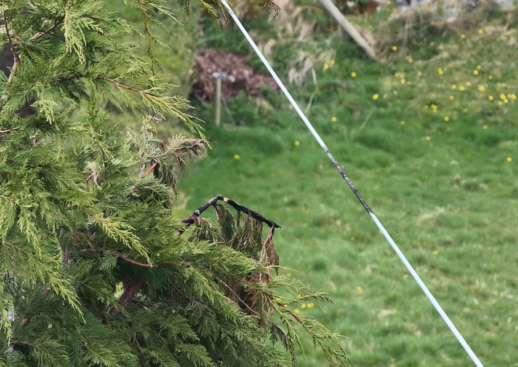
On the left is a tree, on the right is a live 10kV line. This is the kind of vegetation encroachment we locate routinely during corridor surveys for ESB. Identified early, it is a straightforward maintenance task. Left undetected, it is a potential line fault — or worse, a safety incident. Our drone surveys give network operators a precise, georeferenced record of every encroachment along the full corridor, so hazards are resolved on a planned schedule rather than discovered during an outage.
Complex surveys and inspections require more than just a pilot. Our engineers can help you scope your requirements and indentify the right approach.




























































Optical zoom is a feature found in cameras that allows you to change the focal-length of the lens, which in turn magnifies the image. Unlike digital zoom, which simply enlarges the pixels of an image, optical zoom physically moves the lens elements to zoom in or out, resulting in a higher-quality, more detailed image.
Optical zoom is better than digital zoom for several reasons. Firstly, optical zoom maintains the image quality and sharpness because it captures more detail from the subject. In contrast, digital zoom often results in a pixelated, blurry image because it enlarges the existing pixels of an image, which degrades the quality.
Secondly, optical zoom allows you to get closer to your subject without physically moving closer, which can be useful in situations where you cannot or do not want to approach your subject closely. This can be especially helpful for wildlife photography or for taking photos of events from a distance.
Overall, optical zoom is a valuable feature that can help you capture high-quality, detailed images from a distance, making it a must-have for many photographers.

UHD or Ultra High Definition signifies that a camera's resolution is 3840x2160 pixels. This is exactly four time higher than high definition cameras (1920x1080 pixels), and so UHD is often also know as 4K.