A photo of a cell phone tower taken with a drone

Drone Line of Sight (los) Survey for Telecommunications A faster, more efficient way to connect your network

A line of sight survey is essential when expanding a network

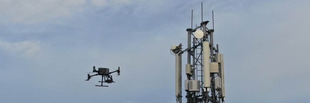
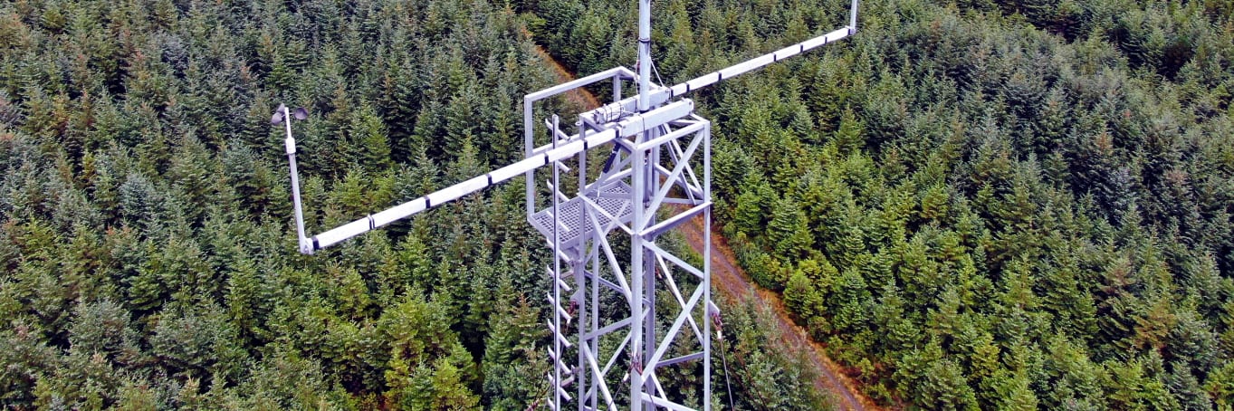
If radio frequency (RF) paths are obstructed, telecom towers can't function. Outdated survey methods delay work and frustrate everyone involved. Completing a line-of-sight (LOS) survey with drones is a low-risk, no-fuss way of ensuring your next tower site is a success. Engineers With Drones establish LOS and minimum tower height for you — allowing you to expedite this stage of the process.

Why choose us?

Qualified engineers

As licensed engineers, we also provide the expertise, understanding, and knowledge necessary to carry out a thorough inspection, with deliverables to match. Our skilled engineers are at the ready.

IAA certification

The Irish Aviation Authority has awarded Engineers with Drones full approval in accordance with the most recent European-wide EASA regulations.

Latest technology

To ensure that you always get the best possible service and cutting-edge deliverables, we purchase the most up-to-date drone technology as soon as it's available.

Rigorous HSSE standards

The operation of Engineers With Drones is governed by a comprehensive HSSE system. Our guiding principles are to reduce risk through rigorous assessment, and to maintain a high level of staff education and training.

Fully insured

We have 6.5 million in public and product liability insurance, and 13 million in employers' liability insurance. Engineers with Drones are fully insured to fly wherever you need.

Based in Ireland

As we're situated in Ireland, we can respond to your needs quickly, with zero travel complications.

First-class deliverables

As seasoned engineers in the field, we are aware of the trouble that shoddy reports and deliverables can create. For this reason, we provide you with exactly what you require.

Quick turnaround times

Thanks to our fast turnaround times, your entire project can be completed in a fraction of the time of traditional methods, without any compromise in the quality of your deliverables.

4K and VR Footage

In addition to quadrupling the resolution of an HD camera, 4K also gives you quicker frame rates, incredible contrast variations, and expanded colours. VR video takes the level of immersion and clarity to the next level.

Why use a drone for your line of sight survey?

Cost-efficient

Drone inspections take up less of your manhours and resources than traditional inspections, giving you a faster and more budget-friendly return on your investment.

Greater Accuracy

Drones capture high-quality, impartial information that gives you an exact assessment of the status and needs of your asset.

Quick turnaround

We understand that you need answers fast. We can deliver a plain-English report with clear-cut conclusions in days. Then, you can take the steps you need to and get back to doing what you do best.

Rapid response

Need us there in a hurry? No problem. Let us know what you need, and we can be there on the same day. After all, sometimes the problem just won't wait.

Real-time consulting

Sometimes the brief can change even in real-time. If need be, you can be stood there right next to the drone operator, directing them as the situation develops.

Detect hidden problems

We use cutting-edge technologies to detect problems that would otherwise be invisible. These include ultra-HD photography/video, LIDAR and thermal imaging.

See more

Thermal IR technology and ultra HD allow our engineers to get a view that is not available to the naked eye. From a safe distance, we can find defects and insights that are only visible with a drone.

Safety

The safety of your personnel and our own is paramount, and we place it at the forefront of our company culture. Ask us about our HSSE systems and practices.

Your No-Fuss Line of Sight Survey

Our method of surveying can be completed in a fraction of the time when compared to common methods. All that’s required is to fly the drone straight up, point it in the correct direction, and zoom in until the tower is located. Risks of injury, damage to towers, and delays are all minimised, while personnel stay firmly on the ground.

Determining minimum build height for new towers is equally painless - our drone takes photos at regular intervals on the flight back down, and we record the moment LOS is lost.

A drone inspection of a met mast
Get a closer look without the hassle, delays or risk

Drone bridge inspections are more efficient

Today, using drone technology...

One flyover with a drone can take in the entirety of a bridge, both above and below. Traffic remains unaffected. Because there is no need for structural support, the whole process is completed in a fraction of the time, and at a fraction of the cost. With the added mobility of a drone, we can view a bridge from previously impossible angles and access confined spaces with ease.

How does it work?

Reach out and tell us your idea

We take emails, phone calls, messages, everything! If you are unsure of what's possible we are happy to advise, the most important thing is to get in touch. We would be delighted to answer any questions you may have.

Start at the end

With drones, it's best to begin where you want to end up. What sort of deliverable would you like when it's all finished? If you are not sure then we can advise. We can look at what you would like and work backwards from there.

Scope of work and set a price

Once we have agreed on what is to be done, the scope of work is set and a price is agreed upon. We feel it is vital that everyone knows what they are getting and what they are paying for it. There should be no confusion.

Permits and other paperwork

Once we have confirmation you are happy to proceed, we start the ball rolling. We organise things like RAMS, site permits, Air Traffic Control clearance and much more. Basically, we generate everything needed to turn up on-site with all our ducks in a row.

Field Operations

Next, we do the work on site. We have the gear, we have the know-how, so now it's time to get the job done. This can sometimes be affected by the weather, but for the most part, we get the job done on the date specified.

Post Processing

This is where we take what we generated in the field and turn it into a final deliverable for you. This can be anything from the raw data itself, to fully processed Orthophotos, condition reports, CAD line work or thermal imagery.

Handover

The final step is the handover of the deliverables. We tend to use a cloud-based service, so you can access your data anywhere. We can also tie into your existing systems if that is more convenient.

Get a quote

Our Services Not just photos from the sky

Spoiler alert: we don't do weddings! We're professional engineers who have learned to fly drones really well. If you're looking for a photo of your garden or a swooshing shot of your wedding reception, we're probably not the right people for you. But if you need an engineer's eyes and experience, combined with next-generation UAV technology and industry-leading deliverables, then you've come to the right place.

Drone Photography

Capture high-quality imagery of your assets from never before seen vantage points.

Find out more

What technology do we use for line of sight surveys?

We purchase the latest drones as they come on the market to ensure you are getting the highest quality service from us at all times. Here is a quick look at what we would be most likely to use for a typical drone line of sight survey.

Our equipment
DJI MatriceM300 RTK M300 RTK by DJI

Our flagship drone: The M300 RTK by DJI is the premier enterprise-level inspection drone on the market. With a flight time of up to 55 minutes, lots of built-in redundancy, and a host of payloads to choose from, this is our go-to UAV for inspection work. When coupled with the Zenmuse H20T camera, it is capable of safely inspecting high-value assets at a stand-off range.

  • Drone
  • Camera
  • Thermal Imaging
  • Ultra HD
  • Long range
More info
Our equipment
MultinnovStereo 2 Stereo 2 confined space drone by Multinnov

The confined space master: The Stereo 2 by Multinnov is the cutting-edge in confined space and indoor inspection drone technology. Eliminating the need to send personnel into hazardous locations, the Multinnov Stereo 2 can be deployed at a fraction of the cost, and with zero downtime. This is a drone designed from the ground up to get into restrictive and hard-to-reach places.

  • Drone
  • Camera
  • Confined spaces
  • Indoors

People often ask us about...

Our Equipment
Check out our cutting-edge drone equipment and find out what it can do for you.

Read more...

IAA Certification
We are fully accredited by the Irish Aviation Authority to the latest European-wide EASA regulations.

Read more...

HSSE
Health and safety is a core principle of our business. Find out how we put these principles into practice.

Read more...

Fully insured
We hold 13m employers' liability insurance and 6.5m public & product liability insurance.

Read more...

Deliverables
Tell us what you need in your inbox, and we will start planning from there. Fully customised.

Read more...

Expert engineers
We are experienced engineers with strong technical backgrounds.

Read more...

Irish location
Based in Ireland, we'll be with you quickly - ready with all the correct permits.

Read more...

The Weather
Find out how we factor the weather into when we provide drone services.

Read more...

We have worked with...

All assets and industries

Our specialities don't begin and end with line of sight surveys, we perform surveys and inspections across a wide variety of industries. Click on an asset or industry below to find out more.

A UAV performing a drone bridge inspection on an old stone road bridge

Bridge Inspections

Safer, more cost-efficient, with less downtime

Find out more
A UAV performing a drone building inspection

Building Inspections

Clearer, faster results without the risks

Find out more
A DJI inspection drone inspecting the wall of a coastal pier

Coastal Infrastructure

Monitor coastal assets safely and with more precision

Find out more
A confined space drone inspection with a Flyability Elios 2 drone

Confined Space Drone Inspections

Eliminate safety concerns, save costs and reduce downtime

Find out more
An image of a construction site taken by a drone performing drone services for construction.

Construction Services

Instant, actionable data with no downtime

Find out more
A drone performing a wind turbine inspection

Energy Inspections

Inspect and maintain energy assets without risk or downtime

Find out more
TODO

Farm Mapping Services

Accurate and efficient analysis of crops and land

Find out more
An aerial image of an oil refinery taken with a drone conducting a flare stack inspection

Flare Inspections

Safer and more cost-efficient flare (oil and gas) inspections

Find out more
A photo of an agricultural field taken with a drone

Forestry and Agricultural

Faster, cheaper and more accurate analysis of land

Find out more
todo

Forestry Mapping

Faster, cheaper and more accurate analysis of land

Find out more
An old round martello tower building taken with a drone

Historical Buildings

Analyse historical buildings without risk to people or property

Find out more
A photo of a load of industrial chimneys taken with a drone

Industrial Chimneys

Actionable data from a safe distance, with less downtime

Find out more
A photo of industrial infrastructure taken with a drone during an inspection

Industrial Inspections

Keep production running while collecting instant critical data

Find out more
An image of a damaged building taken by a drone performing drone services for insurance.

Insurance Services

Record and document reliable visuals without safety concerns

Find out more
A view of the landscape taken by a drone on a survey

Landscape Inspections

Endless perspectives, without manned aircrafts or structures

Find out more
A photo of a cell phone tower taken with a drone

Line of Sight Surveys

Reduced risk, damage to towers and delays

Find out more
A photo of a quarry taken with a drone

Mines, Quarry and Landfill

Monitor status and progress without downtime

Find out more
A photo of an oil refinery taken with a drone during an inspection

Oil & Gas Inspections

Fast, actionable data without the risks of traditional inspections

Find out more
A close-up photo of an electrical pylon taken during a drone inspection

Power Grid Inspections

Instantly usable data via a safer and more cost-effective process

Find out more
A photo of a railway tracks and a bridge taken with a drone

Rail Inspections

Eliminates downtime and safety concerns, at a fraction of the cost

Find out more
A house next to a river taken by a drone performing drone real estate services

Real Estate Drone Services

Add "Wow Factor" to residential and commercial property listings

Find out more
A photo of a river taken with a drone during an inspection

Rivers and Waterways

Safer, more precise data collection at a fraction of the cost

Find out more
A drone performing a roof inspection

Roof Inspections

Accurate, safe and instantly actionable data collection

Find out more
A photo taken by a drone of rooftop solar panels during an inspection

Rooftop Solar Inspections

Ensure solar panel efficiency from precise data collection

Find out more
A photo of a ship being inspected by a drone

Ships and Marine

Safe, precise and instant reports on vessels and infrastructure

Find out more
Solar panels being inspected by a drone

Solar Farms

Get actionable data on quality and operational health

Find out more
An image of a storm-damaged building and roof taken by a drone during a storm damage inspection.

Storm Damage

Assess damage quickly and with pinpoint accuracy

Find out more
A photo of a storage tank being inspected by a drone

Tanks, Silos and Vessel Inspections

Get fast, usable data from a safe distance

Find out more
A telecommunications tower being inspected by a drone

Telecommunications

Get critical data on cell and telecommunication infrastructure

Find out more
A drone performing an inspection of a communications tower

Tower Inspections

Instantly view complex structures, keeping risks to a minimum

Find out more
A photo of a water tower taken by a drone during an inspection

Water Tower Inspections

Critical, pinpoint details with none of the risk

Find out more
A drone inspecting a wind turbine in ireland

Wind Turbine Inspections

A more cost- and time-effective way to receive critical data

Find out more