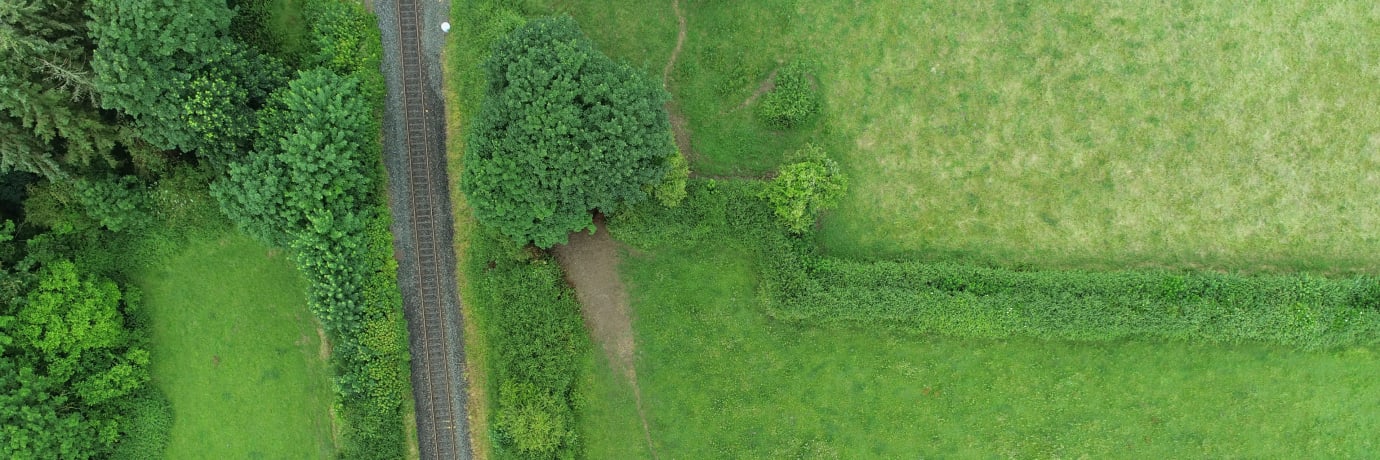
We have worked with some of the biggest names in Irish farming and forestry. Our engineers use multispectral imaging, LiDAR, and high-resolution photography to give you the data that drives better decisions — where crops are stressed, how water drains, how a plantation is growing, and how much timber is standing.
How much land can one survey cover?
Large farms and forestry blocks can typically be covered in a single sortie, with every field mapped to the same standard. A survey that would take days on foot is captured in hours.
Discuss surveying your landCan you see the ground below tree canopy?
Yes. LiDAR recovers bare-earth elevation through vegetation, so the terrain beneath a canopy is measured, not guessed — essential for drainage and access planning on forested ground.
More about LiDAR drone surveysWhat does multispectral imaging show on a crop?
Crop stress, disease, and nutrient deficiency often appear in plant reflectance before they are visible to the eye. Multispectral imagery shows that stress field by field, so you can treat the problem before it becomes obvious.
More about multispectral imaging










Multispectral surveys show crop stress field by field, before it is visible to the eye.
LiDAR measures the ground beneath the canopy, not just the top of the trees.
Terrain models show where water runs and pools before drainage work begins.
Georeferenced maps delivered in the format your agronomy or forestry team uses.
Enhance farming operations with precision drone surveys and inspections. Our engineers use drones equipped with multispectral imaging payloads, thermal cameras and LiDAR to monitor crop health, assess soil conditions and optimise irrigation. Our deliverables can help improve yield and reduce costs while ensuring sustainable and compliant farming practices. Common LIDAR deliverables include point clouds, Digital Elevation Models (DEM), 3D models, contour maps, orthomosaic imagery and volumetric calculations.
What does multispectral imaging show?
Crop stress, disease, and nutrient deficiency often appear in plant reflectance before they are visible to the eye.
More about multispectral imagingHow is farm mapping delivered?
As orthophotos and field maps with crop health layers, delivered in the format your agronomy team uses.
Discuss a farm surveyDrones equipped with multispectral imaging can monitor crop health by detecting variations in plant reflectance. This data helps identify areas of stress, disease or nutrient deficiency, enabling targeted interventions and improving overall crop yield.
Using LiDAR and photogrammetry, our engineers can create detailed terrain and drainage maps that support ground-based soil assessment. This information supports precision agriculture practices, optimising planting, fertilisation and irrigation strategies.
Drones equipped with thermal cameras can monitor irrigation systems and identify areas of over- or under-watering. This data helps optimise water usage, reduce waste and ensure crops receive the right amount of water for optimal growth.
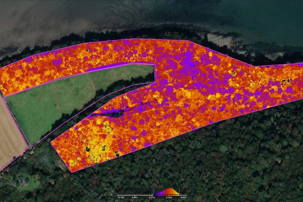
Using LiDAR, multispectral imaging and high-resolution cameras, our engineers can assess forest health, track growth and detect signs of disease or pest infestation. Such insights can support sustainable forestry practices and efficient resource management.
Drones equipped with multispectral imaging can monitor forest health by detecting variations in tree reflectance. This data helps identify areas of stress, disease or pest infestation, enabling targeted interventions and promoting overall forest health.
Using LiDAR and photogrammetry, our engineers can create detailed 3D models of forested areas, tracking tree growth and biomass over time. This information supports inventory management, sustainable harvesting practices and long-term forest planning.
Drones equipped with LiDAR and photogrammetry can create accurate maps and measurements of forested areas. This data helps in planning and managing forestry operations, including tree planting, thinning and harvesting. It also supports environmental impact assessments and compliance with forestry regulations.
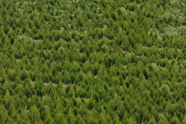
Whether you are managing a farm or a forest, the single most valuable dataset you can have about your land is an accurate topographic model. A LiDAR survey captures millions of survey-grade measurements in a single flight and produces the digital terrain and surface models that reveal how water drains, where slopes are steepest, and how the land is changing over time.
What is the difference between a DSM and a DTM for land management?
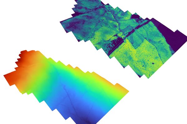
A digital surface model (DSM) includes everything on the ground — crops, trees, hedgerows, buildings. A digital terrain model (DTM) represents the bare earth with all surface features removed. Both are generated from the same LiDAR point cloud.
For a farmer, the DTM reveals the natural drainage pattern of a field — where water will pool, where it will run, and where contour ploughing would be most effective. For a forester, the DSM minus the DTM over a stand of trees gives the timber volume without anyone setting foot in the plantation.
More about LiDAR drone surveysWhat does an elevation heatmap tell me that a photograph of the land does not?
A photograph of a field or forest can be misleading. Shadows, crops, and vegetation can hide slope angles and elevation changes. An elevation heatmap replaces colour with absolute height data — every pixel has a known Z-value — so slopes, depressions, and drainage paths are unambiguous.
For agriculture, this is particularly useful for planning field drainage, identifying low spots where frost will settle, and verifying that land levelling has achieved the designed gradient. The heatmap turns a site photograph into a measurable management tool.
Discuss elevation mapping for your land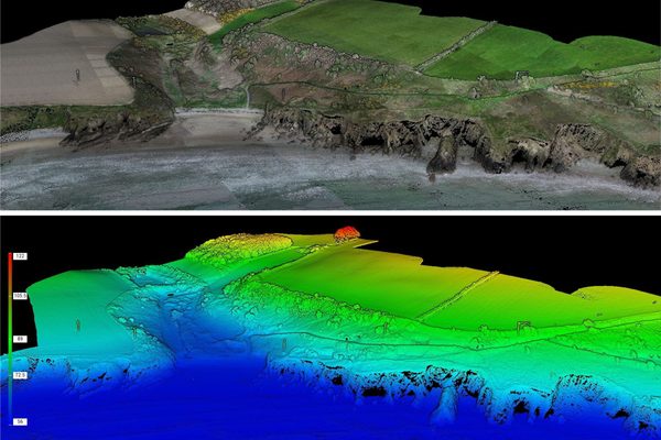
The time invested in planning pays off year after year. Up-to-date and detailed aerial imagery of your land is priceless. Drone farm surveying can create these images for you in a fraction of the time, so you can plan with confidence and move on to the next phase.
Clear images simplify road and access planning and help you use your land efficiently. Up-to-date images are invaluable in boundary disputes. Our topographic maps of your property make it easier to plan crops, paddocks, drainage and irrigation. When you know the lay of the land, you can irrigate more efficiently and avoid flooding. We take care of this in a single flight.
Aerial photographs show variations in health and density that aren't visible from a human perspective. Inspection efficiency allows for more frequent crop monitoring. A high-resolution camera captures detailed images without endangering crops, and intervention before health is poor enough to be visible from the ground often saves entire areas of crops from failure.
Multispectral imaging provides information about the health of plants, and can detect pests or diseases. Fertilisation is also more efficient when you can pinpoint exactly where it's needed. With multispectral imaging we can detect pests and diseases before the situation is bad enough to be obvious.
Livestock is tracked down easily. Drones cover larger areas and difficult terrain faster than a human, and with a sharper eye. Thermography is used to pinpoint lost livestock.
Farm buildings of all types can also be inspected using a drone, giving you peace of mind — including silos, tanks, and vessels.
Multispectral imagery shows crop density, allowing you to estimate yield more accurately. Planning sales and distribution is made more efficient, and can be done at an earlier stage.
We help to facilitate forest planning. It's important to get an overview of the land first, as long-term crops need access for years after planting. Efficient land use can facilitate access at all stages of a forest's lifecycle.
Dense forests cause visibility issues. Aerial views of forests provide a better perspective and a clearer view of the area. Planning access roads and walkways is easy when you no longer have to physically navigate the area.
Aerial images of trees show differences in health and density. Problems that aren't visible from a human perspective become apparent when you're above the tree line. After storms and damaging events, drone photography reveals windthrow and storm damage that can be quickly assessed.
Multispectral imaging gives insights into the health of individual trees and the forest as a whole. By finding areas that need fertilising, you can focus your efforts where they're needed.
Drones detect disease and pests earlier than the human eye. They can intervene before the problem is so bad that it becomes visible, saving trees at risk of failing.
Using drone LiDAR technology for mapping and analysing forestry is an efficient approach. LiDAR sensors on drones can capture precise and detailed data of the forest canopy and terrain, which is essential for forest management and planning. The LiDAR data can provide insights into the forest's height, density, and structure, allowing forestry professionals to assess the forest's health and identify areas that require attention.
Drone LiDAR can also facilitate the identification of areas that have suffered from deforestation or other disturbances, enabling efficient restoration and conservation efforts. Common applications of drone LiDAR in forestry include:
Drone LiDAR can rapidly and accurately inventory forests, providing detailed information on tree height, canopy density, and tree structure. This information can be used to assess forest health, monitor changes over time, and plan for sustainable forestry practices.
One of the primary benefits of drone LiDAR in forestry is its ability to accurately measure tree height, even in dense forested areas. This information can be used to estimate biomass, predict timber volume, and assess the potential for wind damage or other hazards.
Drone LiDAR can generate detailed maps of canopy density, which can be used to identify areas of high tree cover or areas where thinning or other forestry practices may be necessary.
Drone multispectral cameras capture light beyond the visible spectrum, revealing information about the health and growth of trees that a standard camera cannot. This allows us to better understand and manage forest ecosystems.
Multispectral imaging can identify different types of vegetation, as well as areas of stress or damage caused by pests, diseases, or environmental factors. This information can be used to create high-resolution maps, monitor changes over time, and make informed decisions about forest management practices. Drone multispectral imagery can be used in forestry for a variety of purposes, including:
Drone multispectral imagery can create high-resolution maps of forests that provide information on tree height, crown diameter, stem density, and species composition. This information can help forestry managers make better decisions about forest management and planning.
Multispectral imagery can detect early signs of forest pests and diseases, such as bark beetles or fungi. This can help prevent the spread of these problems, and enable targeted treatment before large-scale damage occurs.
Drone multispectral imagery can estimate the volume of timber in a forest, which is important for planning and monitoring harvests. This can help forestry managers make better decisions about when and where to harvest, and ensure that the forest remains healthy and sustainable.
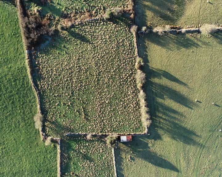
Engineers With Drones used drone-based LiDAR and multispectral sensors to map large areas of farm land across Ireland, providing detailed information about farms and their carbon sequestration potential.
Complex surveys and inspections require more than just a pilot. Our engineers can help you scope your requirements and indentify the right approach.