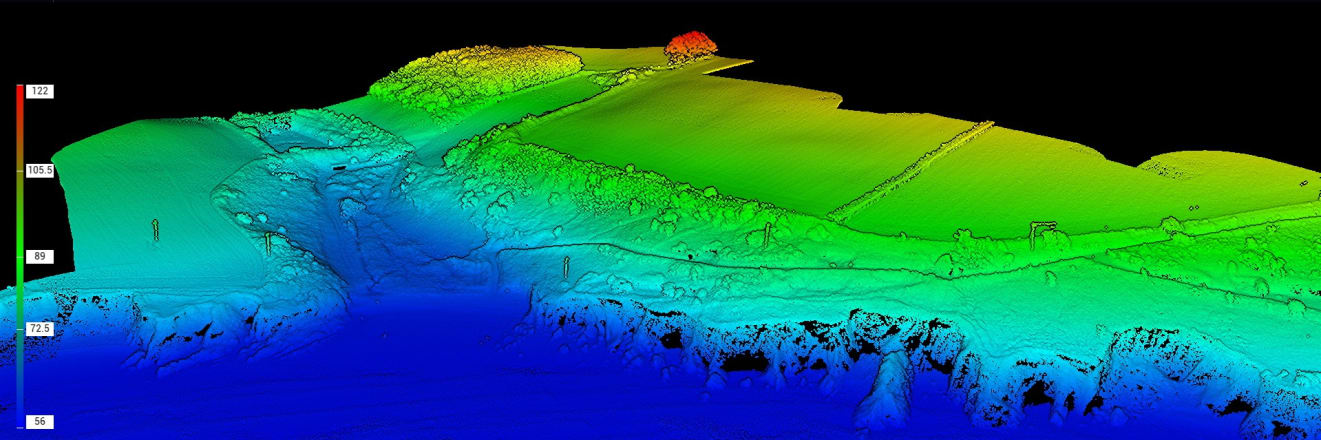
LiDAR is the only drone survey method that recovers the true ground surface beneath vegetation. For drainage design, earthworks calculations, flood modelling, solar farm siting, and forestry management, it gives you the bare-earth data that photogrammetry cannot reach — a survey of the land itself, not of the vegetation covering it.
What is LiDAR?
LiDAR — Light Detection and Ranging — uses laser pulses to measure distances and build a precise 3D point cloud of the surveyed area. Each pulse can return multiple measurements, which is how LiDAR recovers the bare-earth ground surface beneath vegetation.
How does LiDAR see through vegetation?
A LiDAR laser fires pulses that return up to five measurements each — from the top of the canopy, through the mid-canopy layers, and finally from the ground itself. That last return is the bare-earth point, which is how the survey recovers the true ground surface beneath hedgerows, crops, scrub, and woodland edges.
Do I need LiDAR or photogrammetry?
It depends on what covers your site. On hardscape — roads, buildings, gravel, ploughed fields — photogrammetry achieves around 2 cm accuracy and is often faster and more cost-effective. On vegetated land, only LiDAR recovers the ground beneath the canopy.
Read the guide to choosing the right drone survey







Pre-design topographic surveys for road schemes, drainage networks, flood defence works, and linear infrastructure corridors. On any site with hedgerows, scrub, or uncut verges, a photogrammetric DTM records the vegetation surface — not the ground. LiDAR gives you the bare-earth profile needed to design drainage gradients, calculate earthworks volumes, and tie corridor surveys to Ordnance Datum. As-built surveys of completed earthworks verify cut-and-fill against design intent. Coastal and riverbank profiles capture the true toe of the bank where photogrammetric models are systematically too high.
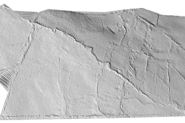
Field drainage design requires accurate bare-earth topography of the ground beneath the crop, the hedgerow, and the drainage ditch. LiDAR recovers that data on a single flight. Ditch profiles, field-margin slopes, and invert levels that a photogrammetric survey cannot reach through tall vegetation are all captured and classified in the point cloud. For land levelling assessments, soil movement calculations require the true ground surface — not the top of whatever is growing on it. LiDAR is also used for pre-drainage feasibility assessments across larger holdings where fall and catchment boundaries are not immediately obvious from a visual inspection.
The above DEM is given in miniature in order to fit it on this web page. But even in this small format, it is possible to pick out various features which would otherwise be obscured by vegetation. There is an obvious linear boundary in the form of a deep diagonal channel or embankment cutting across the landscape from upper left to bottom right. In several areas, particularly in the upper middle section, there are faint parallel linear striations. These are likely indications of historic ridge and furrow farming. The upper right quadrant is very uneven, marked by irregular pits and bumps, possibly indicative of past human extraction activity, such as shallow quarrying. In a field covered with thick vegetation, none of these features would be visible without LiDAR.
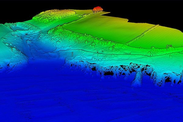
A single LiDAR sortie over a forested block returns both the canopy surface and the bare earth beneath it simultaneously. The canopy height model — the difference between the two — gives tree height, density, and volume estimates across the block without ground-truthing every stand. Bare-earth data provides the access road topography and drainage profile needed for harvesting and replanting planning. For coupe boundary surveys, LiDAR resolves the ground surface beneath dense edge vegetation where photogrammetry cannot penetrate. Change detection across repeat surveys tracks canopy growth and identifies areas of die-back or wind damage.
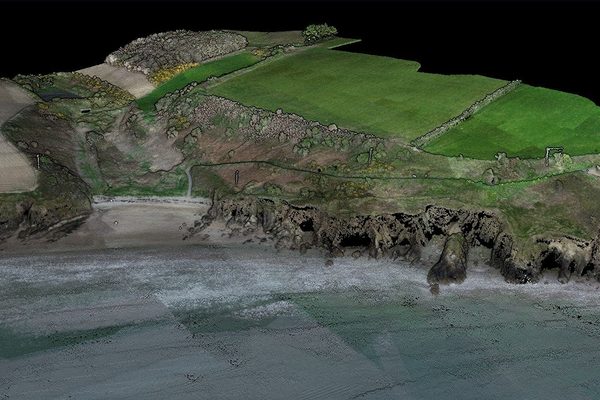
Pre-construction site assessments for solar farms and wind turbine foundations depend on knowing the true ground surface to model drainage, calculate cut-and-fill, and identify areas with problematic gradients. Where the site carries vegetation — rushes, gorse, scrub, or rough grazing — photogrammetry records the vegetation, not the ground, and the error accumulates across the site. LiDAR resolves this on a single flight. Drainage catchment analysis across large energy sites requires bare-earth data tied to the wider catchment — particularly where planning submissions require hydraulic modelling to demonstrate no increase in runoff.
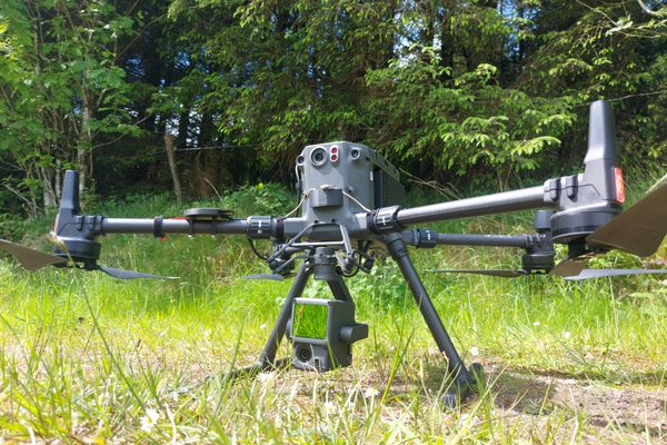
Five returns per laser pulse — our LiDAR sensor recovers ground elevation through hedgerows, tall crops, scrub, and woodland edges where photogrammetry records only canopy height.
A single LiDAR sortie delivers a classified point cloud (LAS/LAZ), digital terrain and surface models, and contour plans at your specified interval.
Our LiDAR sensor captures a 20 MP georeferenced colour orthomosaic on the same flight as the LiDAR scan — no second flight, two spatially consistent datasets.
Combined system accuracy (sensor + RTK + IMU) is 4 cm vertical at 150 m altitude. On hardscape with GCPs, photogrammetry achieves around 2 cm — we recommend the right method for your site.
The sensor's 75° vertical field of view captures the full face of a chimney, retaining wall, or pier from a single flight line at a safe standoff — no multiple passes at varying altitudes.
At 150 m altitude and 15 m/s, our LiDAR sensor covers 2.5 km² per battery — practical for corridor mapping, large farm surveys, and catchment-scale flood modelling.
Our LiDAR sensor requires no warm-up period — it is ready the moment the payload is powered on. No waiting in the field before the survey mission can begin.
When the laser hits a tree canopy over open ground, it doesn't return a single reading. It returns up to five: one from the top of the canopy, one or more from mid-canopy layers, and one from the ground. That last return is the bare-earth point — the actual ground surface beneath the vegetation. With a spot size of 4×12 cm at 100 m, our sensor recovers ground points through denser cover than older LiDAR systems allowed. For Irish field surveys with hedgerows, drainage ditches, and uneven scrub, this directly determines whether a usable DTM can be produced.
The sensor also pairs a 20 MP 4/3" RGB mapping camera on the same rigid mount — meaning a single flight delivers both the classified point cloud and a georeferenced colour orthomosaic, spatially consistent with each other and requiring no additional registration work.
The key question is what your site is covered with. On hardscape — roads, buildings, gravel, ploughed fields — photogrammetry achieves around 2 cm accuracy and is often the faster, more cost-effective option. On softscape — tall grass, crops, ferns, hedgerows, forestry — photogrammetry records the top of vegetation, not the ground beneath. Actual ground level may be 10–30 cm lower and is unknowable from the photogrammetric dataset, regardless of how many GCPs are used.
For any project requiring true bare-earth topography — drainage design, earthworks calculations, flood modelling, solar farm siting — LiDAR is the correct instrument. We will confirm the right method for your site before any survey is commissioned.
Read our guide: LiDAR or photogrammetry — which do you need?
Just call us, and we'll help you.
Every LiDAR survey produces a classified point cloud in LAS/LAZ format, a digital terrain model (DTM) of the bare-earth surface, a digital surface model (DSM) including above-ground features, contour plans at your specified interval, and a survey report with accuracy statement. Where the mission profile includes the LiDAR system's RGB camera, a georeferenced colour orthomosaic is also included. All data is tied to Irish Transverse Mercator (ITM) and Malin Head Ordnance Datum.
LiDAR survey costs depend on site area, accessibility, and required accuracy. We will confirm the right approach and provide a fixed-price quote before any work begins. Contact us to discuss your project.
How accurate is a LiDAR drone survey?
Combined system accuracy — sensor, RTK, and IMU — is 4 cm vertical at 150 m altitude. On hardscape with ground control points, photogrammetry achieves around 2 cm; we recommend the right method for your site.
More about drone survey accuracyWhat does a LiDAR survey deliver?
A classified point cloud in LAS/LAZ format, a digital terrain model of the bare-earth surface, a digital surface model including above-ground features, contour plans at your specified interval, and a survey report with accuracy statement. Where the mission includes the RGB camera, a georeferenced colour orthomosaic is also included.
How much does a LiDAR survey cost?
LiDAR survey costs depend on site area, accessibility, and required accuracy. We will confirm the right approach and provide a fixed-price quote before any work begins.
Contact us about your project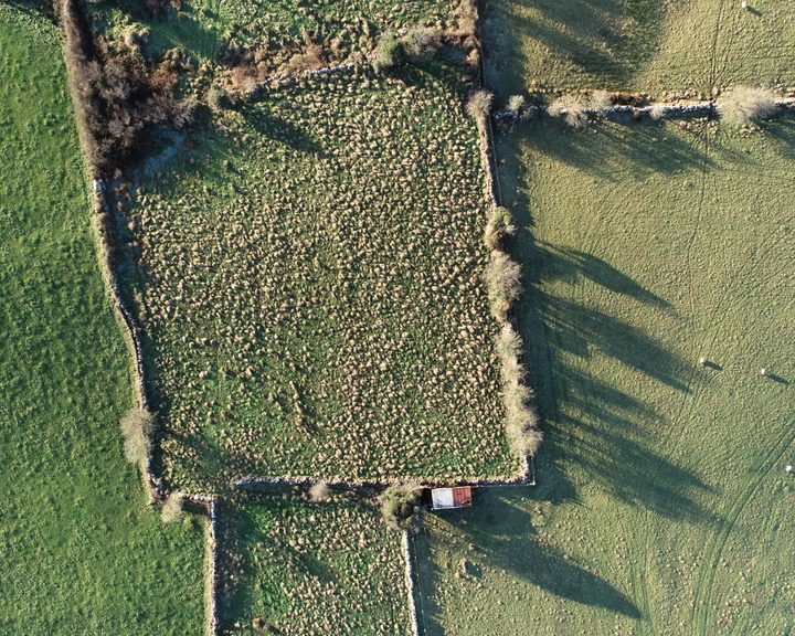
Engineers With Drones used drone-based LiDAR and multispectral sensors to map large areas of farm land across Ireland, providing detailed information about farms and their carbon sequestration potential.
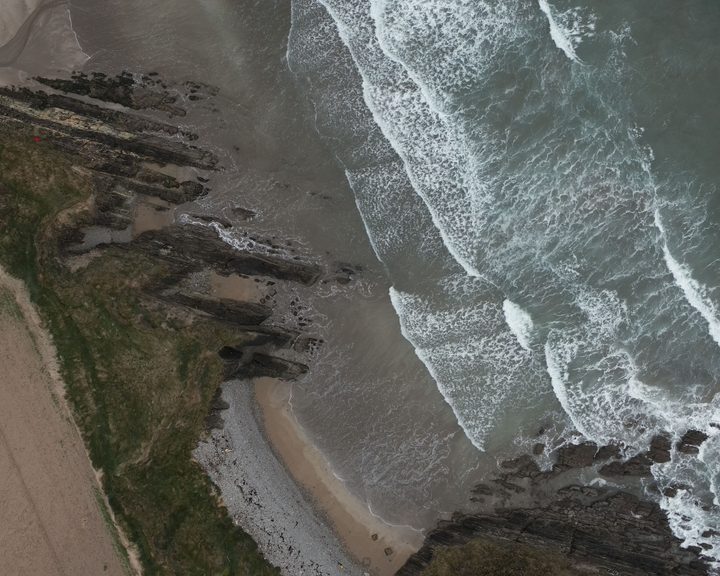
Engineers With Drones surveyed 17 coastal sites across Ireland using drone technology to assess their potential as landfall sites for offshore cables.
Complex surveys and inspections require more than just a pilot. Our engineers can help you scope your requirements and indentify the right approach.