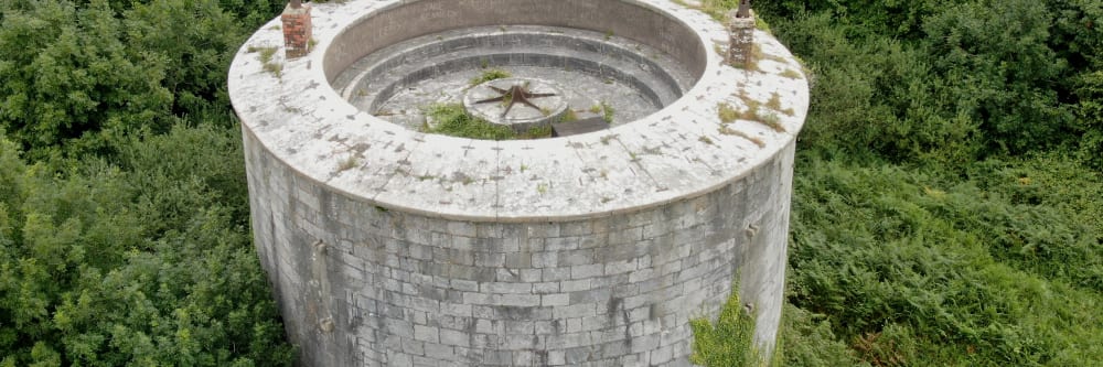
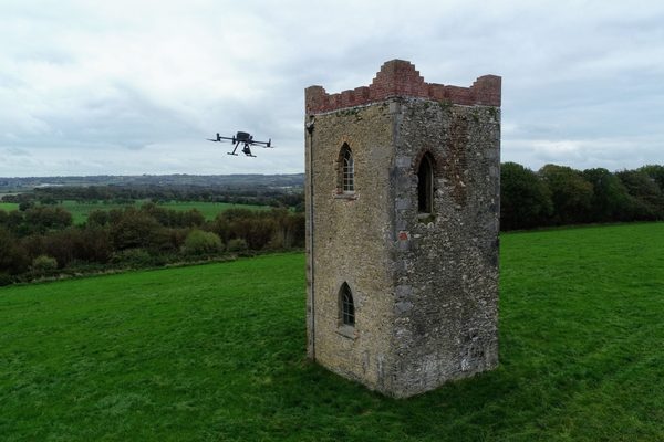
Historic buildings fail slowly — a cracked lintel, failing pointing, a slipped slate — and every intervention carries risk. Erecting scaffolding against a protected structure is costly, invasive, and can itself damage what it is meant to conserve. A drone surveys the whole building from a safe standoff distance, photographing stonework, roofs, and leadwork in detail without a single fixing driven into the masonry.
The result is a dated condition record the conservation team can work from — and, where needed, a measured 3D model of the structure for the conservation file.
What can a heritage survey detect?
Cracking and erosion in masonry, failing pointing and mortar joints, displaced or missing slates, failed flashings and leadwork, vegetation growth, and water ingress around openings.
See what a masonry condition survey coversDoes anyone need to touch the building?
No. The survey is flown from a safe standoff distance with no scaffolding, no abseiling, and no physical contact with the structure. This matters doubly on protected structures, where scaffolding fixings themselves can damage historic fabric.
More about our regulatory complianceCan a 3D model be made for the conservation record?
Yes. Photogrammetric surveys produce a measured 3D model of the structure — a permanent digital record for the conservation file that can be re-surveyed in future years to quantify change.
More about 3D conservation records





























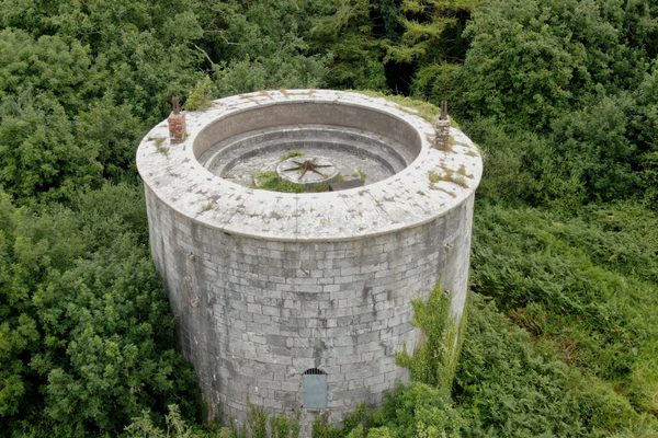
High-zoom photography covers the stonework in detail — towers, spires, steeples, and elevations — recording cracking, erosion, and failing pointing that are invisible from the ground. What the survey typically detects: cracked lintels and voussoirs, open or failed mortar joints, spalled stone, and vegetation rooting into masonry.
What about working at height regulations in Ireland?
The Safety, Health and Welfare at Work (Work at Height) Regulations 2006 (S.I. No. 318 of 2006) require that work at height be avoided where it is reasonably practicable to do so. A drone survey satisfies this at the first step of the hierarchy of control — the structure is surveyed from a safe standoff distance with no personnel working at height.
More about our regulatory compliance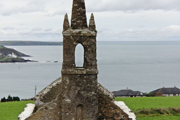
Roof defects are where water gets into a historic building — displaced or missing slates, failed flashings, and cracked leadwork around chimneys, parapets, and valleys. The survey photographs every roof slope and detail, so the conservation team can prioritise repairs before a small opening becomes a water ingress problem.
What roof issues does a drone survey find?
Missing or displaced slates, failed flashings and leadwork, cracked ridge and hip tiles, blocked gutters and outlets, and vegetation growth holding water against the roof surface.
More about drone roof inspections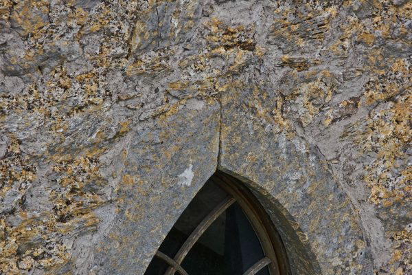
Every finding is compiled into a structured condition report: photographed, described, classified, and assigned a severity level. The report is written to be read by conservation professionals — architect, engineer, or funding body — and provides the dated evidence record required for maintenance planning and grant applications.
Photogrammetric modelling produces a measured 3D replica of the structure — a permanent digital record for the conservation file. Unlike photographs, which show what the structure looks like, a 3D model shows exactly where every surface is in space, so it can be rotated, zoomed, measured, and sectioned on screen. The model can be shared with conservation architects and funding bodies, and re-surveyed in future years to quantify exactly how the building is changing.
What is a photogrammetric record?
A photogrammetric record is a 3D model built from overlapping drone photography, geometrically corrected so it can be measured accurately — a digital twin of the building as it stands on the day of the survey.
More about 3D mappingCan the model be compared over time?
Yes. Re-surveying in future years produces a new model that can be compared directly against the baseline — quantifying crack movement, stone loss, and the effectiveness of past repairs.
Discuss a conservation recordWhat can a 3D model do that photographs cannot?
A photograph shows you a defect. A 3D model tells you exactly how big it is, where it sits in relation to other defects, and whether it has grown since the last survey. Crack lengths, spalling areas, and stone loss can be measured directly on the model — no need to estimate from imagery.
The model also becomes a repeatable baseline. Compare this year’s survey against the next and every change is quantifiable — new cracking, stone loss, structural movement. Conservation professionals who have never visited the site can inspect the structure virtually and take measurements without specialist software.
Discuss what a 3D model could reveal about your building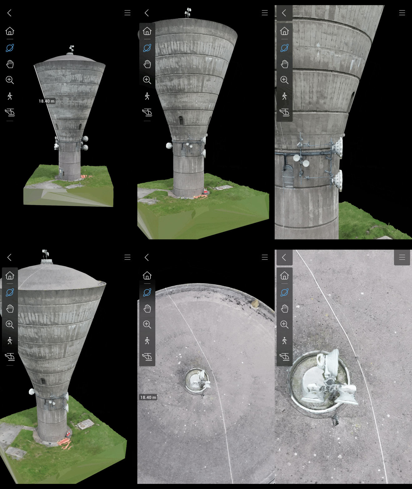
The survey is flown from a safe standoff distance — no fixings into historic fabric, no load on the structure, no personnel at height.
High-zoom cameras record cracks, failed pointing, and spalled stone that are invisible from the ground.
Every roof slope photographed in detail — missing slates, failed flashings, and cracked leadwork found before water gets in.
A measured photogrammetric model of the structure — a permanent digital record for the conservation file.
Every defect described, classified, and located — written for conservation architects, engineers, and funding bodies.
Future surveys compare directly against the original record, quantifying change over time.
Erecting scaffolding against a protected structure is invasive: fixings penetrate historic fabric, the structure must bear the load, and on protected structures the works themselves can require consent. A drone survey captures the same level of detail — stonework, roofs, leadwork — from a safe standoff distance, with no physical contact and no access equipment at all.
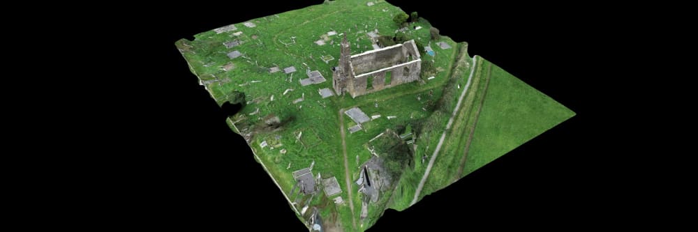
Conservation decisions need evidence — a dated condition record of the building as it stands now. Repeat surveys in future years quantify change directly: crack movement, stone loss, and the effectiveness of past repairs. The report is written for the professionals who act on it: conservation architects, engineers, and funding bodies.
Tell us what you need to know, and we will work with you to design actionable deliverables that give you the outcomes you need.
A typical heritage inspection delivers a high-detail photographic survey of masonry, roofs, and leadwork, with an annotated condition report that classifies every finding by severity.
Where a 3D record is required, a photogrammetric model of the structure can be produced and re-flown in future years, quantifying change against the original survey.
Stonework, roofs, and leadwork photographed from a safe standoff distance.
A measured digital model of the structure for the conservation file.
Every defect described, classified, and located for the conservation team.
Future surveys compare directly, quantifying change over time.
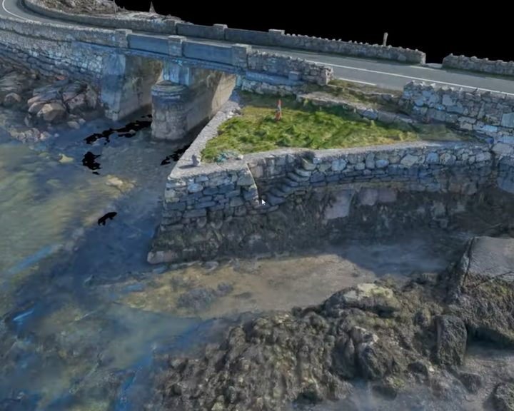
Engineers With Drones surveyed four historic stone causeways in west Galway using photogrammetry to create high-resolution 3D models and technical deliverables.
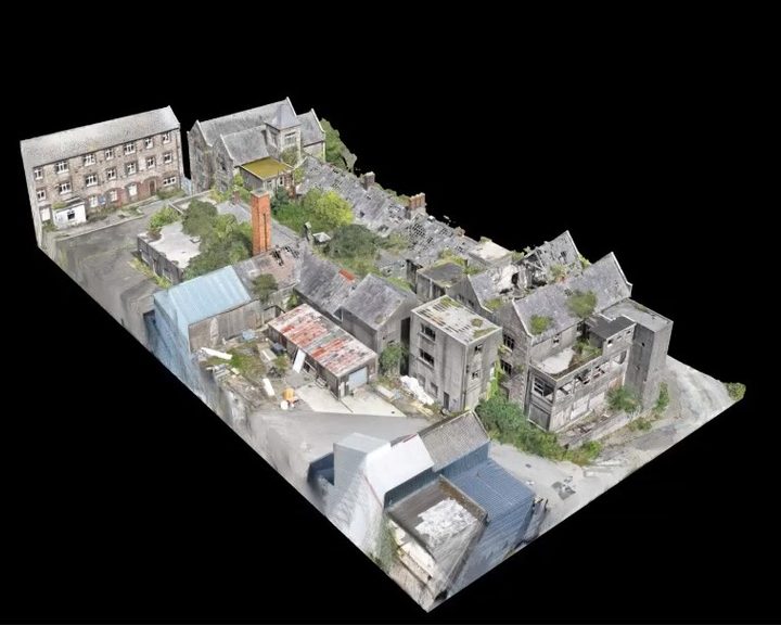
Engineers With Drones used external 3D scanning and internal confined space drones to survey a derelict hospital building for restoration feasibility, without placing any personnel at risk.
Complex surveys and inspections require more than just a pilot. Our engineers can help you scope your requirements and indentify the right approach.