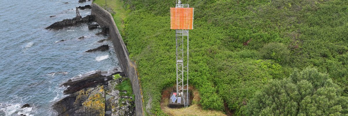
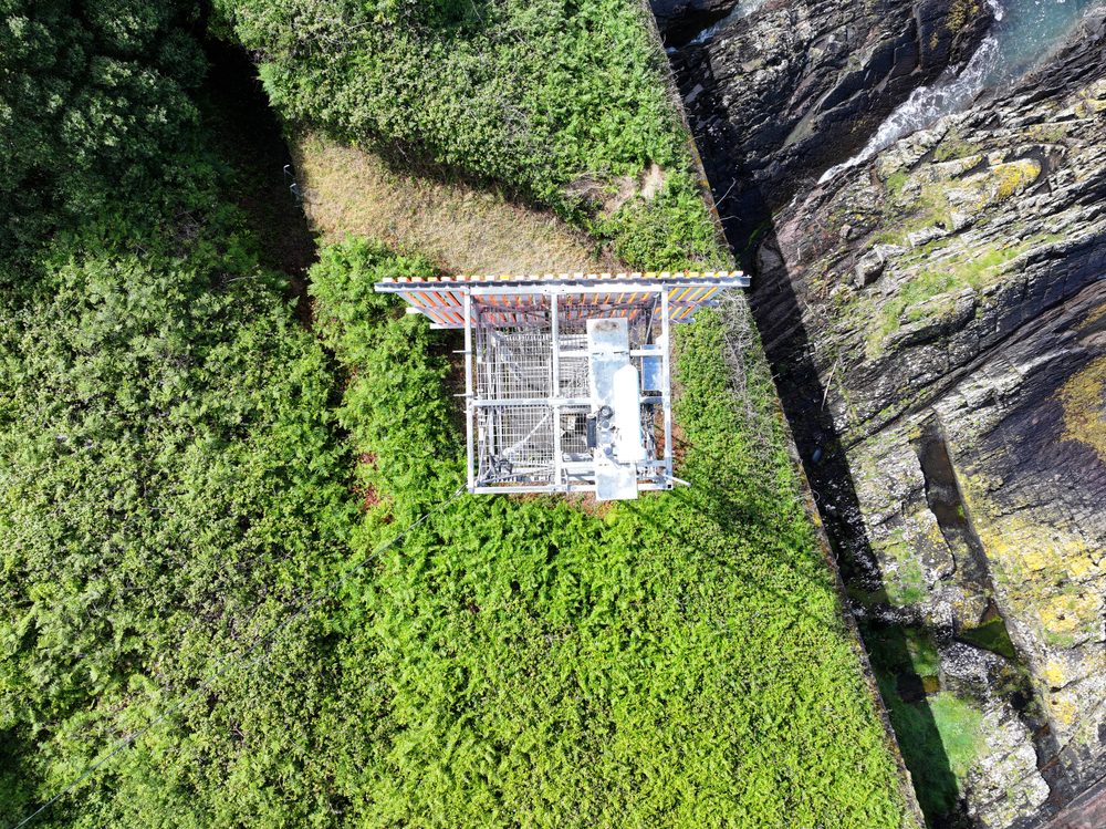
An aerial view of a tall galvanised steel navigation tower carrying an orange board, standing on steep ground above the water at the entrance to Cork Harbour

Ship navigation mast inspection

Cork Harbour Leading line towers at the harbour entrance surveyed from the air, with no need to work at height on steep, inaccessible ground.
Overview

The Job at a Glance

A drone condition survey of the ship navigation leading line towers at the entrance to Cork Harbour. The galvanised steel structure, the high-visibility boards, the lighting, the solar panels and the electrical wiring feeding them were all captured without anyone having to work at height on steep and inaccessible ground.

Location

The entrance to Cork Harbour, on the side of very steep and inaccessible land.

Method

M300 Enterprise drone, using its high-zoom lens to capture high-resolution imagery of every element.

Scope

Lattice structure, board fixtures, lighting, solar panels, electrical wiring and general safety infrastructure.

Deliverable

A full report on each tower, with every defect given a high-resolution image, severity, description and classification.

The context

Guidance infrastructure for ships entering the harbour

The port authority, who we have worked with on a number of previous projects, asked us to inspect their ship guidance infrastructure. These are the leading lines that guide ships safely into Cork Harbour.

The structures are large galvanised steel towers, very similar to a mobile phone mast, erected at the entrance to the harbour. They are positioned so that one is visible over the other, and each one carries a large orange board. Together they give an approaching ship a clear visual line to follow safely into the harbour.

This is important infrastructure, and it is not something you would want falling over in a storm.

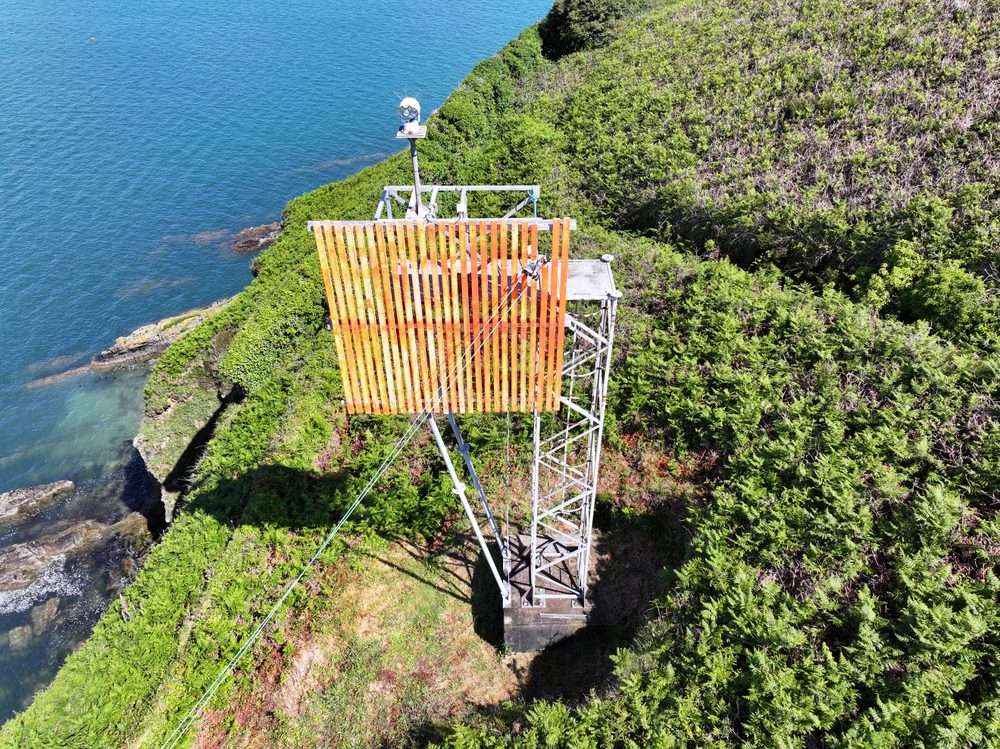
An aerial view of the large orange slatted board mounted on its steel framework on a grassy slope beside the water
The high-visibility board on its steel framework, on a grassy slope at the water's edge.
The structures

A daytime signal, lighting, and the electrics behind them

The large orange board is the daytime signal, the part that is visible to ships in daylight. Alongside it, the towers also carry lighting. Any lighting means electrics of some description, so there were two distinct aspects to look at: the structure itself, and the electrical and lighting infrastructure mounted on it.

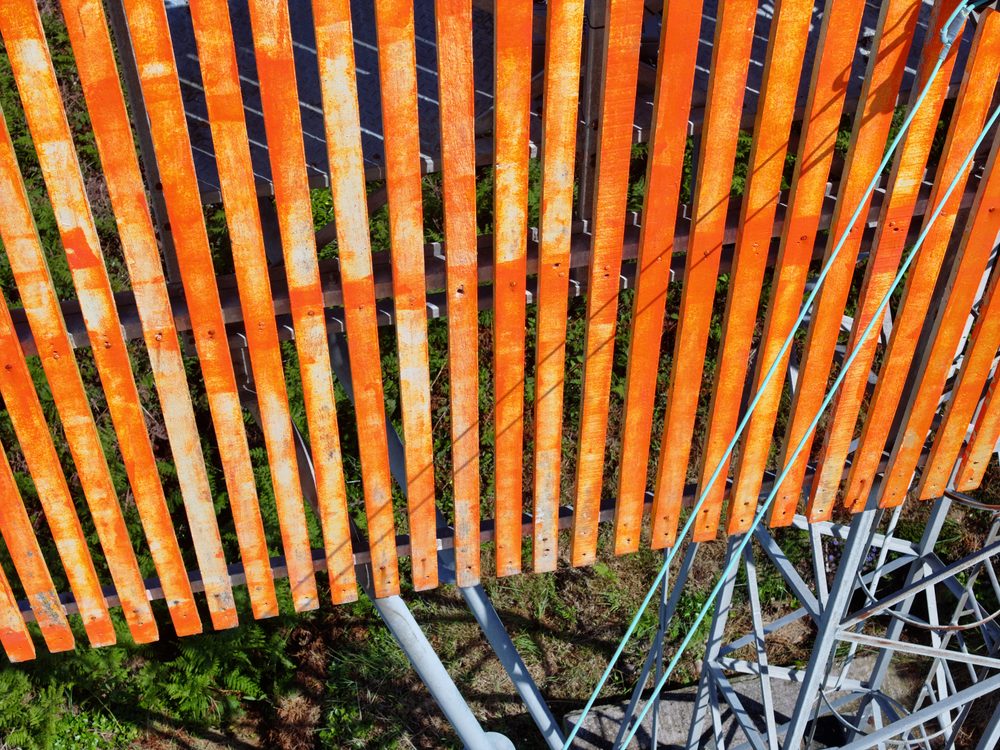
A close-up of the slatted orange board, showing the vertical orange panels fixed to the steel frame
The orange board up close: vertical slats fixed to a steel frame.
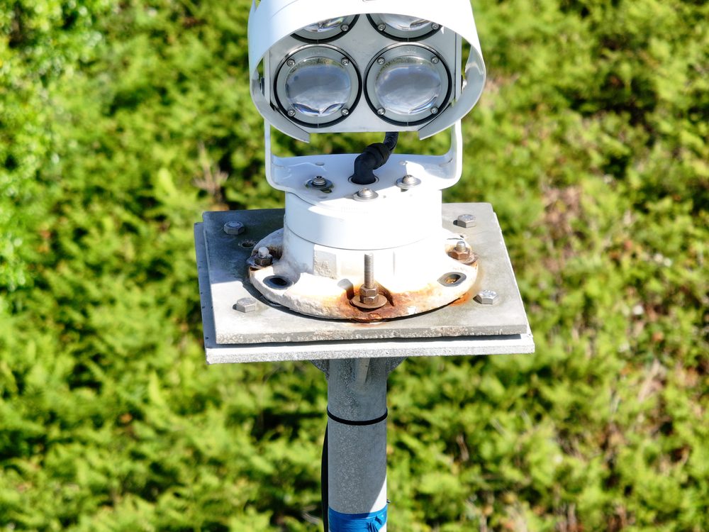
A white multi-lens lighting unit mounted on a grey metal pedestal, with green foliage in the background
One of the lighting units on the tower, part of the electrical infrastructure that had to be looked at.
The challenge

Steep ground, hard to reach, and a fall-from-height risk

The leading lines are on the side of very steep land. They are quite inaccessible and hard to reach, and they are tall as well. That combination meant any inspection carried out by people on the structure would involve a falling-from-height danger.

A high-angle aerial view looking straight down on the platform and top of the lattice tower, surrounded by dense vegetation
Looking straight down on the top of a tower. The surrounding ground is steep and densely overgrown, and difficult to reach on foot.
Methodology

Every element captured from the air

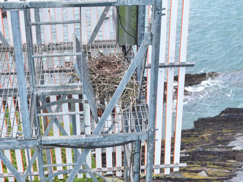
We came in with a drone and captured all of the data we would need. That covered the lattice work, the fixtures holding the large high-visibility boards, the lights, the electrical wires feeding power to them, the solar panels, and the general safety infrastructure.

High-resolution imagery of all of it was captured using the zoom lens of the M300 Enterprise. Once everything was captured, the data was verified in the field to confirm it was intact before being brought back to the office.

A close-up looking up through the grey steel lattice of the tower, showing the cross-bracing and a vertical cable
Looking up through the lattice. Every part of the steelwork was captured in the one survey.
A close-up of the steel lattice structure showing weathered metal grating and a white junction box mounted on the side
Weathered grating and a junction box on the structure, captured alongside the structural steelwork.
Findings

What the survey found

Back at the office we generated a full report on each of the towers, with every defect detailed using a high-resolution image, a severity, a description, and a defect type or classification.

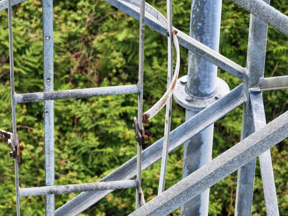
The paint had faded a little, and there was some corrosion on some aspects, but nothing serious. The one item worth flagging was a strip of bar missing on one of the access ladders, which could be a hazard for falling.

The PDF reports were presented to the port authority, who used them to generate a bill of works for fixing the issues that were found.

Deliverables

What the port authority received

Full report on each tower

A separate report for each tower that was inspected.

Image for every defect

Each defect is set out with its own high-resolution image.

Severity, description and classification

Defects were given a severity, a description, and a defect type or classification, so the record could be worked through in order.

Reports ready for a bill of works

PDF reports the port authority could use directly to generate a bill of works for fixing the issues found.

Comparative methodology

Why they chose us

The leading lines stand on the side of very steep land at the entrance to Cork Harbour. Reaching them on foot is difficult, and reaching them to inspect at height is exactly the risk the drone survey was brought in to remove.

Access
Flown to the structure vs walking in and climbing

The towers sit on steep, inaccessible ground, so the survey was flown rather than worked at height.

Height risk
No one at height vs working on the tower

The towers are tall as well as hard to reach, so keeping people off the structure removed the falling-from-height danger.

Coverage
Structure and electrics vs reaching each in person

One survey captured the lattice steel, the boards, the lights, the wiring, the solar panels and the safety infrastructure together.

Efficient option Our method

Using a drone

A single drone survey of the towers at the entrance to Cork Harbour, flown with high-resolution imagery rather than worked at height.

  • Structure and electrics in one survey The lattice work, board fixtures, lights, electrical wires, solar panels and safety infrastructure were all captured in the one visit.
  • No working at height The towers are on steep, inaccessible ground and are tall, so the drone removed the need to put anyone at that height.
  • High-resolution imagery The M300 Enterprise and its zoom lens captured the detail needed to identify and classify defects.
  • A complete defect record A full report on each tower, with every defect given a high-resolution image, a severity, a description and a classification.
  • Findings ready to act on The PDF reports were presented to the port authority, who used them to generate a bill of works for fixing the issues found.
Project status Survey complete and reports delivered
Manned approach Traditional method

Without a drone

What an inspection by people on the structure would have involved at this site.

  • Access to the site The leading lines are on the side of very steep land, quite inaccessible and hard to reach on foot.
  • Working at height The towers are tall, so an inspection carried out by people would mean someone up on the structure.
  • Falling-from-height danger Steep ground and height together create a genuine fall hazard for anyone working on the tower.
  • Covering every element Getting the same close-up record of the lattice, boards, lights, wiring and solar panels would mean reaching each one in person.
Alternative Steep access and work at height
Let's talk

Speak to an engineer about your project

Complex surveys and inspections require more than just a pilot. Our engineers can help you scope your requirements and indentify the right approach.

Talk to an engineer

+353 (0)21 202 8281

Quickest for technical scoping

Email your brief

info@engineerswithdrones.ie

Best for sending detailed specs

Next steps

Where to find out more

You can find out more about our tower inspection services and our coastal and marine structure inspection services. For the lattice structures that sit behind this work, see our telecoms tower inspection services. For another Cork Harbour project, read our radio mast inspection case study. Alternatively, you can contact us here to ask what we can do for you.

Last updated: