A drone's-eye view of a housing estate roof showing defective flashing areas

Roof inspection of 70 housing units

Identifying defective flashing across an entire estate in a single day.
Overview

The Job at a Glance

A facility management company needed to assess defective flashing work replicated across all units of a newly built housing estate. Using a sub-250g C0 drone, Engineers With Drones inspected every unit in a single day, producing a per-unit report that identified affected properties, assigned severity levels, and served as a complete rectification work list.

~70 units inspected

All units in the estate shared the same roof design, meaning the contractor's defective flashing work was replicated identically across the entire development.

One day on site

The entire inspection campaign - from arrival to data capture - was completed in a single day, minimising disruption to residents.

Sub-250g C0 drone

A lightweight, ultra-quiet drone was chosen specifically for safe operation in a residential area, flying close to people and property without risk.

Per-unit report

Each unit was documented individually with imagery and a severity rating, producing a prioritised picking list for rectification work.

Background

A contractor's mistake repeated across an entire estate

Our client, a facility management company, was facing a significant problem. A contractor had carried out flashing work across a newly built housing estate, but the work was defective - and the error had been replicated across every unit. The buildings were all the exact same design, so the same poor workmanship appeared identically across all ~70 homes.

Some of the defects were at ground level and easy to spot. Others were on the roof pitch, completely out of sight from the ground. The client needed a clear, definitive picture of exactly what they were dealing with: which units were affected, how severe each defect was, and where the rectification team should start.

An overview of the housing estate roofs showing the scale of the inspection campaign
A housing estate unit, all shared the same roof design and needed any defective flashing identified, located and categorised according to severity.
The Challenge

70 identical units, one replicated defect

The scale of the problem was simple but daunting. With roughly 70 units all sharing the same roof design, the defective flashing was repeated dozens of times. The client's immediate need was to identify every affected unit and understand the severity of each defect - but the roof-pitch defects could not be assessed from ground level.

The client also needed a practical, actionable output. A report that simply listed issues would not be enough. They needed something their rectification team could take straight into the field: a document that told them, unit by unit, what needed to be fixed.

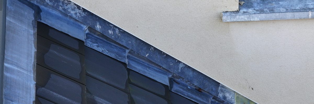
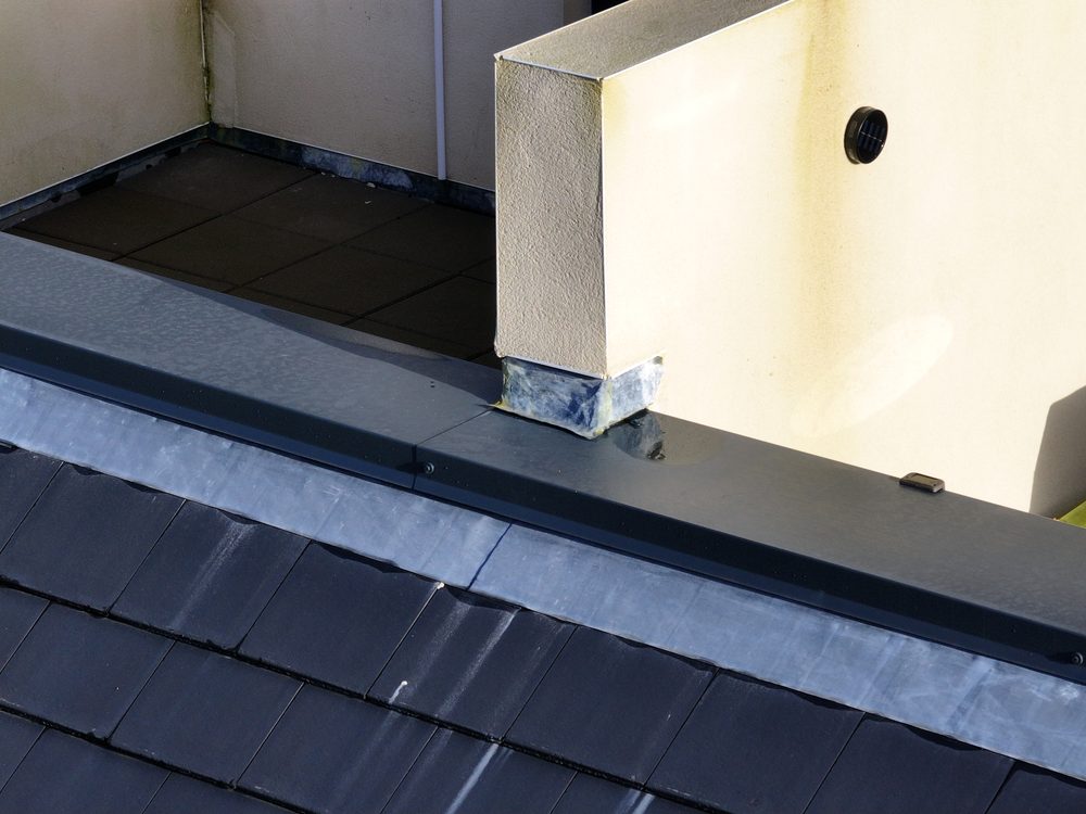
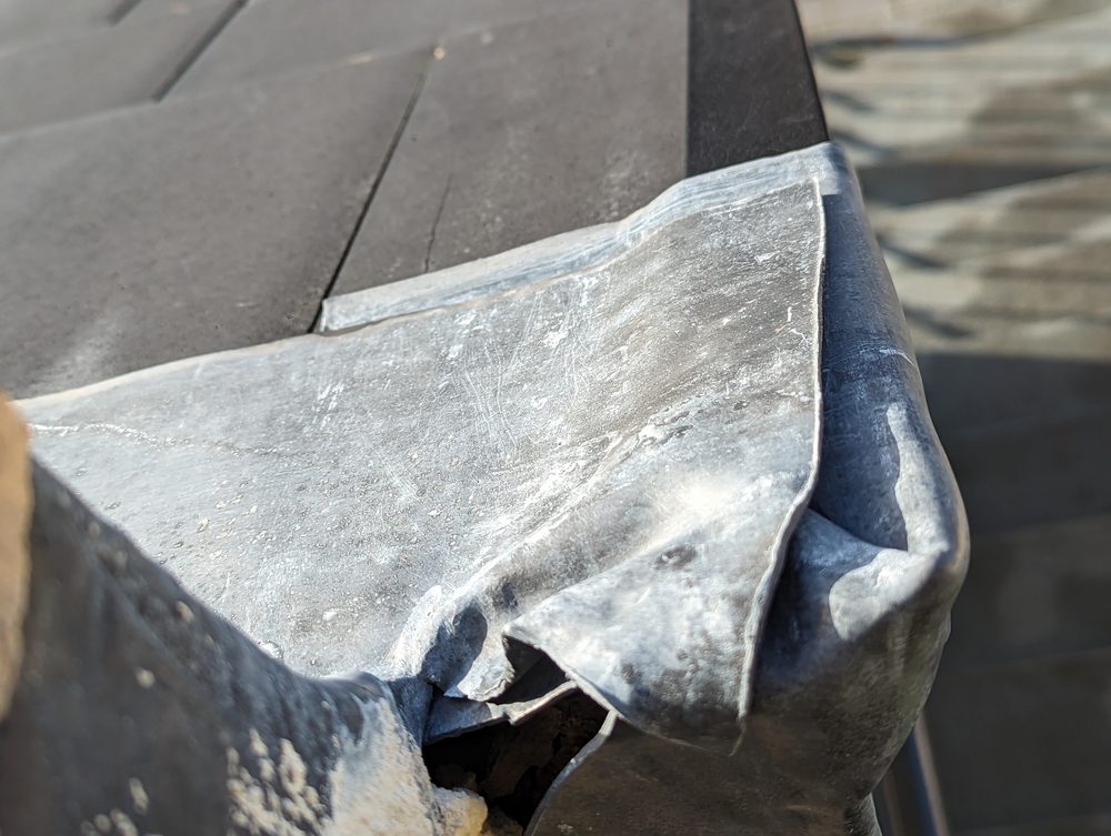
A close-up view of defective flashing on a roof edge showing poor workmanship
The defective flashing as it appeared on many of the units. The issue was replicated identically across the entire estate.
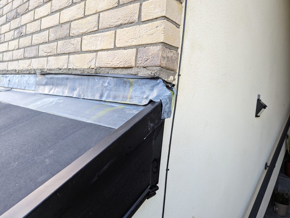
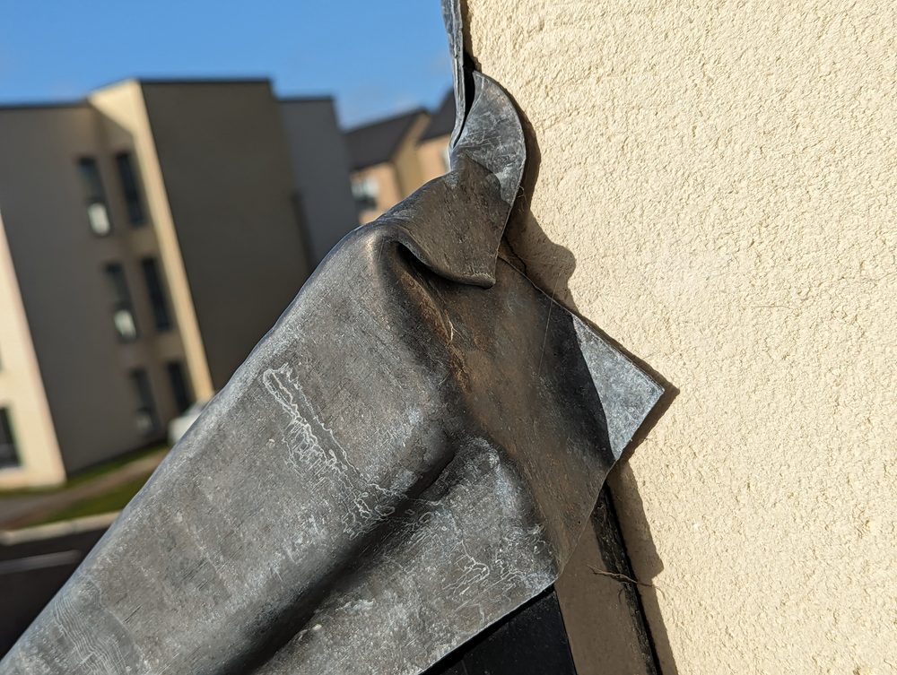
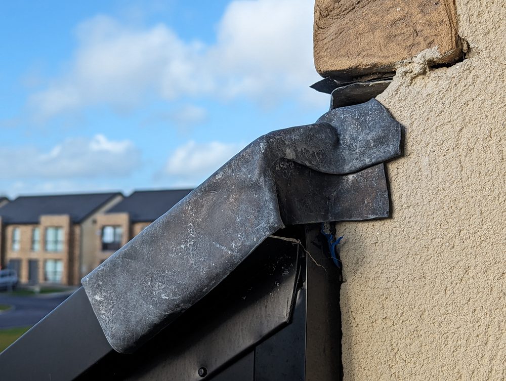
A further example of defective flashing on a housing unit roof showing the defect area
Another example of the flashing defect. Some defects were at ground level and easy to spot; others were on the roof pitch and required the drone to see.
Methodology

A sub-250g drone purpose-built for residential work

To operate safely in a residential area - close to people, parked cars, and private property - we chose a sub-250g C0-class drone. This ultra-lightweight category of drone is designed to fly over people without putting them in danger. If it fell on someone, it would not cause injury. It was also exceptionally quiet: at the height we were flying, it was impossible to hear from the ground, keeping a very low profile throughout the day.

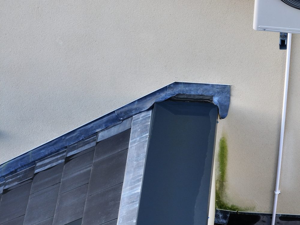
Defective flashing inspection still image taken from the sub-250g C0-class drone showing the roof area.

Before the campaign, the management company that runs the estate communicated with all residents. Everyone in the area was informed that the inspection was happening, why, and who would be carrying it out. This meant no surprises for anyone looking out their window.

On site, we began by capturing overview imagery of the area to orient ourselves back in the office. Then we moved into a systematic campaign: we would find the first one or two defects, refine the exact angle and distance needed to capture them clearly, and then replicate that capture position across the entire estate. Every unit was photographed at the same distance and angle, showing only the defect area - a piece of slate and a piece of gutter, nothing more.

A critical part of the workflow was orientation. When you are taking the same image dozens of times, you need a reliable system for knowing exactly where you are. We used extensive orientation imagery alongside the defect captures to ensure every image could be matched to its correct unit without any ambiguity.

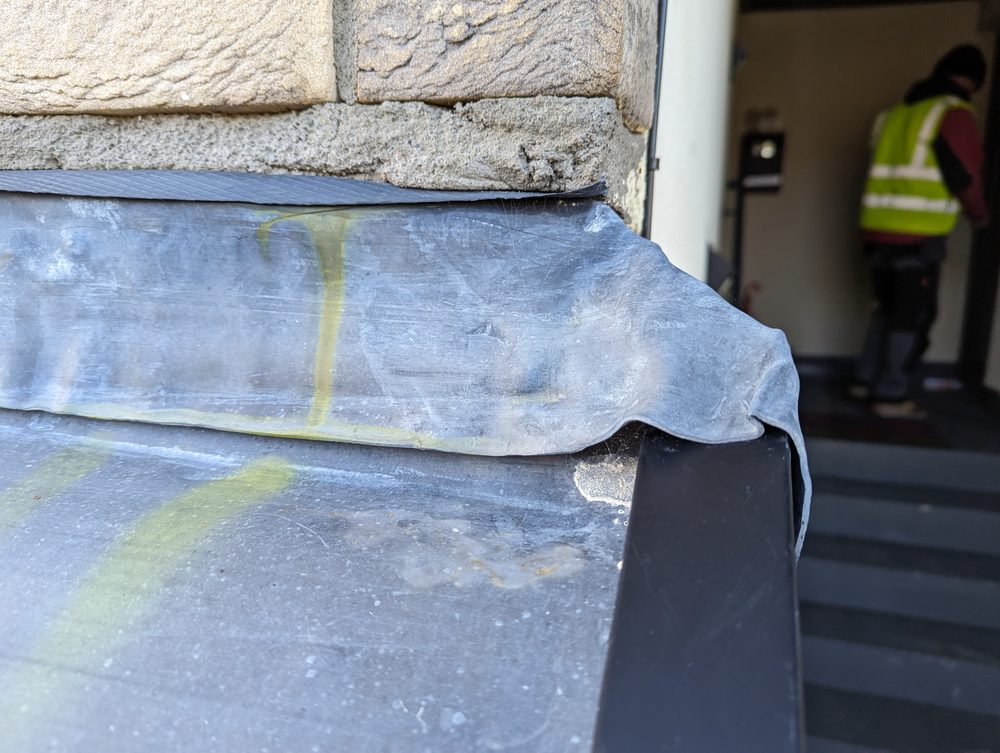
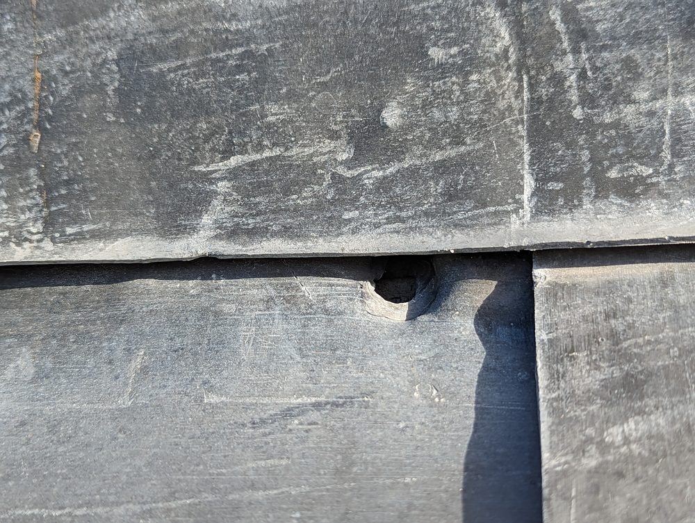
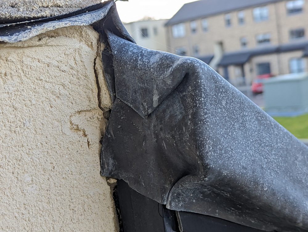
A tightly cropped image of the defect area showing only the roof flashing
Every image was framed tightly on the defect itself - concentrating on the roof flashing, nothing more. This formed part of the process to eliminate the risk of capturing personal data.
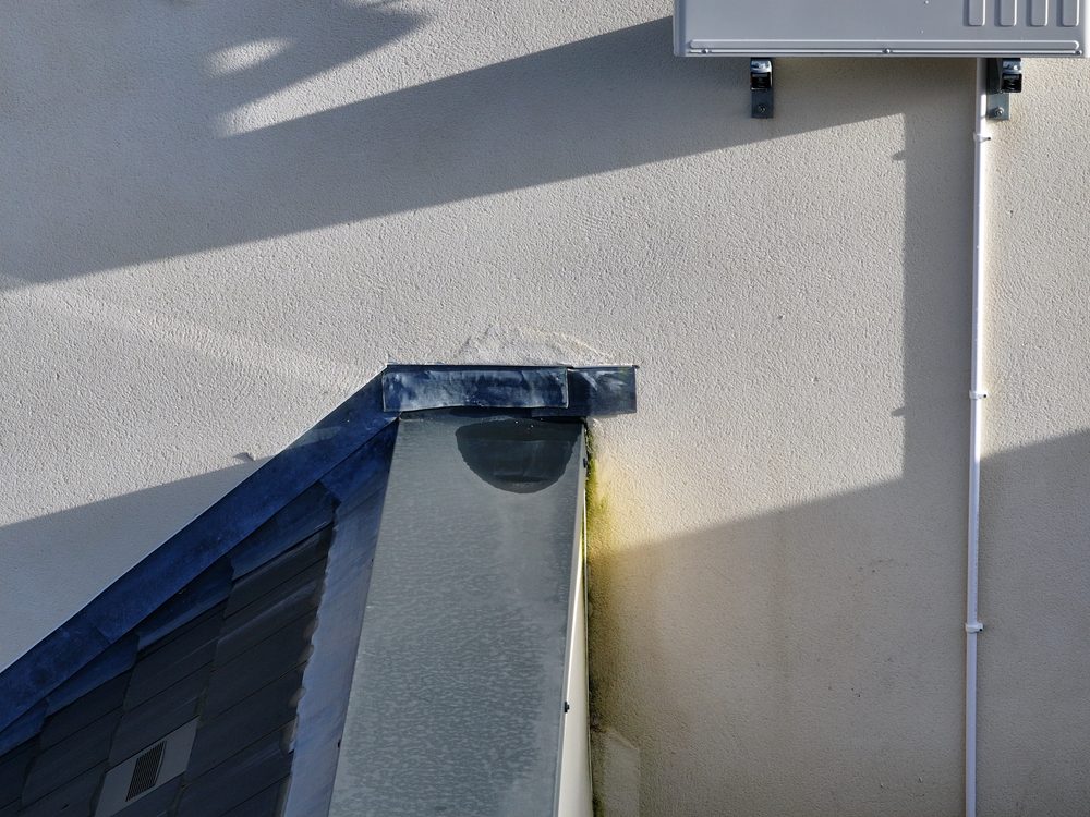
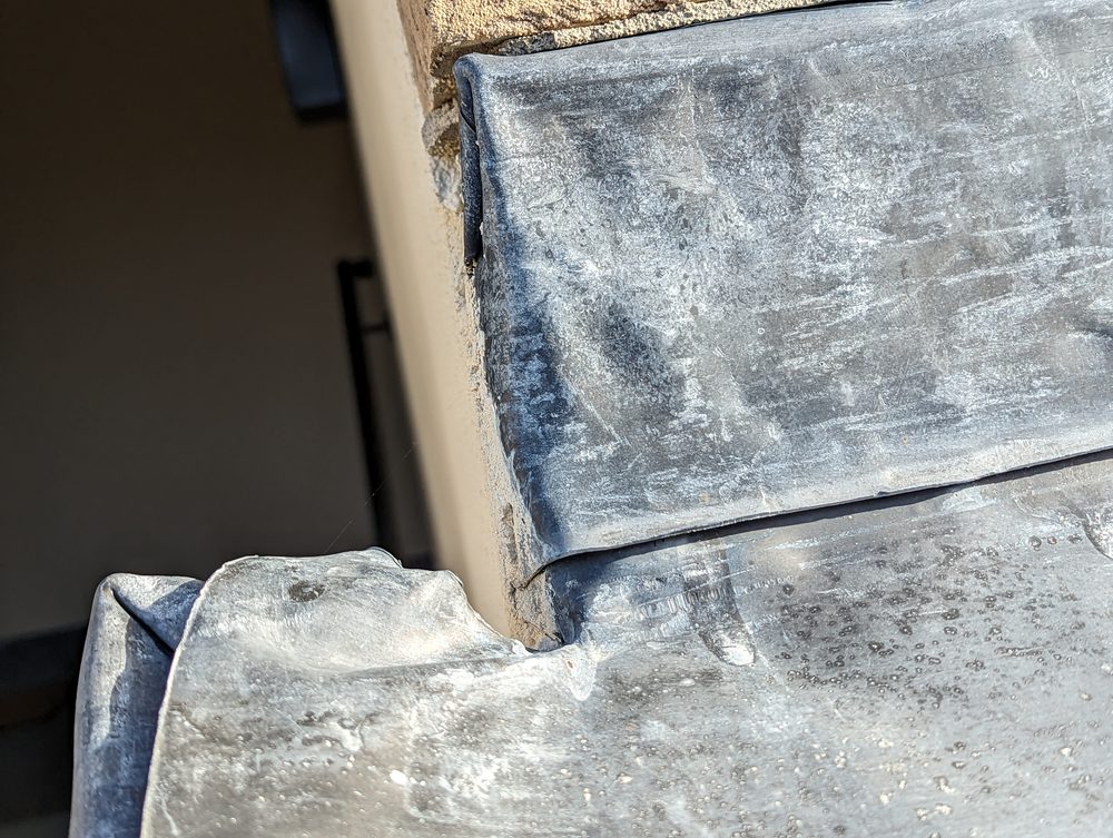
Another tightly cropped image showing the consistent capture angle used across all units
Once the ideal capture angle was established on the first few units, the same position and framing was replicated consistently across the entire estate.
Privacy & Compliance

A GDPR-first approach to residential drone inspection

Operating a drone in a residential area means privacy is paramount. We designed our capture workflow specifically to eliminate any risk of capturing personal data. Every image was tightly framed on the defect itself - so tightly that the only things visible in any given photo were a section of slate and a piece of gutter. No cars, no people, no windows, no details of private property beyond the defect being inspected.

After capture, all imagery was reviewed in the field. Anything that should not have been there was deleted immediately. The result was a dataset that contained no personal data whatsoever - only the defects the client needed to assess.

A defect image showing only the roof flashing area with no personal data visible
The capture workflow was designed from the ground up to avoid capturing any personal data. Every image was reviewed in the field and any unwanted content was deleted immediately.
Assessment & Output

Severity ratings that prioritised the rectification work

Every defect was assessed against a standard five-point severity scale used across the industry. At the low end, severity zero means there is no problem but something worth noting - for example, a mark on a wall that looks like a crack from a distance but is actually harmless. At the top end, severity five means a danger to human life - a loose slate over a front door, for instance. Severity four is a serious structural issue such as a large hole in the roof.

Each affected unit received an image, a defect category, a written description for context, and a severity level. Units where the defect was not present were marked as good. The result was a large report that listed every single unit in the estate, with the imagery and assessment alongside each entry.

For the client, this report was more than a record of findings. It became a complete rectification picking list. Their team could take it into the field and work through it unit by unit: fix the defects on the units flagged as affected, verify the work, and know with certainty when every issue had been resolved.

A defect on a roof edge showing the flashing issue
Each defect was assessed against a five-point severity scale, with an image, defect category, written description, and severity level for every unit.
Another example of the defective flashing captured at the same consistent angle
Every affected unit received the same consistent documentation, allowing the client to compare defects across the estate and prioritise rectification work.
A further example of defective flashing documented during the inspection
The final report listed every unit in the estate with its associated imagery, giving the client's rectification team a complete picking list to work through.
A close-up showing the flashing defect in detail
With every defect documented and severity-rated, the client could confirm with certainty when all issues had been fully resolved.
Deliverables

What the client received

Comprehensive per-unit report

A full report listing every unit in the estate, with images showing the defect or confirming the unit was unaffected.

Severity-rated defect list

Each defect assessed against a standard five-point severity scale, with a category and written description for context.

Rectification work list

The report was structured as an actionable work list, allowing the client's team to progress through affected units in a clear order of priority.

Completion verification

Once all flagged defects were rectified, the client could confirm with certainty that the estate-wide issue was fully resolved.

Comparative methodology

Why they chose us

The client needed to know exactly which units were affected by defective flashing and how severe each defect was - but some of the defects were on the roof pitch, out of sight from ground level. A drone was the only way to inspect every unit safely, efficiently, and without disruption.

Units inspected
~70 in one day vs multiple days on foot

A single-day aerial campaign covered every unit in the estate, regardless of ground-level accessibility.

Access method
C0 drone over residential area vs ladders and scaffolding

The sub-250g drone could fly safely over people and was quiet enough that it was inaudible from the ground.

Deliverable
Per-unit report with imagery vs no systematic photo record

Every unit was documented individually, producing a report that doubled as a rectification work list.

Efficient option Our method

Using a drone

A lightweight, ultra-quiet sub-250g C0 drone allowed our team to inspect all ~70 units safely in a residential area - no ladders, no scaffolding, and no disruption to residents.

  • All units inspected in one day The entire estate was captured systematically in a single day of field work, regardless of ground-level access constraints.
  • Safe over people in a residential area The C0-class sub-250g drone was certified to fly safely over people and property without putting anyone at risk.
  • Inaudible from ground level The drone was so quiet and small that it could not be heard from the ground, keeping a very low profile throughout the campaign.
  • Systematic per-unit orientation Orientation imagery captured alongside each defect ensured every image could be matched to its exact unit, eliminating any confusion.
  • Report doubled as a picking list The final report listed every unit with imagery and severity, giving the client a ready-made work list for rectification.
Project status Completed and delivered
Manned approach Traditional method

Without a drone

Inspecting roof-level flashing across ~70 units without a drone would have required ladders, scaffolding, or elevated access equipment for every roof pitch - a slower and more disruptive process.

  • Defects on the roof pitch invisible from ground Some defects were on the roof pitch and could not be seen from ground level. A foot-based survey would miss these entirely without elevated access.
  • Ladders or scaffolding per unit Accessing roof-level flashing on ~70 units would require repeated setup of ladders, scaffolding, or mobile elevating work platforms - adding significant time and cost.
  • Greater disruption to residents Working at height across a residential estate with scaffolding towers and equipment would be far more intrusive and noticeable to residents.
  • No systematic per-unit photo record Without a consistent aerial capture method, producing a report with a standardised image of every unit's defect would be impractical.
Operational impact Slower, costlier, more disruptive
Let's talk

Speak to an engineer about your project

Complex surveys and inspections require more than just a pilot. Our engineers can help you scope your requirements and indentify the right approach.

Talk to an engineer

+353 (0)21 202 8281

Quickest for technical scoping

Email your brief

info@engineerswithdrones.ie

Best for sending detailed specs

Next steps

Where to find out more

If you are managing a housing development, commercial property portfolio, or any multi-unit site that needs a condition survey, drone inspection offers a faster, safer, and more thorough alternative to traditional methods.

Last updated: