The man-made head race canal at Ardnacrusha, which carries water from up-river in the Shannon to the dam

Culvert inspection in Ardnacrusha

Two culverts beneath the Ardnacrusha head race canal and Parteen Weir, captured end to end by an ELIOS 3 confined space drone.
Overview

The Job at a Glance

A confined space drone inspection of two culverts at Ardnacrusha. Using the ELIOS 3, the team flew the full length of each culvert and back, capturing the side walls, roofs, and interior detail in high-resolution video alongside a survey-grade point cloud. One culvert ran beneath the head race canal and held only a couple of inches of water; the second was built into Parteen Weir itself and had to be continually drained while the work was carried out.

Ardnacrusha, County Clare

Two culverts — one beneath the head race canal and one built into Parteen Weir under the River Shannon.

ELIOS 3 confined space drone

A premier confined space inspection and surveying drone, with high-powered LED lighting for dark interiors.

Very different water conditions

The first culvert held only about two inches of water in mid-summer; the second was continually drained with pumps running full time.

Point cloud and video record

A high-resolution survey-grade point cloud and a high-resolution video data set of both culverts.

Background

A head race canal built over two rivers

At Ardnacrusha there is a large man-made canal, built around a hundred years ago to transport water from up-river in the Shannon down to the dam itself. When it was built, this canal was one of the major engineering wonders of the world, one of the most impressive projects on the planet at the time.

Because the canal crossed the path of two pre-existing rivers, the builders had to carry those rivers beneath the canal so their water would not mix with the canal water. To do this they built culverts over the rivers but under the canal, water on top and water underneath. The rivers themselves were relatively small: maybe two metres across at that point, and perhaps a foot high to two feet deep at the most.

The man-made head race canal at Ardnacrusha, which carries water from up-river in the Shannon to the dam
The head race canal at Ardnacrusha — a man-made waterway built around a hundred years ago to carry water from up-river in the Shannon to the dam.
The challenge

Two culverts, two very different sets of conditions

The client wanted to capture the interior state of these culverts, and the two structures could hardly have been more different to work in.

The first culvert was straightforward. It held water, but only about two inches deep, quite shallow in the middle of summer, and no problem at all. The culvert itself was roughly 75 to 100 metres long, and there was plenty of room to walk inside it, with ample space for a drone to fly all the way down and all the way back to capture the entire culvert in detail.

The second culvert was more challenging. It was built into Parteen Weir itself, so on top of the weir the River Shannon flowed over, while beneath the weir a built-in culvert carried a pre-existing river, what is called the Old Shannon River in that area, into the Shannon. To inspect it, the culvert had to be continually drained, with pumps running full time, and the work involved working at height and confined space access requirements. Like the first, it was also a dark, enclosed interior space.

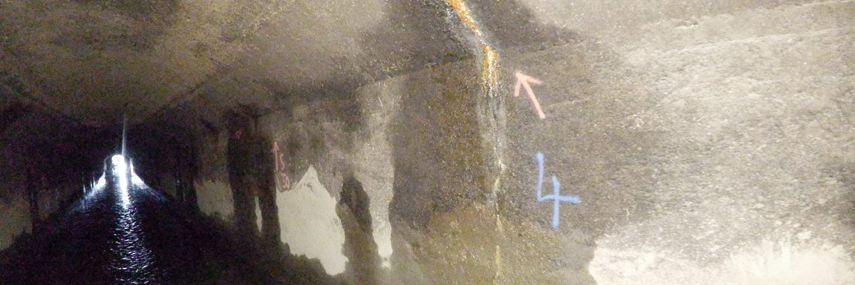
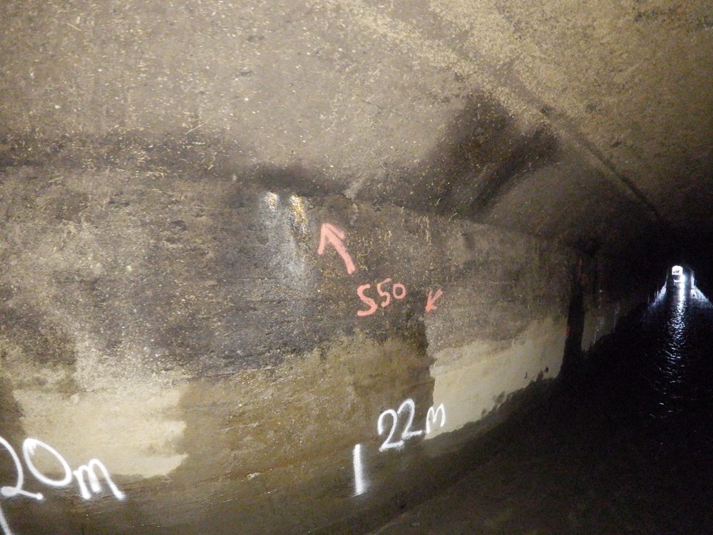
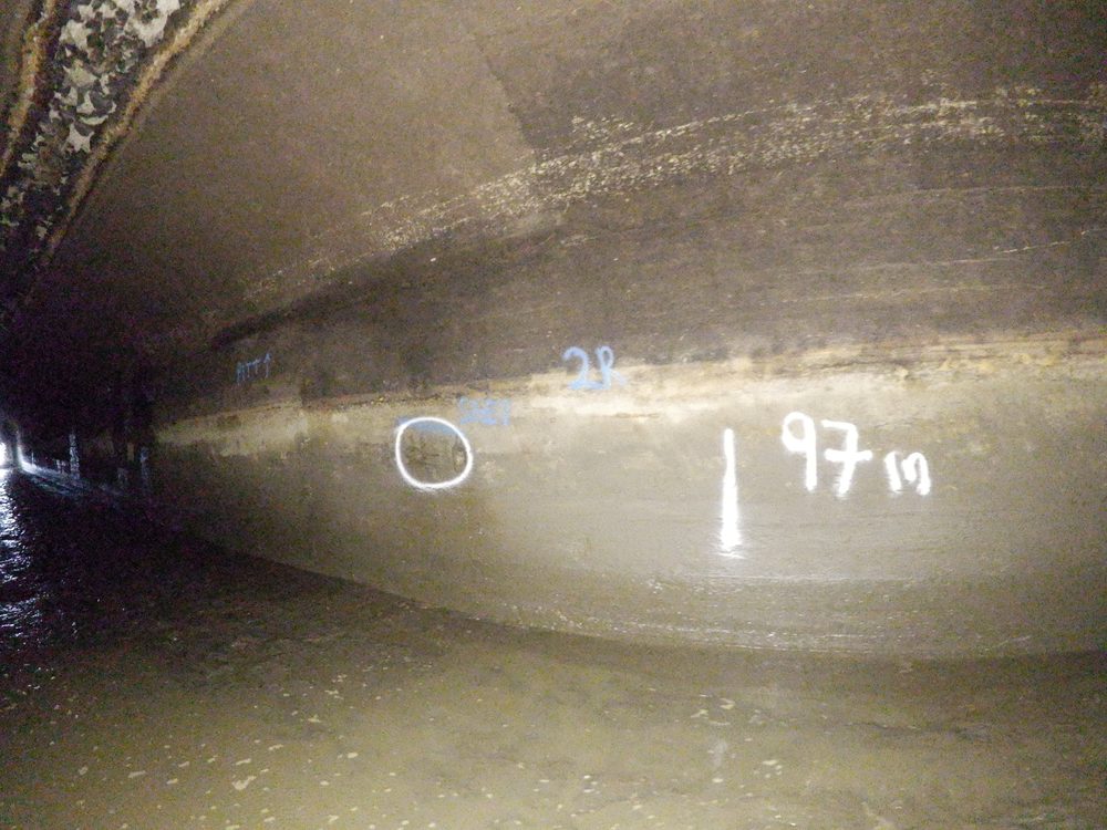
Interior view of the historic Ardnacrusha head race canal showing water flow and painted inspection markings on weathered concrete walls
Interior view of the historic Ardnacrusha head race canal, showing water flow and painted inspection markings on weathered concrete walls.
Methodology

Flying the ELIOS 3 the full length of each culvert

The team used the ELIOS 3, which Bob Foley, founder of Engineers With Drones, describes as "probably the premier confined space inspection and surveying drone on the planet". The drone was flown down through each culvert and back again, capturing all the detail of the side walls, the roofs, and the interior, while a high-resolution survey-grade point cloud was captured alongside it.

Because these culverts are quite dark, the confined space inspection drone’s high-powered LED onboard lighting system was able to light up the walls and roofs as it flew along, bringing out high-resolution detail of any defects. Working to the site engineer’s requirements, the team captured any and all details that were asked for during the projects.

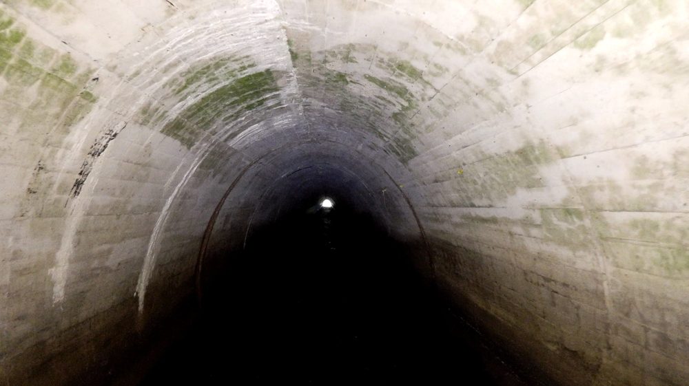
The ELIOS 3 confined space drone operating inside a culvert with its LED lighting illuminating the walls
Interior view of an arched concrete culvert at Ardnacrusha, showing algae growth and mineral staining.
Deliverables

A point cloud and video record of both culverts

The deliverables were a high-resolution point cloud of both culverts and a high-resolution video data set of both, a record the client found extremely useful for all future work.

High-resolution survey-grade point cloud

A measurable point cloud of both culverts, captured alongside the video as the drone flew the full length of each structure.

High-resolution video data set

End-to-end video of both culverts, with the LED-lit interior recorded in high-resolution detail for the client’s future work.

Video footage

Footage from the culvert inspections

High-resolution video footage captured by the ELIOS 3 as it flew the full length of each culvert, showing the side walls, roofs, and interior detail of both structures.

ELIOS 3 confined space drone footage from the culvert inspections at Ardnacrusha.
Comparative methodology

Why a drone made sense here

This was not a job where a drone was strictly required, a person could walk these culverts, and Bob walked the full length of one himself. The drone was chosen because it was an easy way to film the whole thing consistently and capture a survey-grade point cloud at the same time, and its LED lighting was hard to replicate.

Consistency
One continuous full-length pass vs manual filming in a dark culvert

The drone flew the length of each culvert and back, capturing the entire interior consistently in a single pass.

Lighting
High-powered LED lighting vs hard to replicate by hand

The ELIOS 3’s onboard lighting lit the walls and roofs so defects showed in high-resolution detail.

Deliverables
Point cloud plus video vs a visual record alone

The drone captured a survey-grade point cloud alongside the video, something a manual walk-through would not have produced.

Convenient option Our method

Using a drone

An easy way to film the full length of each culvert consistently, while capturing a survey-grade point cloud at the same time.

  • Consistent full-length coverage The drone flew all the way down and back through each culvert, capturing the entire interior in one continuous pass.
  • Survey-grade point cloud alongside the video A high-resolution point cloud was captured at the same time as the video, giving the client a measurable record of both culverts.
  • High-powered LED lighting The onboard lighting system lit the dark interior so walls, roofs, and any defects showed in high-resolution detail.
  • Built to the site engineer’s requirements The team captured any and all details the site engineer asked for during the projects.
  • Side walls and roofs captured The flights recorded the side walls, the roofs, and everything else the client needed to assess the culverts’ condition.
Project status Completed — both culverts surveyed and delivered
Manned approach Traditional method

Without a drone

A person could walk these culverts, and Bob walked the full length of one himself, but filming the full length consistently, lighting the dark interior, and producing a point cloud would all be harder to replicate.

  • Harder to film consistently end to end Manual filming along a 75 to 100 metre culvert is harder to keep uniform than a single continuous drone pass.
  • Dark interior lighting hard to replicate The ELIOS 3’s high-powered LED lighting is the kind of consistent illumination that is difficult to match on foot.
  • No survey-grade point cloud A walk-through produces a visual record, but not the same high-resolution point cloud the drone captured.
  • Pumping and access requirements on the second culvert At Parteen Weir the culvert had to be continually drained with pumps running full time, with working-at-height and confined-space access requirements, conditions where the drone’s lighting and consistency were especially useful.
Operational impact Harder to film consistently, and no point cloud
Let's talk

Speak to an engineer about your project

Complex surveys and inspections require more than just a pilot. Our engineers can help you scope your requirements and indentify the right approach.

Talk to an engineer

+353 (0)21 202 8281

Quickest for technical scoping

Email your brief

info@engineerswithdrones.ie

Best for sending detailed specs

Next steps

Where to find out more

You can find out more about our confined space drone inspections or our rivers and waterways inspections. You may also be interested in our case study on the Parteen Weir underwater ROV inspection. Alternatively, you can contact us here.

Last Updated: