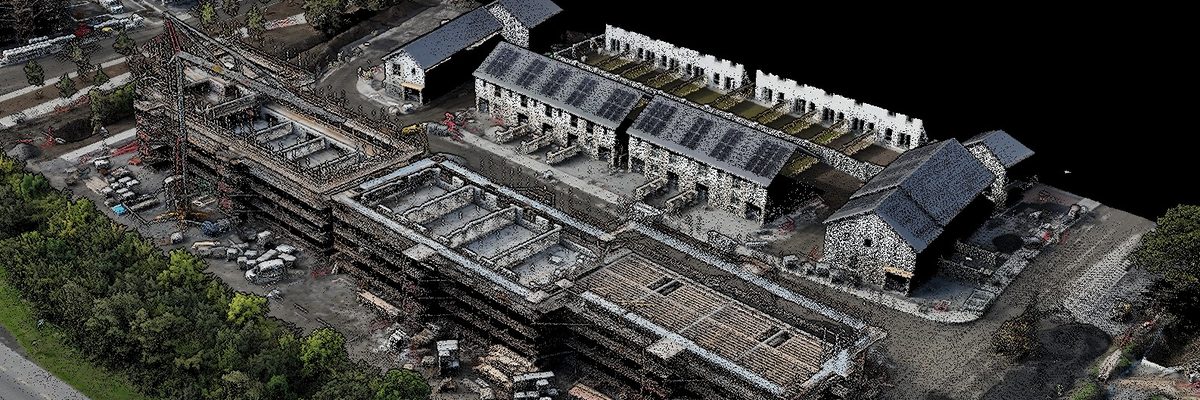
Nationwide construction progress monitoring, site by site
Covering over 20 live sites, some every weekday, others once a month.The Job at a Glance
One of Ireland's largest construction firms needed consistent progress imagery on over 20 sites nationwide, some every weekday, others once a month. We risk-assessed every site in turn, built a capture plan around each one, and we've been flying the programme ever since.
Nationwide, site by site
Over 20 sites spread across the country, each one assessed individually for air risk and ground risk before anything flew.
Every weekday to once a month
Some sites were captured every single weekday, others weekly, twice weekly or monthly, with once-off sites added as they came up.
Restricted airspace experience
The client specifically needed someone who could operate drones in restricted areas, including around airports.
Four core deliverables
Orthophotos, 360 imagery, single point imagery and video, specified site by site.
One of Ireland's largest construction firms had more sites than it could resource
The client is one of Ireland's largest construction firms, with active sites right across the country. They came to us through a referral from another client and got in touch by phone. Everything they described was work we take on routinely, and we had plenty of capacity for it.
The problem they opened with was a resourcing one. They were having trouble getting sufficient resources in place to carry out progress monitoring across the number of sites they had. They also wanted a partner who could operate drones in restricted areas, around airports in particular, and capture multiple sites in a day safely, legally and correctly.
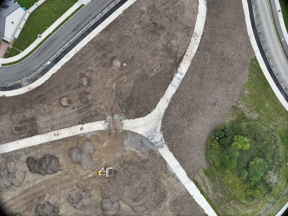
Send through every site in KML, and we'll work out what each one needs
The first thing we asked for was every site in KML format, so we had the location and the shape of each one. From there we reviewed each site in detail and ran risk assessments on it, looking at both the air risk and the ground risk to establish how the job could progress safely and legally.
The client sent through over 20 sites. Once we had all of that data we built a plan of attack that would let us capture every one of them in detail. Then we got on a call with the client and worked through each site: crane heights, local access, points of contact, and whatever peculiarity of a site they were particularly interested in.
The rest of the brief was about what each site actually needed. Some wanted an orthophoto plus 360 imagery, others just an orthophoto. A greenfield site, for instance, only needed to show roughly what it looked like. Frequency varied just as much: some sites every single weekday, others weekly, twice weekly or monthly, with once-off sites added to the list as they came up.
Assess the risk, agree the detail, secure the airspace permissions, then mobilise
Every site went through the same three steps before a single flight. Each was assessed on its own for air risk and ground risk. The deliverables and the frequency were agreed with the client site by site. And the airspace permissions for each location were secured before we mobilised.
We've been mobilised ever since, carrying out progress monitoring on their sites across the country and capturing exactly the data they look for, all to the same specification.
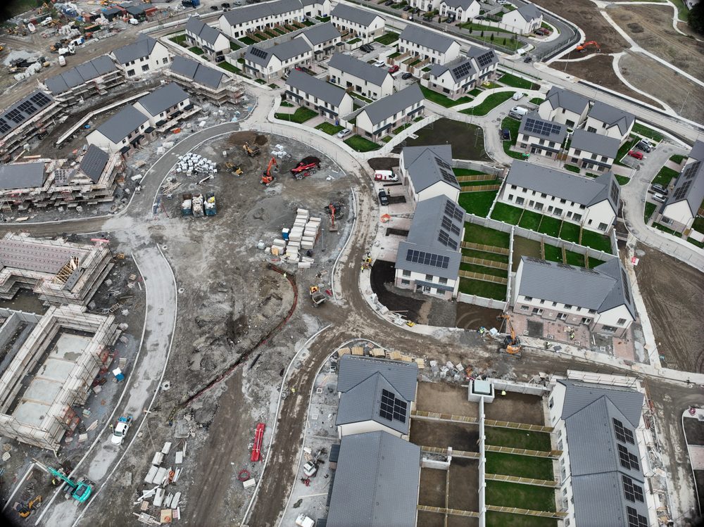
Four core deliverables, specified site by site
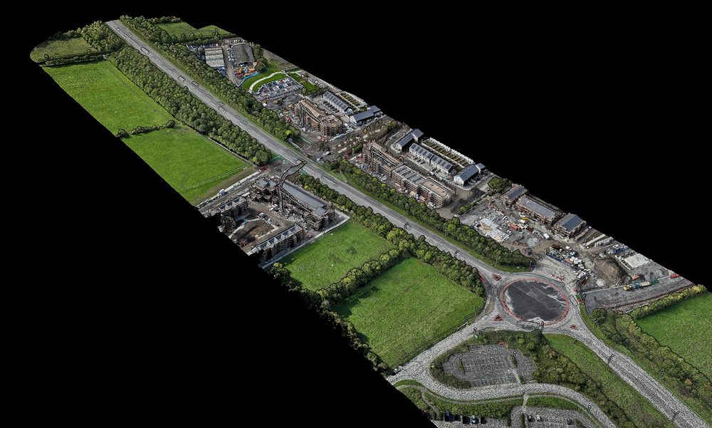
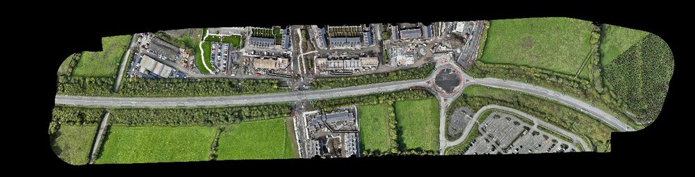
The primary deliverables are orthophotos, 360 imagery, single point imagery and video, depending on the site. Where a site needs something more specific again, that's been built into the plan too.
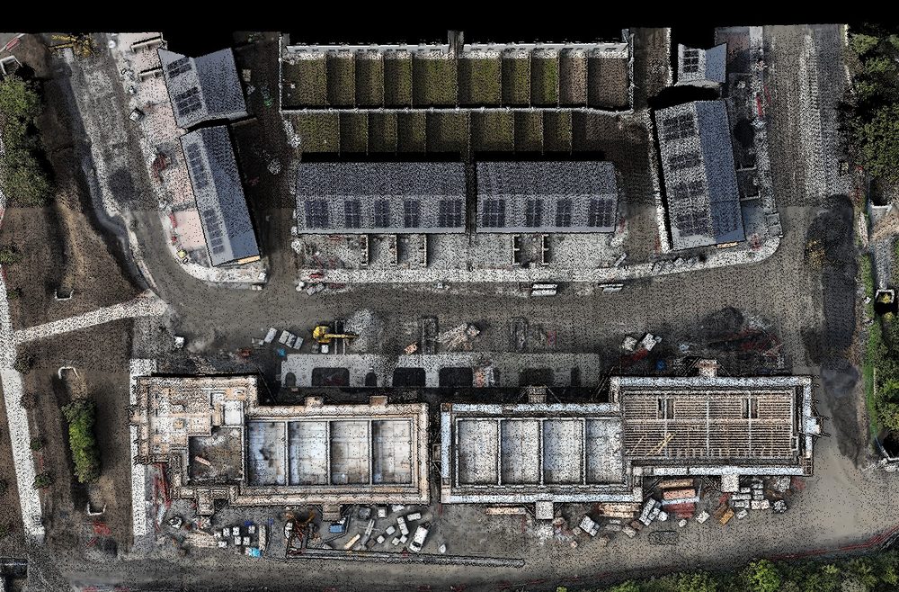
Orthophotos
One of the primary products, and the one that shows progress across the whole footprint in a single top-down image.
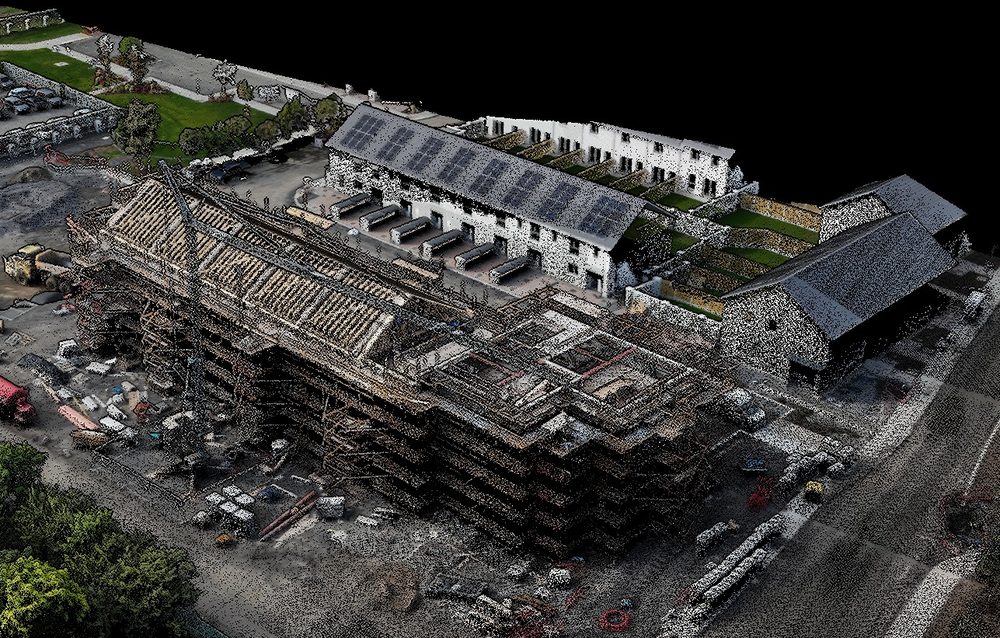
360 imagery
Capture that lets whoever's reviewing the site look at it from the ground as well as from above.
Single point imagery
Stills of one specific point on a site, captured to the client's order.
Video imagery
Requested alongside the stills and orthophotos on some sites.
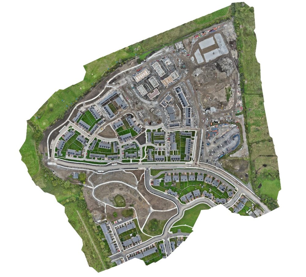
Every site accommodated, every one to the client's specification
Between the standard product set and the odd very specific request, this client has handed us a wide spread of progress monitoring work, and we've been able to accommodate all of it without issue.
One example worth highlighting. Some sites need very specific technical imagery, flown at a very specific height over a highly specific point, in order to verify viewpoints for planning permission. That's a different job to a site-wide orthophoto, and it's been delivered to the same specification as everything else.
Why they chose us
The client had more sites than they could resource. That's the short version of why they called us.
The client had the site list. What they didn't have was sufficient resources in place to capture all of it.
Capturing multiple sites in a day, safely and legally, was the requirement the client brought to us.
Sites in restricted areas, around airports in particular, are exactly what the client wanted specialist drone operating expertise for.
Using a drone
Each site was assessed on its own air risk and ground risk, then captured to a plan agreed with the client site by site.
- Over 20 sites Every one reviewed in detail from its KML boundary, with air risk and ground risk assessed individually.
- Multiple sites in a day Sites are captured in a day safely, legally and correctly.
- Restricted areas Including sites around airports, which is exactly what the client came to us for.
- Frequency set per site Every weekday, weekly, twice weekly or monthly, with once-off sites added as they come up.
- Deliverables to specification Orthophotos, 360 imagery, single point imagery and video, plus specific technical imagery for planning viewpoints.
Without a drone
Before the programme, the constraint wasn't the imagery. It was getting enough resource in place to capture the number of sites the client had.
- Coverage capped by resource The client was having trouble getting sufficient resources in place to capture the number of sites they had.
- Restricted sites needed expertise Sites in restricted areas, including around airports, called for drone operating expertise the client went looking for.
- Multiple sites in a day wasn't guaranteed Capturing multiple sites in a day, safely, legally and correctly, was the requirement, not the starting position.
- Every frequency had to be resourced Sites needed capturing anything from every weekday to once a month, and each of those frequencies had to be met.
- Once-off sites kept arriving On top of the standing list, once-off sites were being added as they came up.
Speak to an engineer about your project
Complex surveys and inspections require more than just a pilot. Our engineers can help you scope your requirements and indentify the right approach.
Where to find out more
If you've a programme of sites that needs capturing to a schedule, send us the whole list and we'll tell you what's flyable and how we'd approach it. Have a read about construction inspections, construction and real estate, photogrammetry and 3D mapping, and cut and fill analysis. Or you can contact us here to ask what we can do for you.
Last Updated: