When buildings haven't been entered in over 50 years, confined space drones go first.
Overview
The Job at a Glance
A confined space drone inspection of three derelict buildings in Dublin city centre — an old bakery, a storage and clerical building, and a historic vat house. The buildings hadn't been entered in upwards of 50 years. The confined space drone flew in through windows and documented every accessible space, giving the client a complete picture of structural condition, heritage features, and safe access routes before anyone set foot inside.
Dublin city centre
Three derelict buildings — bakery, storage/clerical, and historic vat house — closed and isolated for 50–60 years. An engineering and architectural firm needed a pre-redevelopment condition assessment.
Three buildings surveyed
Each building accessed through open windows by a cage-protected confined space drone with onboard illumination and 4K camera, operating without GPS inside the enclosed structures.
Heritage-sensitive assessment
The vat house contained original 1960s laboratory samples, a foreman's workstation with period paperwork, and giant wooden storage vats on cast iron lattice — all documented before any works commenced.
Zero human entry required
No personnel entered any of the three buildings. The drone went in through windows while the pilot and client's team remained outside throughout the inspection.
The challenge
Three buildings, no drawings, and nobody had been inside for decades
An engineering and architectural firm was tasked with generating a plan to redevelop a number of old buildings in Dublin city centre. A lot of these buildings were now derelict and had not actually been entered in many, many years. In fact, some of these buildings were completely isolated and shut off from entry for about 50 or 60 years — quite a long time.
The client needed to know two things: first, whether it was safe to go in to make an assessment of these buildings, and second, what the buildings looked like so they could start their pre-planning process. They realised they could not go straight in because the buildings were so old and from the outside they could see there were issues. So they asked Engineers With Drones to assist.
There were no drawings for buildings like these. They were built years and years ago, and everything from the road suggested significant internal deterioration. The challenge was to document the interiors comprehensively without putting anyone at risk.
Technology
A confined space drone built for the dark and the unknown
The drone deployed for this inspection was a confined space platform — a small, cage-protected drone with several critical features for working inside abandoned structures. It does not need a GPS signal, which is essential because GPS is unavailable inside enclosed buildings. It has onboard illumination because derelict buildings receive no natural light beyond what enters through broken windows. And it carries an excellent 4K camera for capturing very high-resolution imagery of every surface.
The protective cage surrounding the propellers allows the drone to make contact with walls, beams, and debris without crashing — essential in a narrow, cluttered, and completely unknown interior space. The pilot navigates entirely by visual reference from the live camera feed, flying the drone in through a window from outside and then systematically documenting every accessible area.
As Bob Foley, founder of Engineers With Drones, explains: "We got our confined space drone, which is a drone with onboard illumination, it does not need GPS signal, it has an excellent 4K camera for taking very high-resolution imagery, and it can fit through small windows. So from the outside we could fly the drone in through a window and then have a good look around inside the building and see what was going on."
Findings
What the inspection revealed across the three buildings
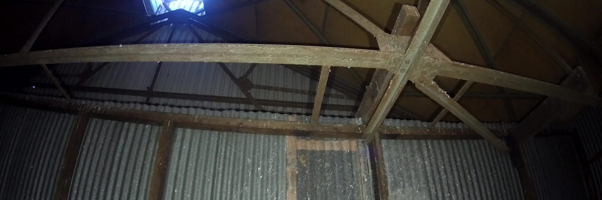
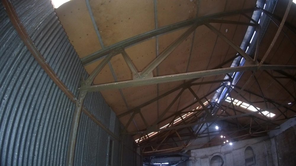
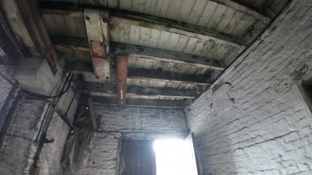
Once inside each building, the team systematically captured all aspects that might be important: beams that had been rotted out with water ingress over the years, floors that were starting to rot and collapse, roofs and ceilings that were starting to rot and collapse — documenting every defect that could be detrimental to anybody entering.
Building 1 — the old bakery
The first building was an old bakery. Inside, the drone captured the original industrial ovens from the 1960s — these beautiful old ovens for cooking bread back in the day, still sitting there decades after the last loaf came out. The drone flew in through an open window and had a good look around the whole building, documenting storage areas and then moving upstairs to where the people who ran the bakery had been living.
There was also an unusual flat roof covered in grass that needed to be captured, which the drone documented as part of the survey. The combination of decades-old living quarters above a working bakery gave the client a complete picture of the building's layout, condition, and heritage significance.
Inside the old bakery — the original industrial ovens from the 1960s still in place, captured by the confined space drone through an open window.
Building 2 — the storage and clerical building
The second building was an old storage and clerical building, attached to a much larger structure. It had three stories, and the drone went up and into each one in turn, having a good look around inside each level. Again, the team isolated and identified any defects with the building structure itself that could be detrimental to anybody entering.
This survey also served another purpose: it gave the client an idea of what was actually in the building and whether they could commence with demolition straight away, or whether there was something culturally sensitive or sensitive from a heritage perspective that they should pay a bit more attention to before starting work.
Inside the old storage and clerical building — the drone moved through all three storeys documenting structural condition, debris, and overhead pipework before any decisions about demolition or retention could be made.
Building 3 — the old vat house
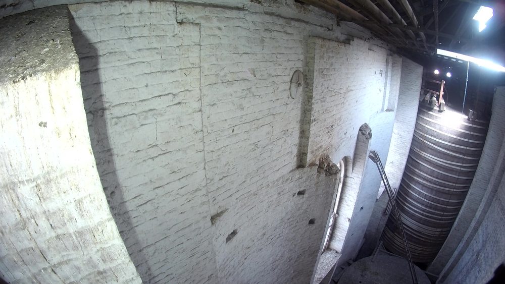
The third building was probably one of the most interesting — an old vat house. If you imagine a large community hall, but bigger, and inside there are giant barrels that look for all the world like whiskey barrels, but they are not whiskey barrels — they are giant wooden storage vats. All of them are suspended on an old riveted cast iron lattice work about a metre and a half off the ground, and the whole place is elevated above a large basement designed to contain any leaks or washing debris.
As Bob Foley recalls: "This building, when you went into it, there was a laboratory for testing the product from way, way back in the day. There was the old test samples still in their bottles, and there was even an old foreman's workstation and all the paperwork from way back in the day was still there. So it was an extremely interesting building from a heritage perspective."
The entire vat house was connected through underground tunnels that ran under the streets of Dublin to various other nearby facilities. The client was believed to be looking at turning this particular building into some sort of venue — an excellent candidate for it — but they needed to know the condition of the roof, the walls, and the vat structures first.
Inside this building, the drone flew up in and around all the old vats, inspecting the tops of them. The team documented where pigeons had been getting in over the years and how to isolate them, looked for leaks in the roofs, and identified a tree that was actually growing out of one of the roofs — its roots growing into the wall and then back out of the wall again. The drone flew around the whole interior, looked at the entire roof structure, all of the internal structures and walls, and captured everything in very high detail.
Looking down from drone height inside the old vat house — giant wooden storage vats suspended on riveted cast iron lattice, captured by the confined space drone as it flew up through the structure.
Deliverables
What the client received
All of the data captured across the three buildings was processed so that it was easy to understand. Everything was labelled correctly and a diagram was put in place so the client could understand where the drone started and ended in each building and what they were looking at. The client could then take either snippets of video or stills — whatever they wanted — and use those to plan how they were going to move to the next phase of the project.
High-resolution 4K video
Complete 4K video record of all accessible areas across all three buildings, with onboard illumination for dark interior spaces.
Labelled and diagrammed
Every building documented with orientation diagrams so the client could understand exactly where the drone was in each structure and what they were looking at.
Still image extraction
High-resolution stills extractable from the 4K footage at any point, allowing the client to isolate and share individual details and defects.
Structural defect record
All areas of structural concern — rotted beams, collapsing floors, water ingress, roof failures — identified and documented with their location in each building.
Video footage
Confined space drone inspection footage
4K video footage captured inside the derelict buildings in Dublin city centre, showing the interior condition, heritage features, and structural documentation recorded during the inspection.
Confined space drone footage from the derelict buildings inspection in Dublin city centre.
Comparative methodology
Why they chose a confined space drone
The three buildings had been closed and isolated for 50 to 60 years. Nobody knew what was inside, and the external signs suggested significant structural deterioration. A confined space drone allowed the client to see inside without sending anyone into an unsafe structure.
Safety
Nobody entered the buildingsvs risk of collapse on entry
The drone flew in through windows while the pilot and the client's team remained outside. No personnel were exposed to collapsing roofs, rotting floors, or unstable structures.
Speed of assessment
All three buildings surveyed efficientlyvs weeks of structural propping
Traditional entry would have required structural surveys, temporary propping, and safety assessments before anyone could even look inside. The drone eliminated all of that.
Heritage preservation
Full visual record before any worksvs losing detail during demolition prep
The drone documented original 1960s ovens, period laboratory samples, paperwork, and the vat house interior in situ — a permanent record of what was there before the redevelopment team moved in.
Efficient optionOur method
Using a confined space drone
This is what the inspection looked like using a cage-protected confined space drone with onboard lighting and 4K video.
No human entry into unsafe structuresThe drone flew in through windows while the pilot and the client's team remained outside. Nobody was exposed to collapsing roofs, rotting floors, or unstable walls.
Built-in illumination for pitch-dark interiorsThe drone carried its own high-intensity lights, capturing clear 4K footage in buildings that had received no natural light for decades.
GPS-free navigation through enclosed spacesThe drone navigated entirely by visual reference from the live camera feed — essential inside steel-framed and stone-walled buildings where GPS is unavailable.
Heritage features documented in situOriginal 1960s bakery ovens, laboratory samples, period paperwork, and the vat house interior were captured exactly as found, before any works commenced.
Complete visual record for the project teamLabelled, diagrammed video and stills gave architects, engineers, and planners a clear understanding of every building before anyone set foot inside.
OutcomeComplete condition baseline, zero entry
Manned approachTraditional method
Without a drone
What the same assessment would have involved using conventional methods.
Structural survey before entryA structural engineer would need to assess each building from the outside first — and even then, entering a building unseen for 50 years carries inherent and unpredictable risk.
Temporary propping and shoringUnstable floors and ceilings would require propping before anyone could walk through safely, adding weeks of preparation before the actual assessment could begin.
Confined space entry proceduresEnclosed spaces with potential atmospheric hazards would require gas monitoring, permits, and standby rescue teams — all before the actual condition could be assessed.
Heritage features at risk during access worksScaffolding, propping, and personnel movement through fragile interiors risked disturbing or damaging the very heritage features the assessment needed to document.
No systematic visual recordTraditional entry assessments rely on notes, handheld photography, and memory — no continuous 4K video record of the full interior to review, pause, and share with the wider project team.
Operational impactWeeks of preparation, higher risk, no permanent record
Let's talk
Speak to an engineer about your project
Complex surveys and inspections require more than just a pilot. Our engineers can help you scope your requirements and indentify the right approach.