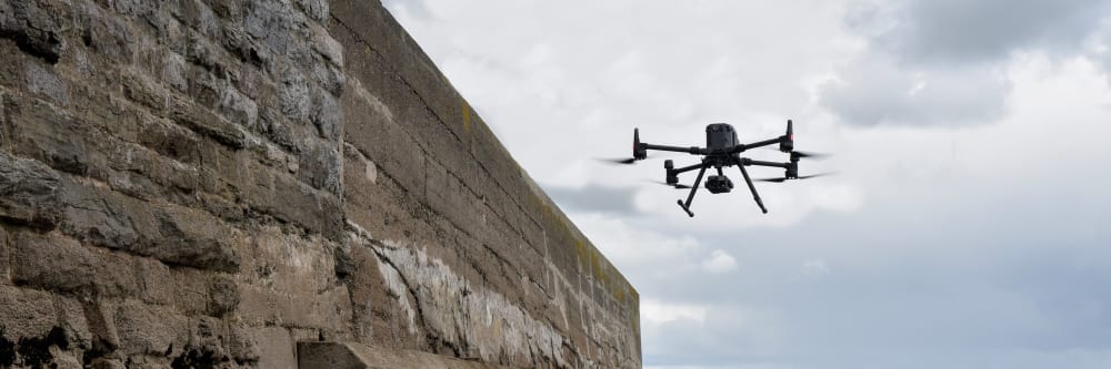
Coastal structures face the harshest environment of any asset class: continuous wave action, saltwater corrosion, and rapid deterioration. Yet inspecting them traditionally means boats, tide windows, and personnel working at height over water. A drone flies the structure from a safe standoff — over the water where necessary — and captures every metre of sea wall, breakwater, or pier face in detail.
For what sits below the waterline, an underwater ROV records foundations and faces while the team stays dry. Combined in a single mobilisation, the aerial survey and the ROV pass give a complete condition picture of the whole structure.
What structures can a drone survey cover?
Sea walls, breakwaters, piers, wharfs, jetties, harbour walls, and slipways — plus port infrastructure such as the underside of pile-supported platforms and cranes.
See what an aerial structure survey coversHow do you inspect below the waterline?
An underwater ROV records video and still photography of foundations, piles, and submerged faces — no divers required. The ROV pass is typically completed in the same mobilisation as the aerial survey.
Discuss a combined aerial and ROV surveyWhy not inspect from a boat?
Boat-based inspection of pile-supported structures is weather and tide dependent, slow, and produces poor imagery because the camera is always moving and at a distance from the surface being inspected. A drone flies freely beneath the deck regardless of conditions.
More about underside inspectionsWhat does a 3D harbour model give me?
A measurable digital record of the entire harbour, a baseline for change detection when re-flown in three to five years, and a communication tool your engineers, port authority, and consultants can all work from.
See what a 3D harbour model covers










A single flight photographs the full length of a sea wall, breakwater, or pier face — structures that are awkward and often hazardous to access on foot or by boat. What an aerial survey typically detects: concrete spalling, cracking, and erosion; armour rock displacement and scour; joint and seal failure; and marine growth or debris accumulation.
What about working at height regulations in Ireland?
The Safety, Health and Welfare at Work (Work at Height) Regulations 2006 (S.I. No. 318 of 2006) require that work at height be avoided where it is reasonably practicable to do so. A drone survey satisfies this at the first step of the hierarchy of control — the structure is surveyed from a safe standoff distance with no personnel working at height or over water.
More about our regulatory complianceWhy do coastal structures need frequent inspection?
Coastal structures are exposed to continuous wave action and saltwater corrosion, so condition can deteriorate quickly — a defect that was cosmetic one winter can be structural the next. Frequent drone surveys make it practical to re-inspect on a regular cycle at a fraction of the cost of traditional access.
Discuss an inspection schedule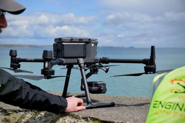
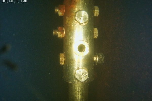
The underside of a pile-supported wharf or quay is one of the most difficult inspection environments in the marine sector. Boat-based inspection is weather and tide dependent, slow, and produces poor imagery from a moving platform. A drone flies freely beneath the deck and manoeuvres to any angle needed to inspect piles, pile caps, the soffit, expansion joints, and structural connections.
How are defects located under a pier without GPS?
Client drawings — showing pile station numbers, the water line, and structural layout — are obtained in advance and used to annotate defect locations. Every defect is reported with a station reference so a follow-on contractor can locate it precisely. Orientation marks visible on both the top and underside of the deck are noted so teams above and below can cross-reference positions.
See how defects are classified and referencedWhat defects are typically found under a deck?
Concrete spalling and delamination with exposed reinforcing steel, structural damage related to heavy plant such as cranes moving on tracks, and localised heavy corrosion on horizontal surfaces where water retention is chronic.
Discuss an underside inspection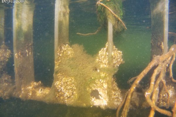
Not all rust is equal — distinguishing cosmetic corrosion from structural compromise is what a professional condition report provides. Every defect is categorised: surface corrosion (ugly but structurally sound), advanced corrosion (the metal is being consumed — blistered, flaking surfaces, bolts rusted conical), and structural compromise (retaining bolts gone, flange welds cracked, clips missing — “a good wave will knock that up”). The client receives a clear categorisation of every defect by severity, with recommended actions.
How are defects referenced on smaller structures?
For localised structures like dolphin walkways, GPS coordinates are not always the primary reference. Reports use structure number plus side designation — for example, “Dolphin Walkway Number 3, Side 1”. A follow-on contractor needs to know that all the bolts on Side 1 of Walkway 3 need replacement, not a centimetre-level coordinate. The designation system is agreed with the client during inspection setup.
See how a full 3D harbour model fits inWhat does a dolphin walkway inspection find?
In a Cork Harbour inspection, the findings included retaining bolts rusted away on most walkway sections, corroded flanges at join sections with uncertain weld condition, missing securing clips, and localised heavy corrosion on horizontal surfaces where water pools. Comparing the few intact bolts against the failed ones shows exactly what “good” versus “failure” looks like.
See a harbour pier inspection case study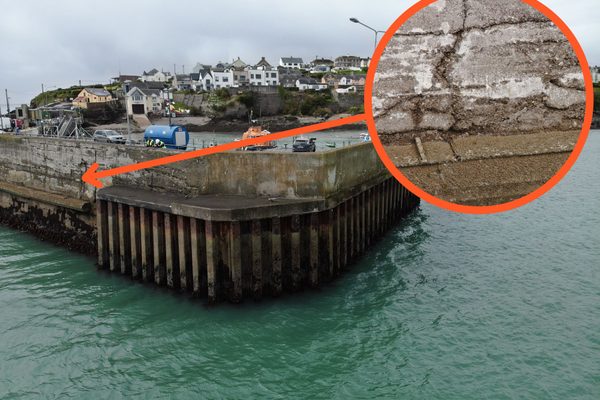
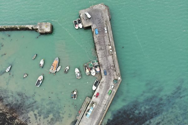
A photogrammetric 3D model of the entire harbour — piers, jetties, dolphins, walkways, and surrounding structures — is one of the core products for coastal inspection. It provides a measurable digital record of the whole asset, a baseline for change detection when re-flown in three to five years, and a communication tool for port authorities, county councils, and engineering consultants. Models export to standard GIS and CAD formats.
What is a 3D harbour model used for?
The model gives every stakeholder the same measurable reference: engineers measure and assess defects without returning to site, port authorities use it for asset planning, and consultants import it into their own GIS or CAD workflows. It is a digital record of the harbour as it stands today.
More about 3D mappingHow often should the model be re-flown?
Re-flying the model every three to five years lets you compare the current condition directly against the previous baseline — quantifying exactly how corrosion has progressed, where armour rock has moved, and which repairs have held.
Discuss a 3D harbour model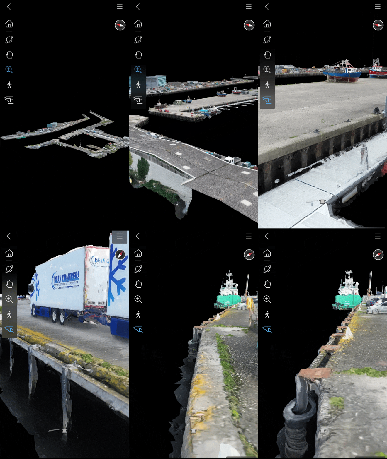
Aerial drone and underwater ROV combined in a single mobilisation — one condition picture for the entire structure, not two separate campaigns.
The underside of pile-supported decks is inspected regardless of tide or sea state, with no one working over or in the water.
Every defect categorised as surface corrosion, advanced corrosion, or structural compromise — each with a recommended action.
A measurable digital record of the whole harbour, re-flown every three to five years to quantify change against the baseline.
High-zoom cameras capture cable, fixing, and pivot detail while the drone stays well clear of potentially unstable structures.
Station numbers and side designations from client drawings mean a follow-on contractor goes straight to each defect.
The underside of a pile-supported wharf is exactly where deterioration concentrates — and exactly where boat-based inspection works worst. Boats need the weather and the tide, keep the camera at a distance from a moving platform, and put personnel under the very structure they are there to assess. A drone flies beneath the deck in any conditions and holds position centimetres from piles, pile caps, and soffits.
Defects are recorded against the client’s own drawings — pile station numbers and orientation marks — so every finding in the report maps directly onto the structure the maintenance team already works from.
Surface corrosion is ugly but structurally sound. Advanced corrosion is consuming the metal — blistered and flaking, with bolts rusted to conical shapes. Structural compromise means the component has failed: retaining bolts gone, flange welds cracked, clips missing. The difference between these categories decides whether a repair is scheduled, prioritised, or urgent — and that distinction is exactly what the condition report delivers.
Tell us what you need to know, and we will work with you to design actionable deliverables that give you the outcomes you need.
A typical coastal inspection delivers an aerial photographic survey of above-waterline surfaces, underwater video and still photography, and an annotated condition report — with defect locations referenced to client drawings or station marks where available.
Findings are compiled into a defect classification report: each defect described, categorised by severity, and assigned a recommended action. A 3D harbour model can sit alongside the report as a measurable baseline for change detection over future inspection cycles.
Complete coverage of sea walls, piers, and breakwaters from a safe standoff distance.
Video and stills of foundations and submerged faces, with no divers in the water.
Every defect categorised by severity with recommended actions, referenced to station marks.
A measurable digital baseline for change detection, exportable to GIS and CAD.
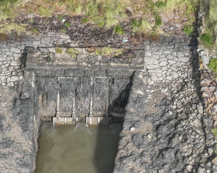
Two kilometres of tidal river embankment on the River Barrow, mapped end to end into a 3D model, a face-on orthophoto and AutoCAD line work of every defect.
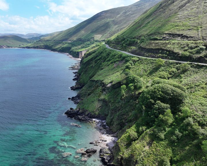
Engineers With Drones captured high-resolution imagery of a 2km section of cliffside road at Mountain Stages, Kerry, replicating exact angles from a 2018 survey for a like-for-like comparison of coastal erosion and landslide activity.
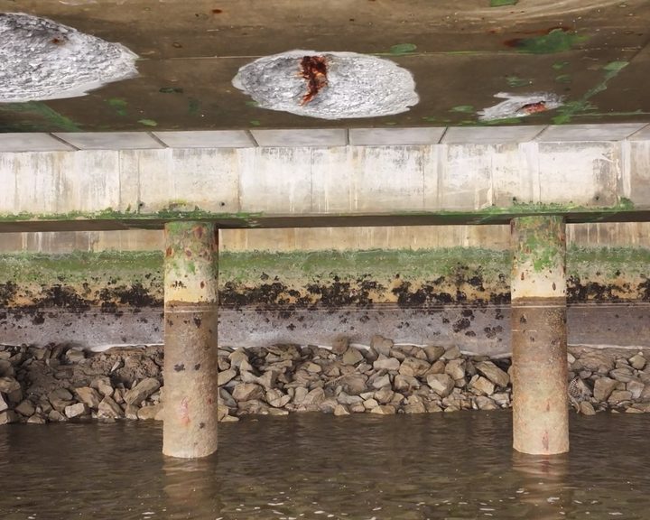
Drone inspection of pier infrastructure at Belview Port — examining the underside of shore-side facilities using UAV technology to assess concrete defects and structural integrity safely.
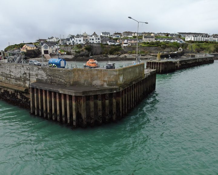
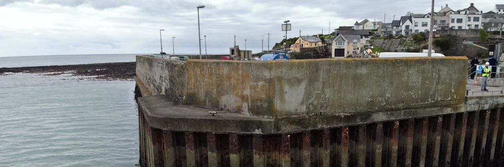
Engineers With Drones carried out a detailed drone inspection of a harbour pier wall, assessing hot-rolled interlocking steel sheet piles and concrete structure for defects and structural integrity.
Complex surveys and inspections require more than just a pilot. Our engineers can help you scope your requirements and indentify the right approach.