Waterways and the structures on them are subject to erosion by running water. It's essential that they are maintained, so they can be used and appreciated for years to come. Drones are an efficient, eco-friendly way to inspect waterways. Engineers With Drones inspects waterways and their surroundings, flagging issues with no impact on the environment.
As licensed engineers, we also provide the expertise, understanding, and knowledge necessary to carry out a thorough inspection, with deliverables to match. Our skilled engineers are at the ready.
The Irish Aviation Authority has awarded Engineers with Drones full approval in accordance with the most recent European-wide EASA regulations.
To ensure that you always get the best possible service and cutting-edge deliverables, we purchase the most up-to-date drone technology as soon as it's available.
The operation of Engineers With Drones is governed by a comprehensive HSSE system. Our guiding principles are to reduce risk through rigorous assessment, and to maintain a high level of staff education and training.
We have 6.5 million in public and product liability insurance, and 13 million in employers' liability insurance. Engineers with Drones are fully insured to fly wherever you need.
As we're situated in Ireland, we can respond to your needs quickly, with zero travel complications.
As seasoned engineers in the field, we are aware of the trouble that shoddy reports and deliverables can create. For this reason, we provide you with exactly what you require.
Thanks to our fast turnaround times, your entire project can be completed in a fraction of the time of traditional methods, without any compromise in the quality of your deliverables.
In addition to quadrupling the resolution of an HD camera, 4K also gives you quicker frame rates, incredible contrast variations, and expanded colours. VR video takes the level of immersion and clarity to the next level.
The safety of your personnel and our own is paramount, and we place it at the forefront of our company culture. Ask us about our HSSE systems and practices.
We understand that you need answers fast. We can deliver a plain-English report with clear-cut conclusions in days. Then, you can take the steps you need to and get back to doing what you do best.
Drone inspections take up less of your manhours and resources than traditional inspections, giving you a faster and more budget-friendly return on your investment.
Thermal IR technology and ultra HD allow our engineers to get a view that it not available to the naked eye. From a safe distance, we can find defects and insights that are only visible with a drone.
We use cutting-edge technologies to detect problems that would otherwise be invisible. These include ultra-HD photography/video, LIDAR and thermal imaging.
Drones aren't just for flying up in the sky. Our specialist drones can fly into confined spaces like chimneys and boilers to look for issues that would otherwise be inaccessible.
Need us there in a hurry? No problem. Let us know what you need, and we can be there on the same day. After all, sometimes the problem just won't wait.
Sometimes the brief can change even in real-time. If need be, you can be stood there right next to the drone operator, directing them as the situation develops.
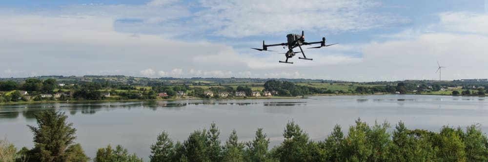
As drones fly above a waterway, they inspect much faster than typical methods. Removing the need to walk or boat down a waterway significantly reduces labour involved. Efficient monitoring can be done more frequently - keeping the waterways are in good shape, to be enjoyed by everyone.
When inspecting waterway structures (dams, weirs, locks, culverts etc.) we view it from all angles. Being able to inspect from above and below, with no climbing equipment or boats, streamlines the process. Damaged structures may be at risk if someone were to climb on it - which is why drones are beneficial. We stay back from all structures to avoid damage, while capturing high-quality images. Our drone is equipped with a high-resolution camera, ensuring no detail is lost. Precise inspection ensures all locks, dams, or weirs are in good working order and don't put anyone at risk.
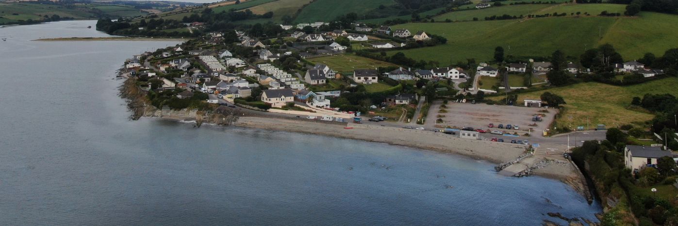
Constant running water erodes waterways, so monitoring their banks helps to maintain them. When inspecting waterways (canals, rivers, etc.) an aerial view gives a clearer insight to the its condition. Invasive vegetation can worsen erosion, and it’s growth can be monitored from above. As we use GPS, we follow the exact same path each time, ensuring the information is accurate. Regular record keeping and monitoring keeps waterways well maintained, ensuring they can be enjoyed for years to come.
We take emails, phone calls, messages, everything! If you are unsure of what's possible we are happy to advise, the most important thing is to get in touch. We would be delighted to answer any questions you may have.
With drones, it's best to begin where you want to end up. What sort of deliverable would you like when it's all finished? If you are not sure then we can advise. We can look at what you would like and work backwards from there.
Once we have agreed on what is to be done, the scope of work is set and a price is agreed upon. We feel it is vital that everyone knows what they are getting and what they are paying for it. There should be no confusion.
Once we have confirmation you are happy to proceed, we start the ball rolling. We organise things like RAMS, site permits, Air Traffic Control clearance and much more. Basically, we generate everything needed to turn up on-site with all our ducks in a row.
Next, we do the work on site. We have the gear, we have the know-how, so now it's time to get the job done. This can sometimes be affected by the weather, but for the most part, we get the job done on the date specified.
This is where we take what we generated in the field and turn it into a final deliverable for you. This can be anything from the raw data itself, to fully processed Orthophotos, condition reports, CAD line work or thermal imagery.
The final step is the handover of the deliverables. We tend to use a cloud-based service, so you can access your data anywhere. We can also tie into your existing systems if that is more convenient.
Spoiler alert: we don't do weddings! We're professional engineers who have learned to fly drones really well. If you're looking for a photo of your garden or a swooshing shot of your wedding reception, we're probably not the right people for you. But if you need an engineer's eyes and experience, combined with next-generation UAV technology and industry leading deliverables, then you've come to the right place.
Capture high-quality imagery of your assets from never before seen vantage points.
Find out moreRecord incredibly detailed elevation data to aid in ultra-precise measurements and calculations.
Find out moreCapture real-world locations and assets digitally, for quicker and more cost-efficient inspections.
Find out moreWe purchase the latest drones as they come on the market to ensure you are getting the highest quality service from us at all times. Here is a quick look at what we would be most likely to use for a typical drone waterway inspection.
Our flagship drone: The M300 RTK by DJI is the premier enterprise-level inspection drone on the market. With a flight time of up to 55 minutes, lots of built-in redundancy, and a host of payloads to choose from, this is our go-to UAV for inspection work. When coupled with the Zenmuse H20T camera, it is capable of safely inspecting high-value assets at a stand-off range.
The confined space master: The Stereo 2 by Multinnov is the cutting-edge in confined space and indoor inspection drone technology. Eliminating the need to send personnel into hazardous locations, the Multinnov Stereo 2 can be deployed at a fraction of the cost, and with zero downtime. This is a drone designed from the ground up to get into restrictive and hard-to-reach places.
Read more...
Read more...
Read more...
Read more...
Read more...
Read more...
Read more...
Read more...